STS033-73-54
| NASA Photo ID | STS033-73-54 |
| Focal Length | 250mm |
| Date taken | 1989.11.23 |
| Time taken | 22:40:13 GMT |
Resolutions offered for this image:
1536 x 1536 pixels 639 x 639 pixels 5700 x 5900 pixels 500 x 518 pixels 640 x 480 pixels
1536 x 1536 pixels 639 x 639 pixels 5700 x 5900 pixels 500 x 518 pixels 640 x 480 pixels

Cloud masks available for this image:
Spacecraft nadir point: 27.1° S, 140.4° E
Photo center point: 27.5° S, 141.5° E
Photo center point by machine learning:
Photo center point: 27.5° S, 141.5° E
Photo center point by machine learning:
Nadir to Photo Center: East
Spacecraft Altitude: 265 nautical miles (491km)
Country or Geographic Name: | AUSTRALIA-Q |
Features: | COOPER CREEK |
| Features Found Using Machine Learning: | |
Cloud Cover Percentage: | 20 (11-25)% |
Sun Elevation Angle: | 39° |
Sun Azimuth: | 96° |
Camera: | Hasselblad |
Focal Length: | 250mm |
Camera Tilt: | 15 degrees |
Format: | 5017: Kodak, natural color positive, Ektachrome, X Professional, ASA 64, standard base |
Film Exposure: | Normal |
| Additional Information | |
| Width | Height | Annotated | Cropped | Purpose | Links |
|---|---|---|---|---|---|
| 1536 pixels | 1536 pixels | No | No | Earth From Space collection | Download Image |
| 639 pixels | 639 pixels | No | No | Earth From Space collection | Download Image |
| 5700 pixels | 5900 pixels | No | No | Download Image | |
| 500 pixels | 518 pixels | No | No | Download Image | |
| 640 pixels | 480 pixels | No | No | Download Image |
Download Packaged File
Download a Google Earth KML for this Image
View photo footprint information
Download a GeoTIFF for this photo
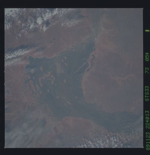
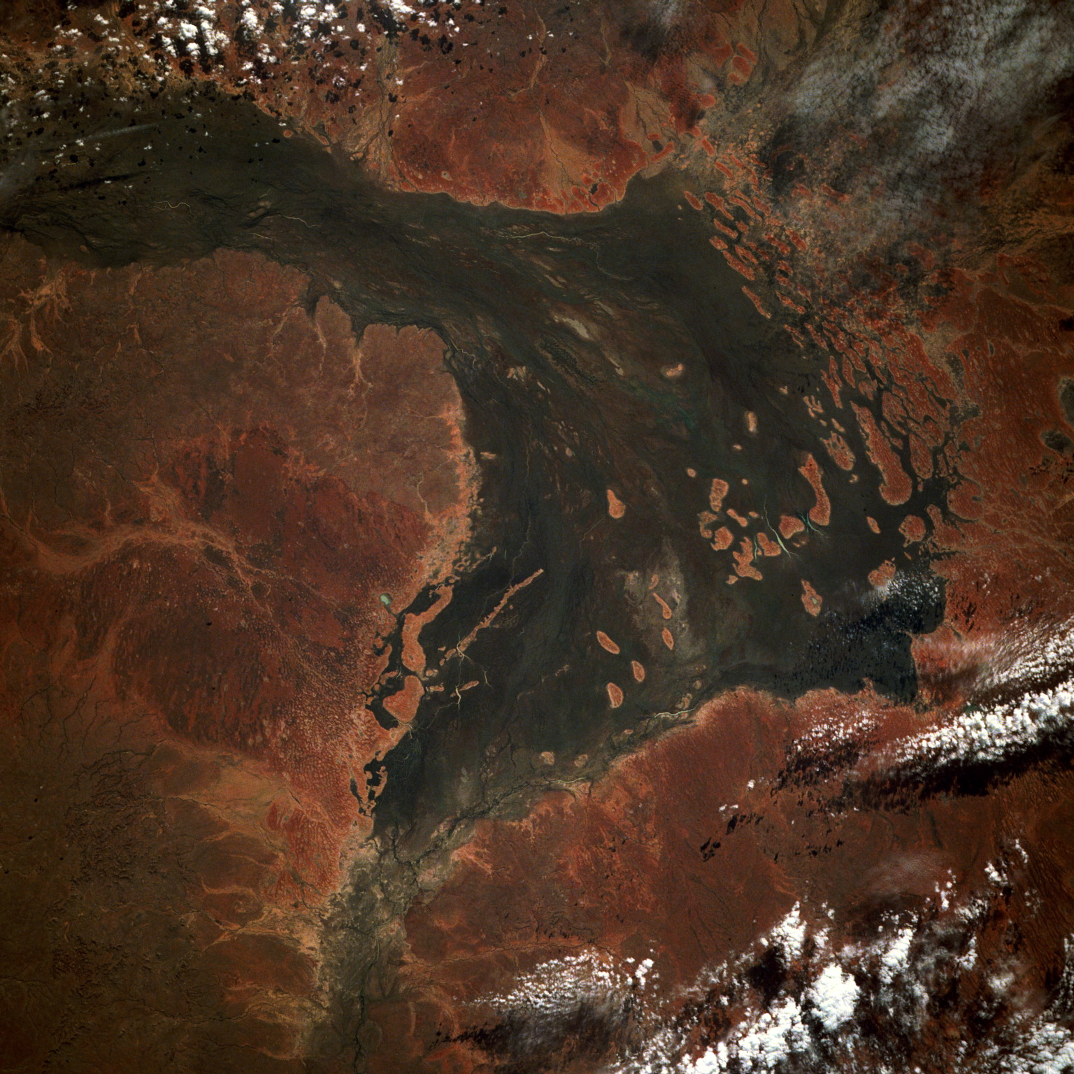
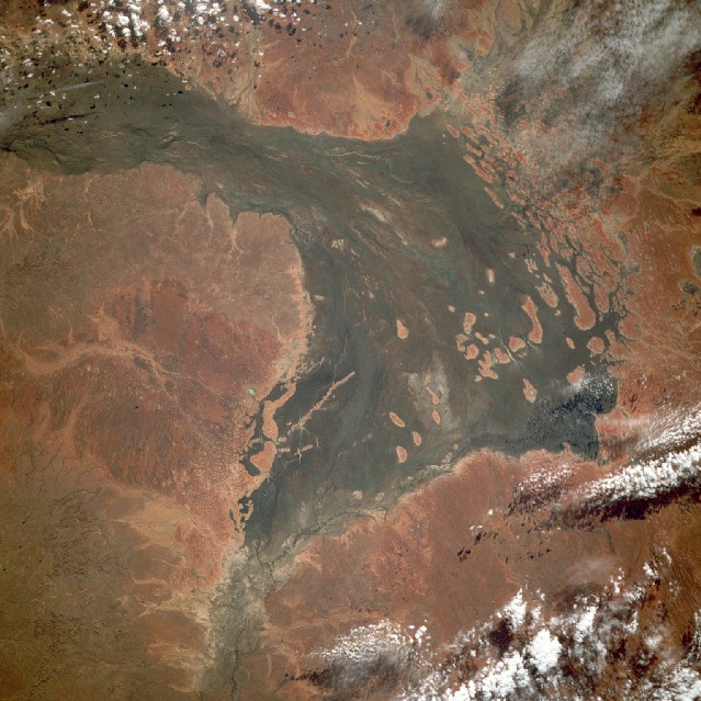
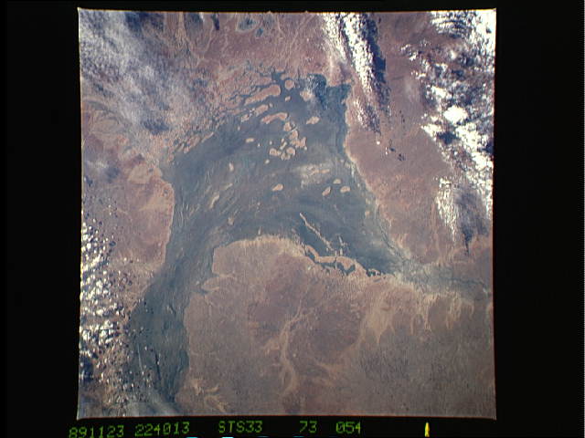
Image Caption: STS033-073-054 Cooper Creek, Queensland, Australia November 1989
Cooper Creek, one of many ephemeral rivers that flow across the central drainage basins of southwestern Queensland and southeastern Northern Territory, flows only after infrequent, prolonged, heavy rains. Most of the rivers, like the generally south-flowing Cooper Creek, traverse a landscape that has little local relief and terrain elevations that rarely exceed 200 feet (61 meters). The arid climate, coupled with very flat relief, promotes the development of extensive, braided streambeds and broad floodplains. The darker area shows the channeling or streamlining through the scrubby vegetation and some algae development within the floodplain. Because of the arid environment, evaporation plays a major role in water loss throughout this region of Australia.
Cooper Creek, one of many ephemeral rivers that flow across the central drainage basins of southwestern Queensland and southeastern Northern Territory, flows only after infrequent, prolonged, heavy rains. Most of the rivers, like the generally south-flowing Cooper Creek, traverse a landscape that has little local relief and terrain elevations that rarely exceed 200 feet (61 meters). The arid climate, coupled with very flat relief, promotes the development of extensive, braided streambeds and broad floodplains. The darker area shows the channeling or streamlining through the scrubby vegetation and some algae development within the floodplain. Because of the arid environment, evaporation plays a major role in water loss throughout this region of Australia.
