STS033-71-94
| NASA Photo ID | STS033-71-94 |
| Focal Length | 250mm |
| Date taken | 1989.11.24 |
| Time taken | 06:27:18 GMT |
Resolutions offered for this image:
5274 x 5221 pixels 640 x 633 pixels 5700 x 5900 pixels 500 x 518 pixels 640 x 480 pixels 2647 x 2609 pixels 2635 x 2589 pixels 2603 x 2569 pixels 2574 x 2572 pixels 2574 x 2572 pixels 909 x 1181 pixels 4096 x 4096 pixels 540 x 702 pixels
5274 x 5221 pixels 640 x 633 pixels 5700 x 5900 pixels 500 x 518 pixels 640 x 480 pixels 2647 x 2609 pixels 2635 x 2589 pixels 2603 x 2569 pixels 2574 x 2572 pixels 2574 x 2572 pixels 909 x 1181 pixels 4096 x 4096 pixels 540 x 702 pixels


Cloud masks available for this image:
Spacecraft nadir point: 21.8° S, 43.6° E
Photo center point: 21.5° S, 43.5° E
Photo center point by machine learning:
Photo center point: 21.5° S, 43.5° E
Photo center point by machine learning:
Nadir to Photo Center: North
Spacecraft Altitude: 240 nautical miles (444km)
Country or Geographic Name: | MADAGASCAR |
Features: | MANGOKY RIVER, LAC IHOTRY |
| Features Found Using Machine Learning: | |
Cloud Cover Percentage: | 0 (no clouds present) |
Sun Elevation Angle: | 56° |
Sun Azimuth: | 95° |
Camera: | Hasselblad |
Focal Length: | 250mm |
Camera Tilt: | 5 degrees |
Format: | 5017: Kodak, natural color positive, Ektachrome, X Professional, ASA 64, standard base |
Film Exposure: | Normal |
| Additional Information | |
| Width | Height | Annotated | Cropped | Purpose | Links |
|---|---|---|---|---|---|
| 5274 pixels | 5221 pixels | No | No | Earth From Space collection | Download Image |
| 640 pixels | 633 pixels | No | No | Earth From Space collection | Download Image |
| 5700 pixels | 5900 pixels | No | No | Download Image | |
| 500 pixels | 518 pixels | No | No | Download Image | |
| 640 pixels | 480 pixels | No | No | Download Image | |
| 2647 pixels | 2609 pixels | No | ReefBase 1 | Download Image | |
| 2635 pixels | 2589 pixels | No | Yes | ReefBase 1 | Download Image |
| 2603 pixels | 2569 pixels | Yes | ReefBase 2 | Download Image | |
| 2574 pixels | 2572 pixels | Download Image | |||
| 2574 pixels | 2572 pixels | Download Image | |||
| 909 pixels | 1181 pixels | Yes | Yes | Publisher Request | Download Image |
| 4096 pixels | 4096 pixels | No | No | Download Image | |
| 540 pixels | 702 pixels | Yes | Yes | Publisher Request | Download Image |
Download Packaged File
Download a Google Earth KML for this Image
View photo footprint information
Download a GeoTIFF for this photo
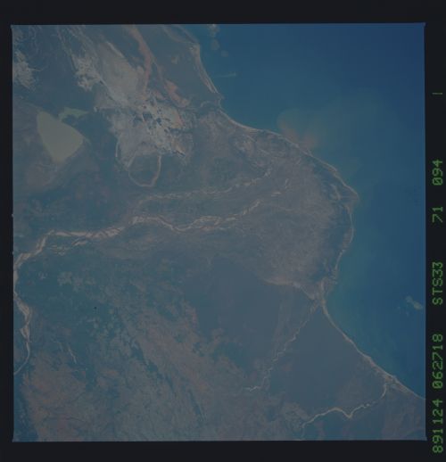
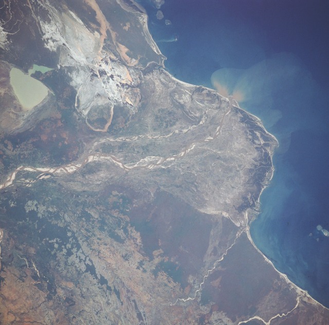
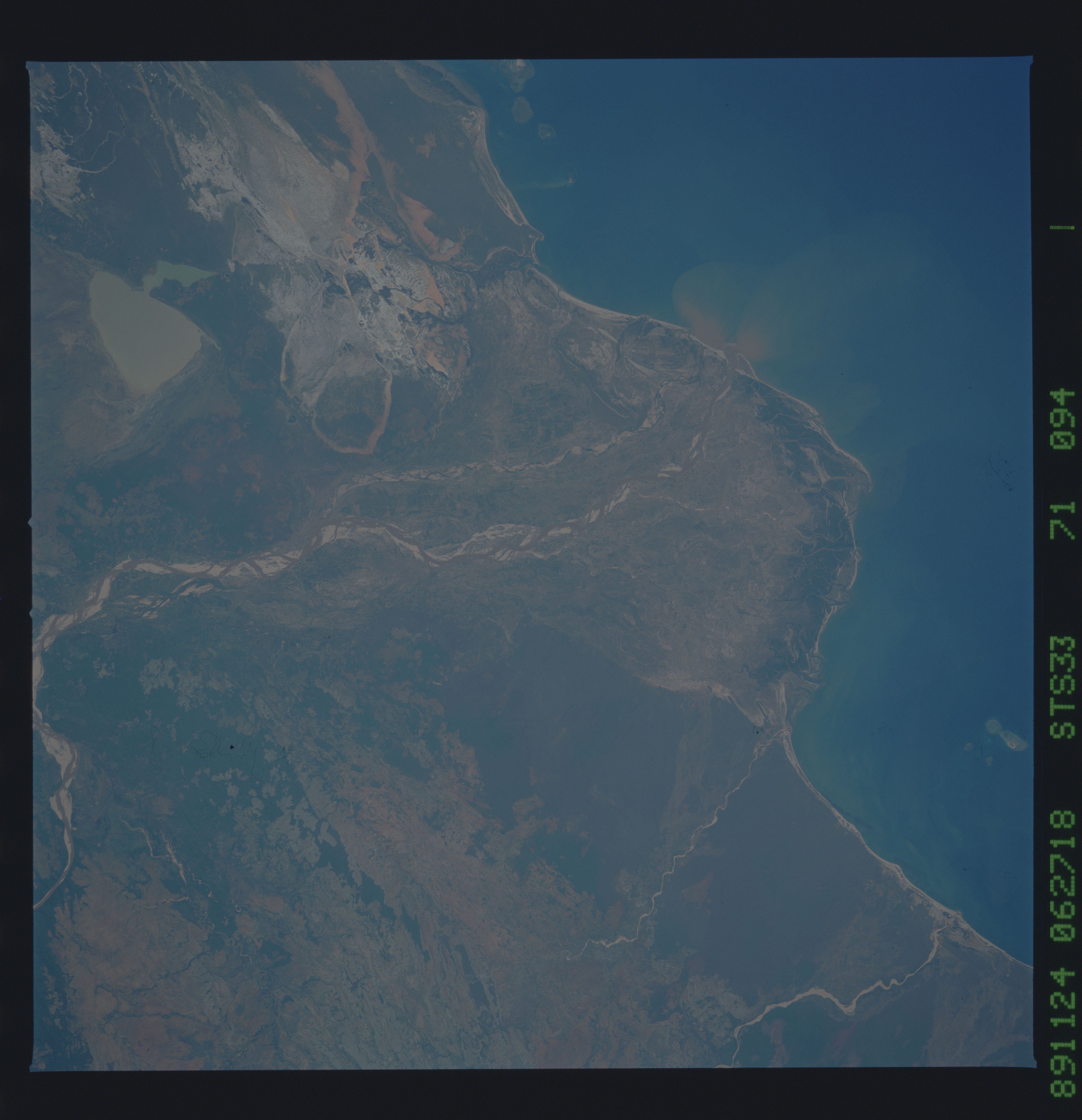
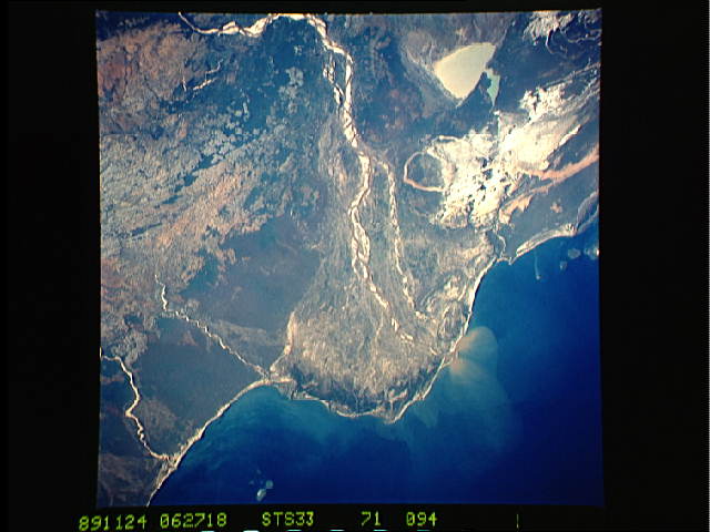
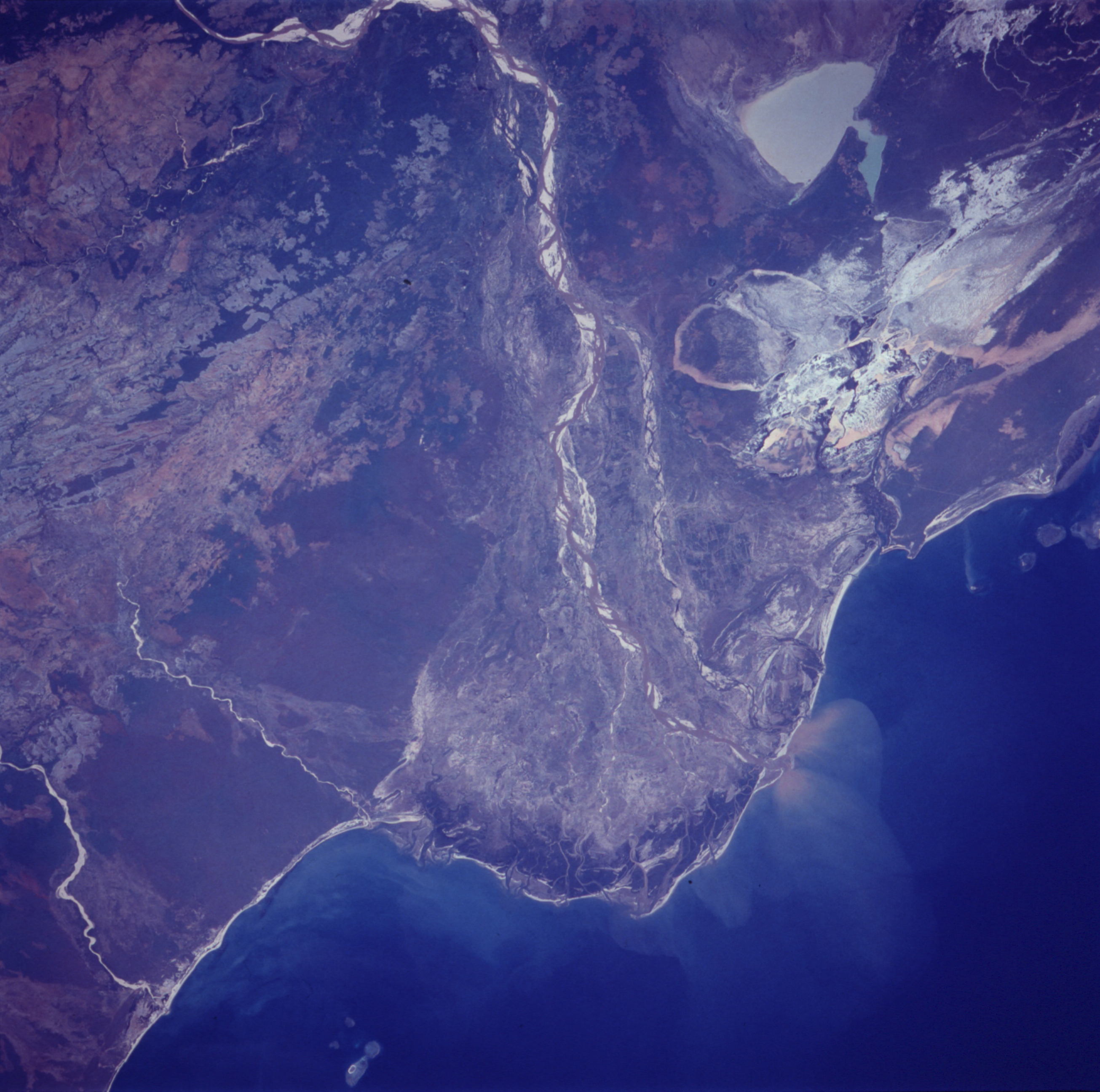
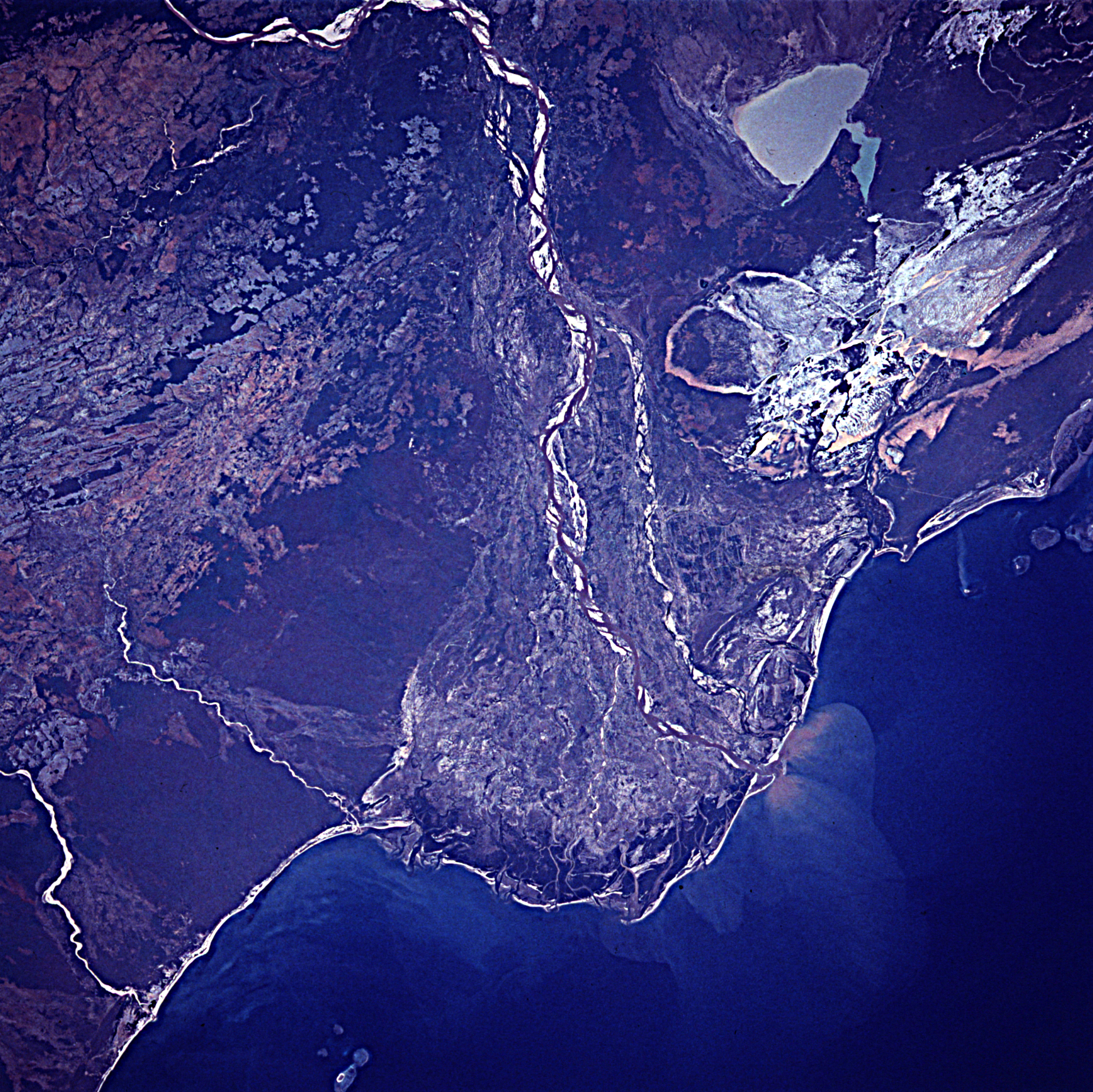
Image Caption: STS033-71-94 Mangoky River Delta, Madagascar November 1989
This low-oblique, southwest-looking photograph reveals the delta of the Mangoky River and the surrounding coastal plain. The Mangoky River is 350 miles (564 kilometers) long and rises in the Central Highlands of Madagascar just east of the city of Fianarantsoa. The river flows generally in a westerly direction out of the highlands, crosses the southern extension of the Bemaraha Plateau, reaches the coastal plain and its delta, and enters the Mozambique Channel north of the city of Morombe (city not shown in the photograph). Most of Madagascar has undergone serious deforestation during the last 40 years. Soil erosion has been extreme, as evidenced by the many sandbars located within the Mangoky River channel. Silt-laden, greenish-tan Lake Ihotry is clearly discernible south of the river. Between the lake and the coast is a rather large, whitish area of sand interspersed with silt-laden ponds. The southern portion of the delta is dominated by successive barrier island and spit formation. In contrast, the northern, protected portion of the delta is dominated by tidal passes and mangrove swamps.
This low-oblique, southwest-looking photograph reveals the delta of the Mangoky River and the surrounding coastal plain. The Mangoky River is 350 miles (564 kilometers) long and rises in the Central Highlands of Madagascar just east of the city of Fianarantsoa. The river flows generally in a westerly direction out of the highlands, crosses the southern extension of the Bemaraha Plateau, reaches the coastal plain and its delta, and enters the Mozambique Channel north of the city of Morombe (city not shown in the photograph). Most of Madagascar has undergone serious deforestation during the last 40 years. Soil erosion has been extreme, as evidenced by the many sandbars located within the Mangoky River channel. Silt-laden, greenish-tan Lake Ihotry is clearly discernible south of the river. Between the lake and the coast is a rather large, whitish area of sand interspersed with silt-laden ponds. The southern portion of the delta is dominated by successive barrier island and spit formation. In contrast, the northern, protected portion of the delta is dominated by tidal passes and mangrove swamps.
