STS033-71-52
| NASA Photo ID | STS033-71-52 |
| Focal Length | 250mm |
| Date taken | 1989.11.24 |
| Time taken | 05:07:32 GMT |
Resolutions offered for this image:
5294 x 5294 pixels 640 x 640 pixels 5700 x 5900 pixels 500 x 518 pixels 640 x 480 pixels
5294 x 5294 pixels 640 x 640 pixels 5700 x 5900 pixels 500 x 518 pixels 640 x 480 pixels
Cloud masks available for this image:
Spacecraft nadir point: 0.8° S, 109.7° E
Photo center point: 0.5° S, 109.0° E
Photo center point by machine learning:
Photo center point: 0.5° S, 109.0° E
Photo center point by machine learning:
Nadir to Photo Center: West
Spacecraft Altitude: 167 nautical miles (309km)
Country or Geographic Name: | INDONESIA |
Features: | SUNGAI RIVER DELTA |
| Features Found Using Machine Learning: | |
Cloud Cover Percentage: | 20 (11-25)% |
Sun Elevation Angle: | 68° |
Sun Azimuth: | 205° |
Camera: | Hasselblad |
Focal Length: | 250mm |
Camera Tilt: | 15 degrees |
Format: | 5017: Kodak, natural color positive, Ektachrome, X Professional, ASA 64, standard base |
Film Exposure: | Normal |
| Additional Information | |
| Width | Height | Annotated | Cropped | Purpose | Links |
|---|---|---|---|---|---|
| 5294 pixels | 5294 pixels | No | No | Earth From Space collection | Download Image |
| 640 pixels | 640 pixels | No | No | Earth From Space collection | Download Image |
| 5700 pixels | 5900 pixels | No | No | Download Image | |
| 500 pixels | 518 pixels | No | No | Download Image | |
| 640 pixels | 480 pixels | No | No | Download Image |
Download Packaged File
Download a Google Earth KML for this Image
View photo footprint information
Download a GeoTIFF for this photo
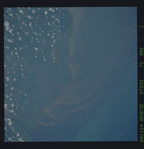
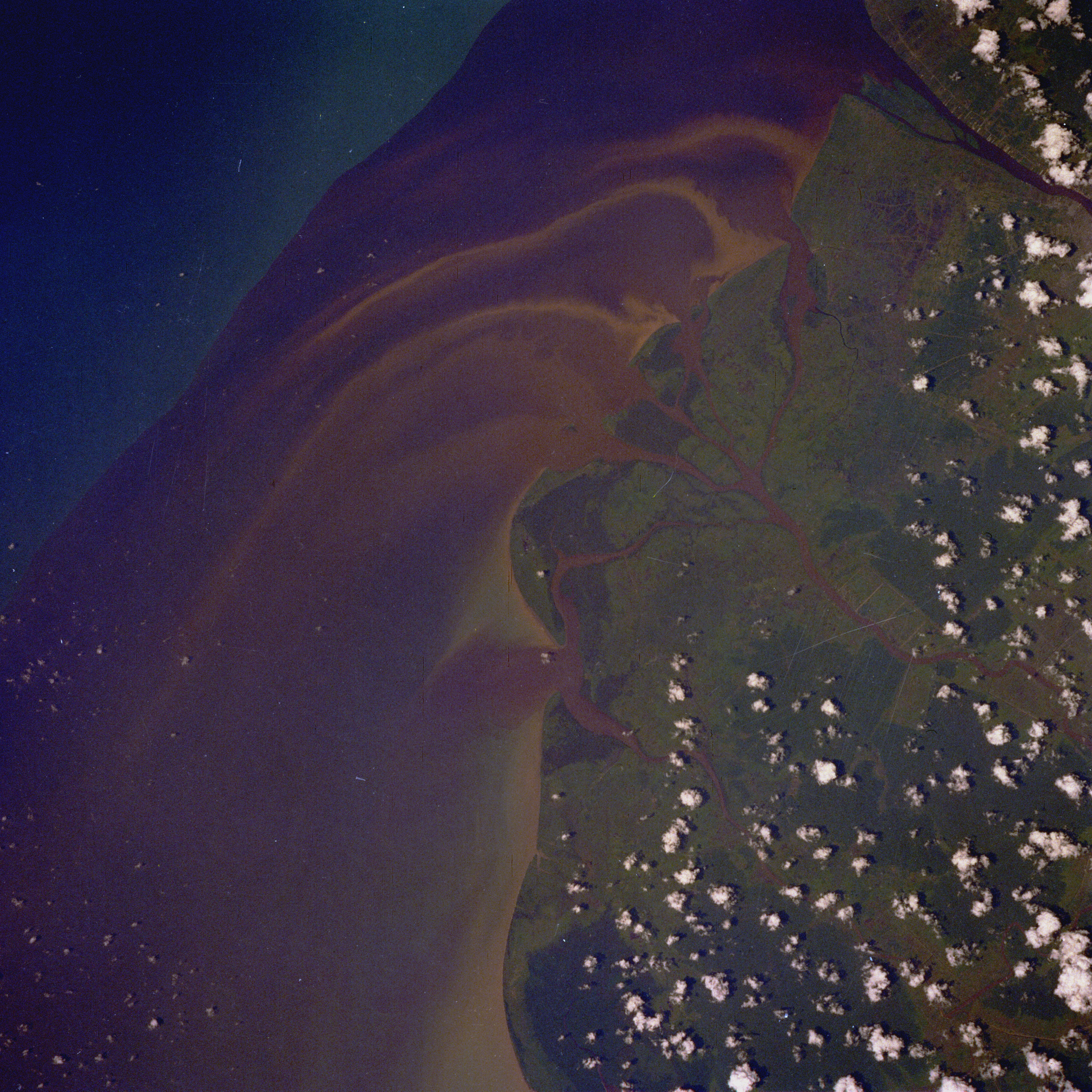
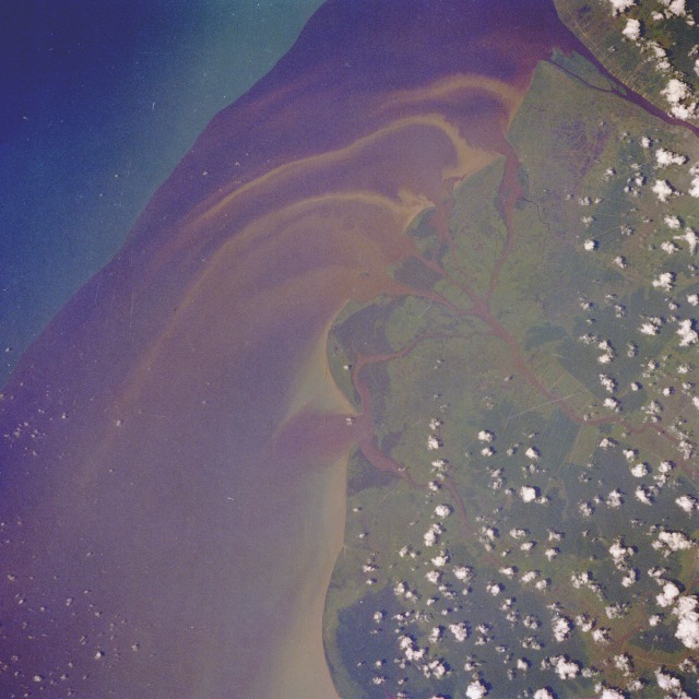
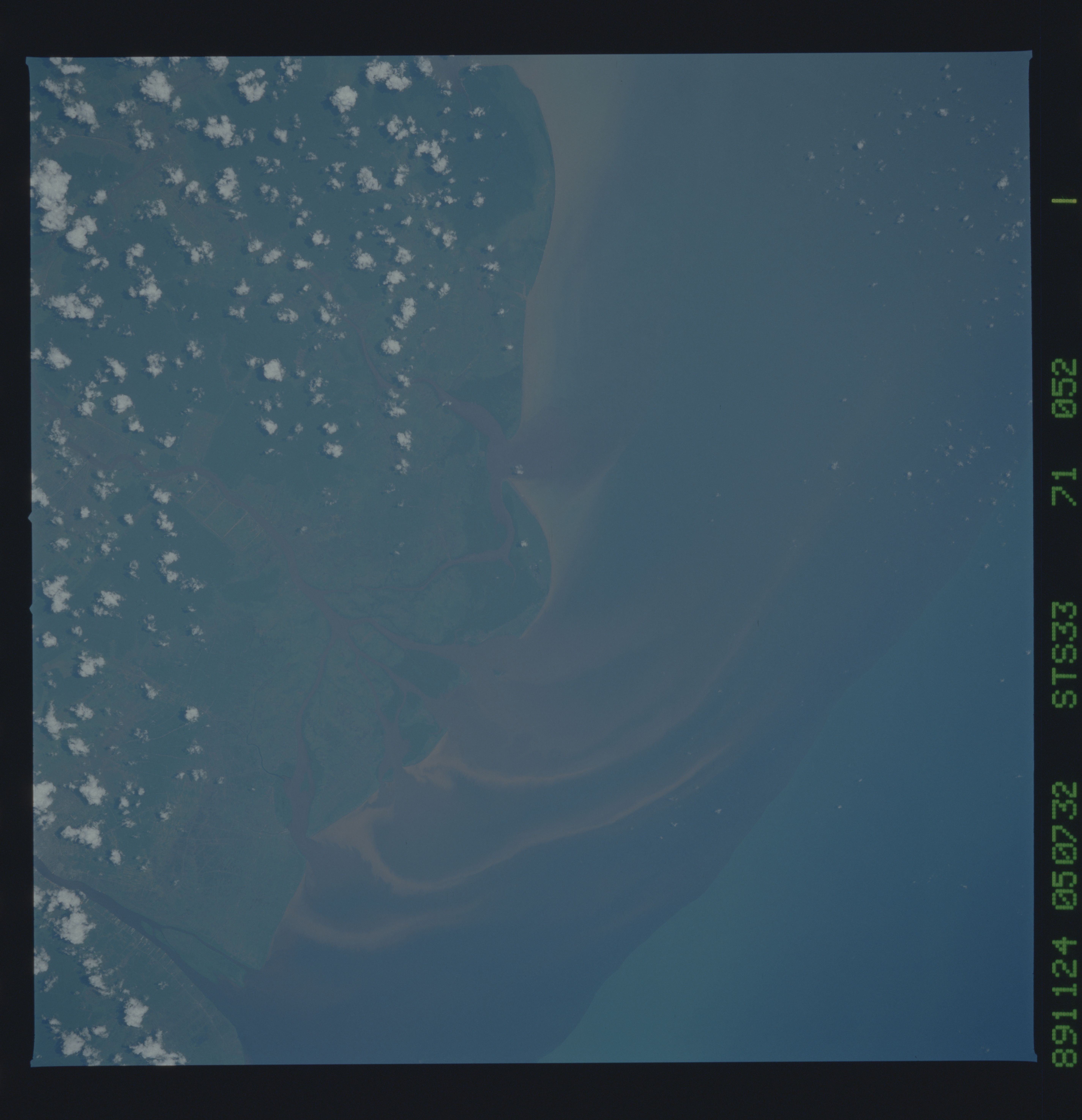
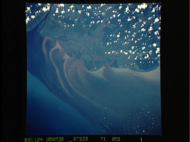
Image Caption: STS033-71-52 Kalimantan Barat Province, Indonesia November 1989
The Government of Indonesia provides financial incentives for its citizens to emigrate from the main island of Java and establish settlements on many of Indonesia's 13 000 other islands. This photograph of a dark plume adjacent to the coastline of western Kalimantan Barat Province on Borneo provides a glimpse of how the redistribution of the population is affecting a small section of the west coast of the province. The equatorial town of Pontianak is barely discernible along the banks of the Landak River in the northeast corner of the photograph. The shore current of this part of the South China Sea is carrying southward the plume material of the westward flowing, multichanneled Kapuas River. Sediment streamers intermingle with the darker plume. The dark color of the water entering the sea is caused by tannic acid in the river water from the massive, decomposing plant material in the soils of the drainage area. The variety of sources of the sediment gives this plume its color, ranging from beach erosion to land run-off erosion. Further west is a definite plume boundary with the blue waters of the South China Sea. The light green, deforested coastline is distinguishable from the darker, undisturbed inland patches of dense rain forest.
The Government of Indonesia provides financial incentives for its citizens to emigrate from the main island of Java and establish settlements on many of Indonesia's 13 000 other islands. This photograph of a dark plume adjacent to the coastline of western Kalimantan Barat Province on Borneo provides a glimpse of how the redistribution of the population is affecting a small section of the west coast of the province. The equatorial town of Pontianak is barely discernible along the banks of the Landak River in the northeast corner of the photograph. The shore current of this part of the South China Sea is carrying southward the plume material of the westward flowing, multichanneled Kapuas River. Sediment streamers intermingle with the darker plume. The dark color of the water entering the sea is caused by tannic acid in the river water from the massive, decomposing plant material in the soils of the drainage area. The variety of sources of the sediment gives this plume its color, ranging from beach erosion to land run-off erosion. Further west is a definite plume boundary with the blue waters of the South China Sea. The light green, deforested coastline is distinguishable from the darker, undisturbed inland patches of dense rain forest.
