STS033-71-35
| NASA Photo ID | STS033-71-35 |
| Focal Length | 250mm |
| Date taken | 1989.11.24 |
| Time taken | 04:48:26 GMT |
Resolutions offered for this image:
5700 x 5900 pixels 500 x 518 pixels 640 x 480 pixels 2648 x 1943 pixels 2308 x 1891 pixels
5700 x 5900 pixels 500 x 518 pixels 640 x 480 pixels 2648 x 1943 pixels 2308 x 1891 pixels

Cloud masks available for this image:
Spacecraft nadir point: 27.6° S, 42.1° E
Photo center point: 25.0° S, 44.0° E
Photo center point by machine learning:
Photo center point: 25.0° S, 44.0° E
Photo center point by machine learning:
Nadir to Photo Center: Northeast
Spacecraft Altitude: 273 nautical miles (506km)
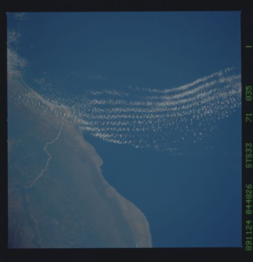
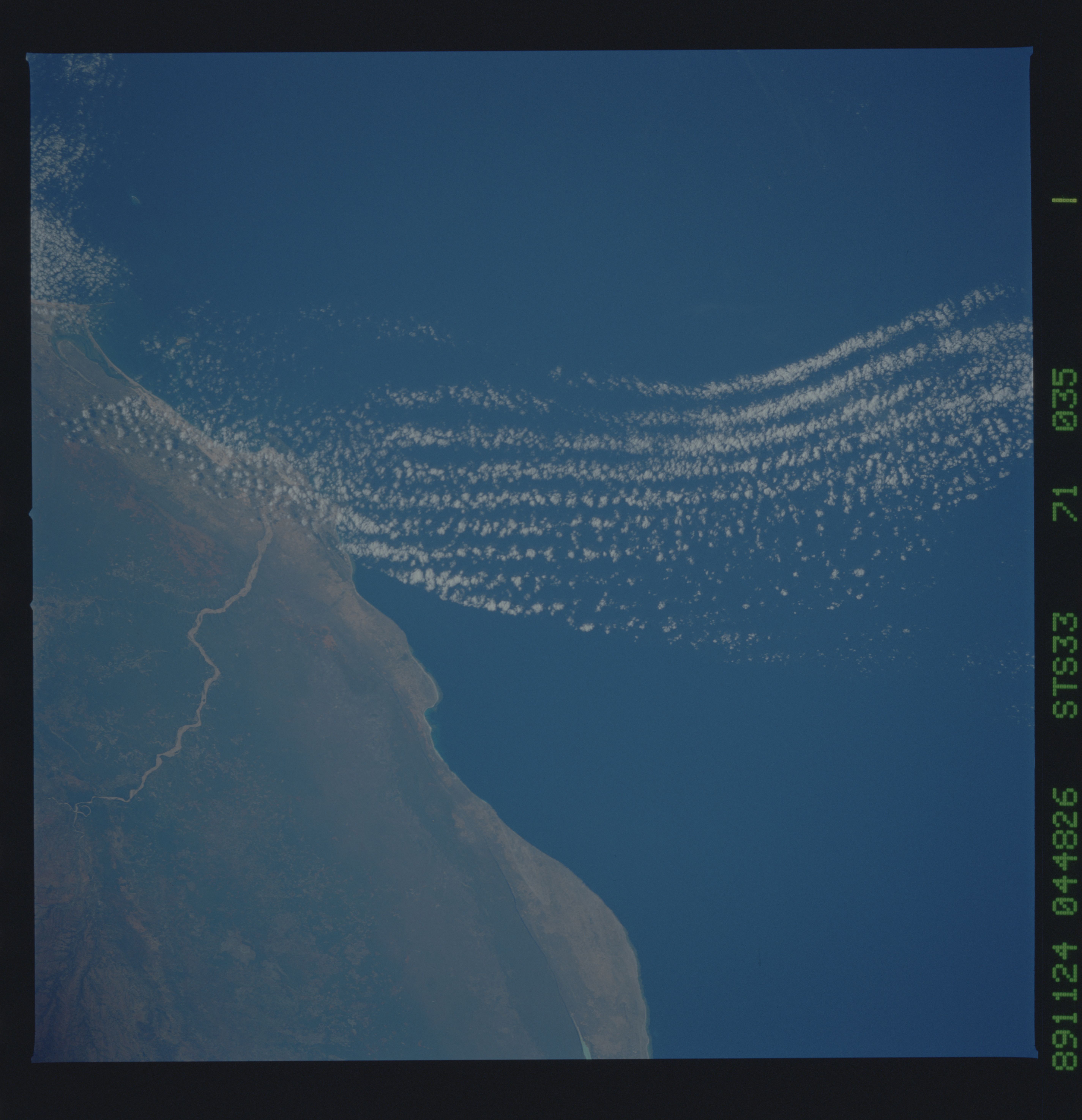
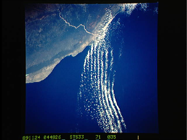
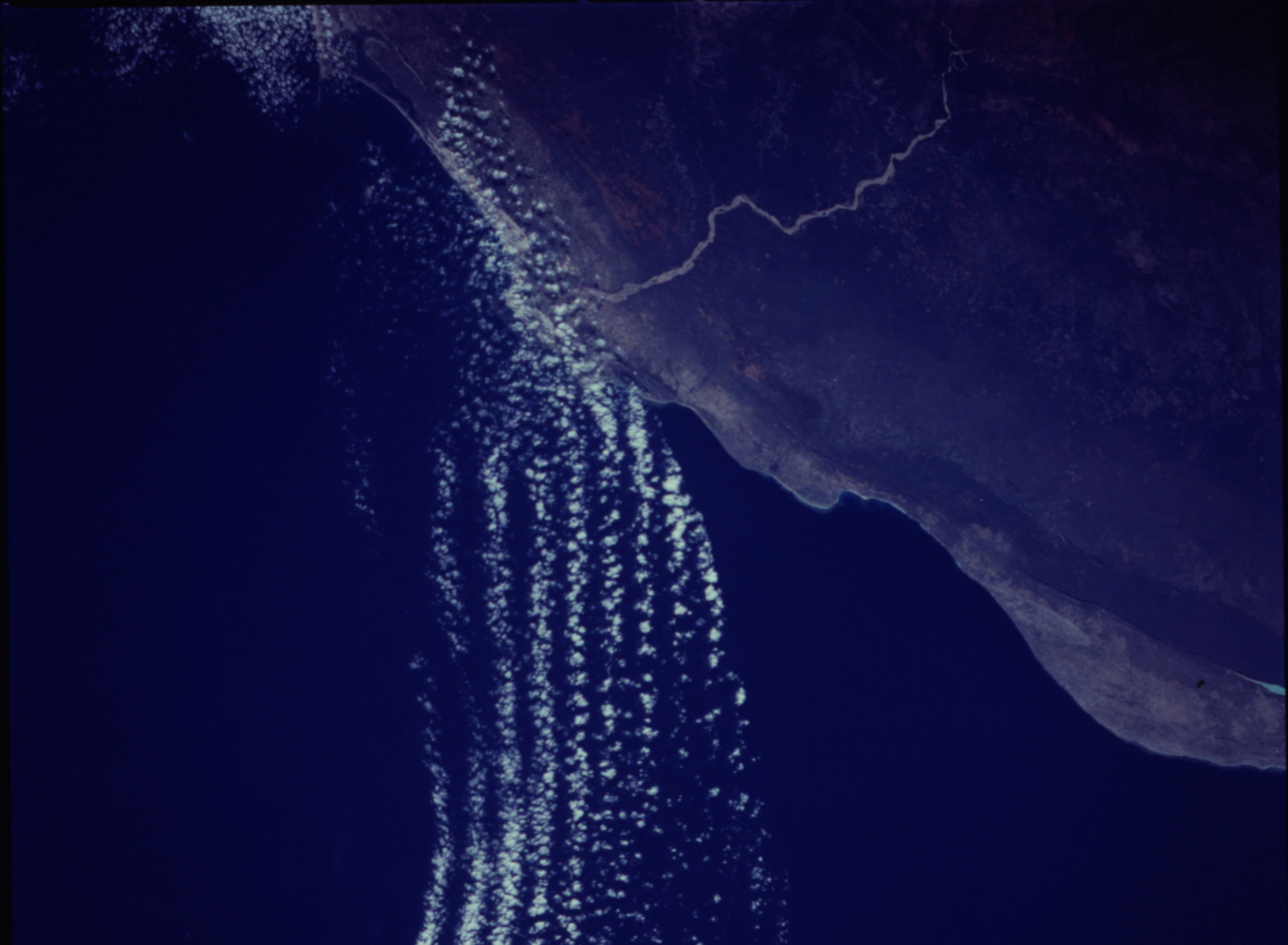
Country or Geographic Name: | MADAGASCAR |
Features: | MENARANDRA RIVER |
| Features Found Using Machine Learning: | |
Cloud Cover Percentage: | 10 (1-10)% |
Sun Elevation Angle: | 33° |
Sun Azimuth: | 98° |
Camera: | Hasselblad |
Focal Length: | 250mm |
Camera Tilt: | 35 degrees |
Format: | 5017: Kodak, natural color positive, Ektachrome, X Professional, ASA 64, standard base |
Film Exposure: | Normal |
| Additional Information | |
| Width | Height | Annotated | Cropped | Purpose | Links |
|---|---|---|---|---|---|
| 5700 pixels | 5900 pixels | No | No | Download Image | |
| 500 pixels | 518 pixels | No | No | Download Image | |
| 640 pixels | 480 pixels | No | No | Download Image | |
| 2648 pixels | 1943 pixels | No | ReefBase 1 | Download Image | |
| 2308 pixels | 1891 pixels | No | Yes | ReefBase 1 | Download Image |
Download Packaged File
Download a Google Earth KML for this Image
View photo footprint information
Download a GeoTIFF for this photo
Image Caption:
A gravity-wave packet along the southeastern coast of Africa
(25S, 44E), generated by wind shear along the obstructing coast,
and trapped by a temperature inversion. Photograph acquired at
7:48 AM local time. S33-71-035.
A gravity-wave packet along the southeastern coast of Africa
(25S, 44E), generated by wind shear along the obstructing coast,
and trapped by a temperature inversion. Photograph acquired at
7:48 AM local time. S33-71-035.
