STS032-87-84
| NASA Photo ID | STS032-87-84 |
| Focal Length | 50mm |
| Date taken | 1990.01.10 |
| Time taken | 21:06:43 GMT |
Cloud masks available for this image:
Spacecraft nadir point: 21.5° S, 69.4° W
Photo center point: 21.5° S, 69.5° W
Photo center point by machine learning:
Photo center point: 21.5° S, 69.5° W
Photo center point by machine learning:
Nadir to Photo Center: West
Spacecraft Altitude: 184 nautical miles (341km)
Country or Geographic Name: | CHILE |
Features: | ANDES MOUNTAINS, BOLIVIA |
| Features Found Using Machine Learning: | |
Cloud Cover Percentage: | 10 (1-10)% |
Sun Elevation Angle: | 29° |
Sun Azimuth: | 256° |
Camera: | Hasselblad |
Focal Length: | 50mm |
Camera Tilt: | 2 degrees |
Format: | 5017: Kodak, natural color positive, Ektachrome, X Professional, ASA 64, standard base |
Film Exposure: | Normal |
| Additional Information | |
| Width | Height | Annotated | Cropped | Purpose | Links |
|---|---|---|---|---|---|
| 5700 pixels | 5900 pixels | No | No | Download Image | |
| 500 pixels | 518 pixels | No | No | Download Image | |
| 640 pixels | 480 pixels | No | No | Download Image |
Download Packaged File
Download a Google Earth KML for this Image
View photo footprint information
Download a GeoTIFF for this photo
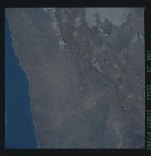
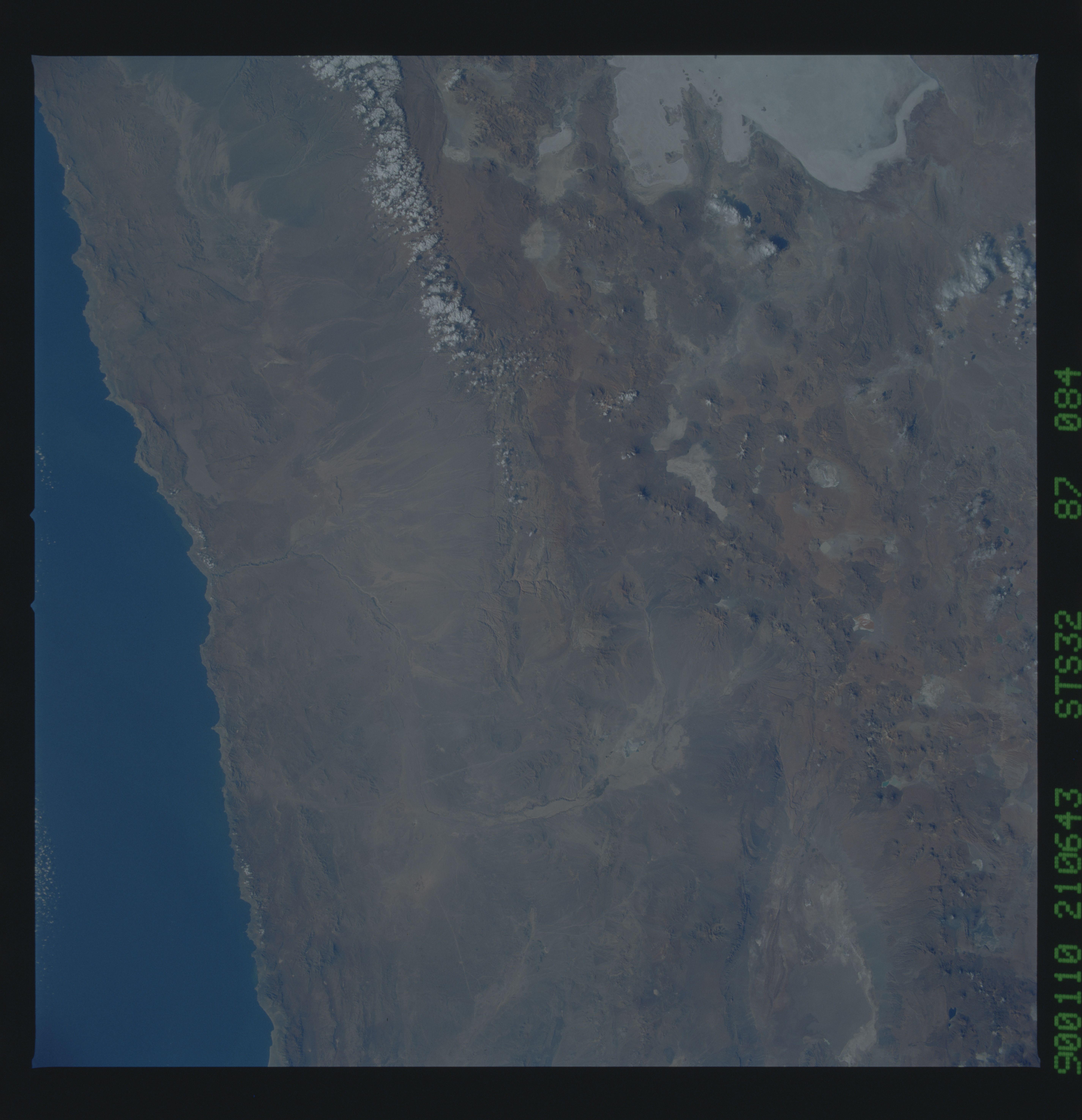
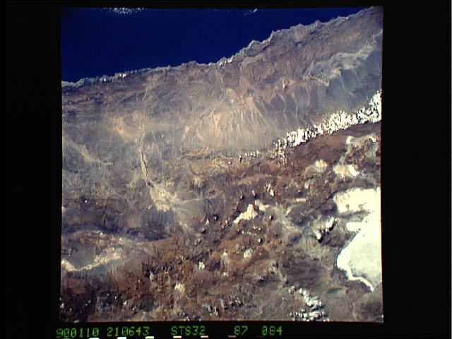
Image Caption:
The high Andean mountains boast hundreds of volcanoes, as seen in
this STS-32 photograph. The spatial distribution of volcanoes and
intervening basins and relationships with large-scale structures,
seen in Space Shuttle photos, are fundamental in the understand-
ing of volcanic provinces. The photograph was taken from an alti-
tude of 184 n.mi. (341 km) using a Hasselblad camera equipped
with a 50 mm lens and color visible film. (Photo ID: S32-87-084).
