STS032-81-79
| NASA Photo ID | STS032-81-79 |
| Focal Length | 250mm |
| Date taken | 1990.01.19 |
| Time taken | 17:28:57 GMT |
Resolutions offered for this image:
5285 x 5285 pixels 639 x 639 pixels 5700 x 5900 pixels 500 x 518 pixels 640 x 480 pixels
5285 x 5285 pixels 639 x 639 pixels 5700 x 5900 pixels 500 x 518 pixels 640 x 480 pixels
Cloud masks available for this image:
Spacecraft nadir point: 28.0° S, 57.0° W
Photo center point: 32.0° S, 52.0° W
Photo center point by machine learning:
Photo center point: 32.0° S, 52.0° W
Photo center point by machine learning:
Nadir to Photo Center: Southeast
Spacecraft Altitude: 180 nautical miles (333km)
Country or Geographic Name: | BRAZIL |
Features: | LAG. MIRIM, LAGO DOS PATOS |
| Features Found Using Machine Learning: | |
Cloud Cover Percentage: | 20 (11-25)% |
Sun Elevation Angle: | 68° |
Sun Azimuth: | 285° |
Camera: | Hasselblad |
Focal Length: | 250mm |
Camera Tilt: | High Oblique |
Format: | 5017: Kodak, natural color positive, Ektachrome, X Professional, ASA 64, standard base |
Film Exposure: | Normal |
| Additional Information | |
| Width | Height | Annotated | Cropped | Purpose | Links |
|---|---|---|---|---|---|
| 5285 pixels | 5285 pixels | No | No | Earth From Space collection | Download Image |
| 639 pixels | 639 pixels | No | No | Earth From Space collection | Download Image |
| 5700 pixels | 5900 pixels | No | No | Download Image | |
| 500 pixels | 518 pixels | No | No | Download Image | |
| 640 pixels | 480 pixels | No | No | Download Image |
Download Packaged File
Download a Google Earth KML for this Image
View photo footprint information
Download a GeoTIFF for this photo
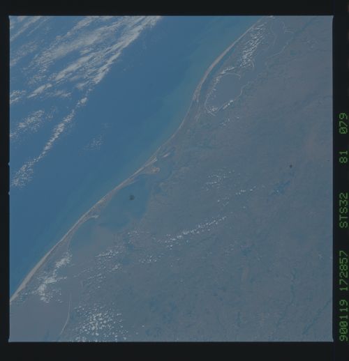
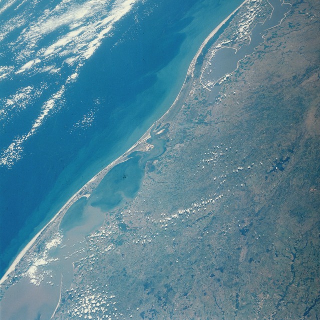
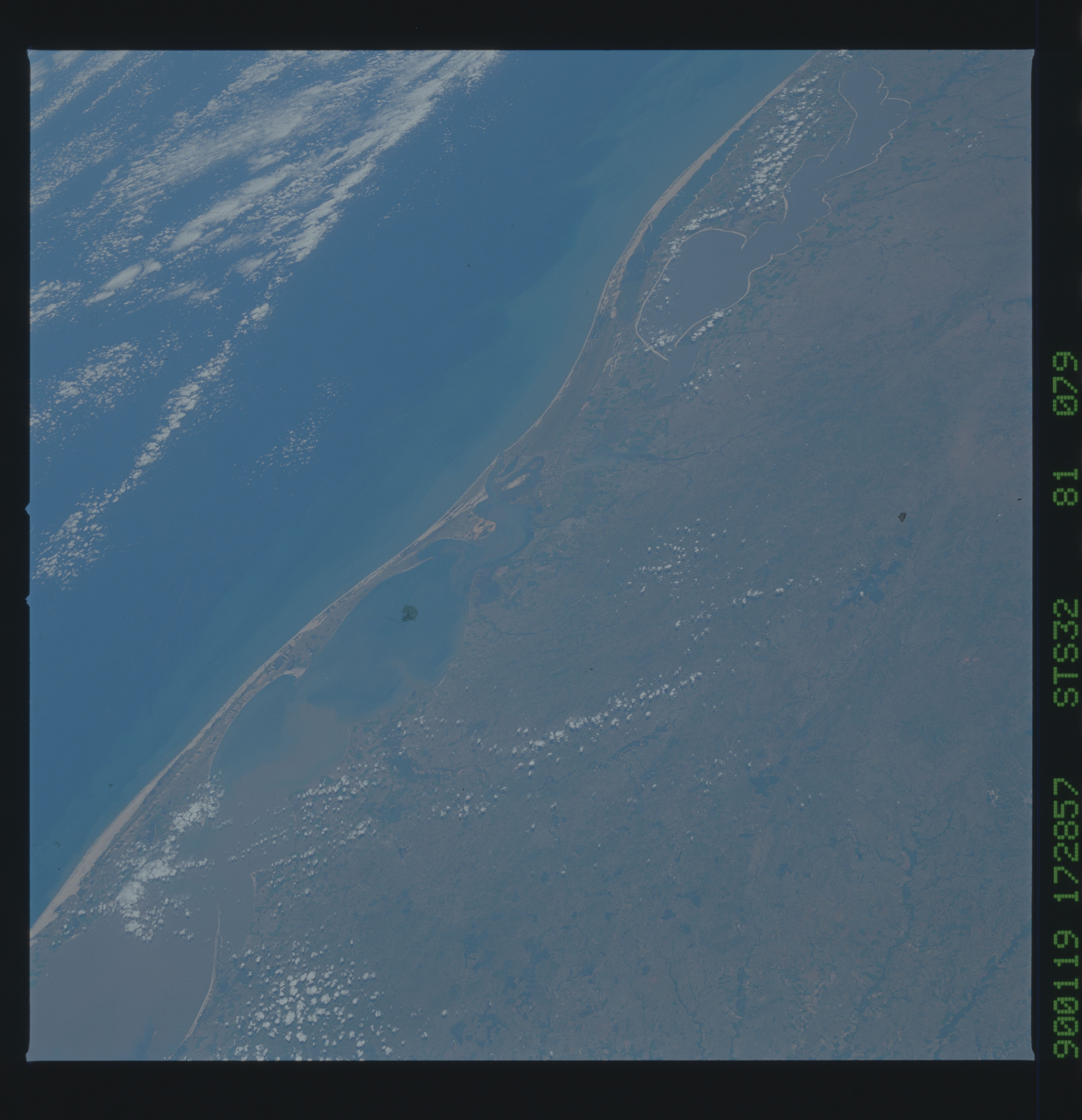
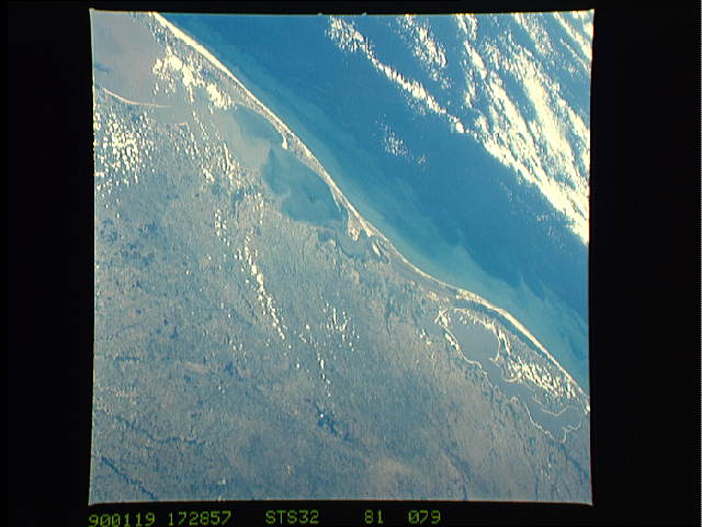
Image Caption: STS032-081-079 Lagoa dos Patos, Rio Grande do Sul, Brazil January 1990
Two large tidal lagoons interconnect in this southeast-looking, low-oblique photograph of the coastal state of Rio Grande do Sul in southernmost Brazil. Aligned northeast to southwest along the coast, Lagoa dos Patos and Lagoa Mirim, respectively, are separated from the Atlantic Ocean by a sandbar of varying widths. Lagoa dos Patos, with pronounced sediment plumes, stretches 150 miles (250 kilometers) from its northernmost point near Pôrto Alegre to its southernmost boundary near the port city of Rio Grande. Drainage from pastureland and rice fields, increasing population, and increased effluents from industrial development have degraded the water quality and created concern for the fragile ecosystem.
Two large tidal lagoons interconnect in this southeast-looking, low-oblique photograph of the coastal state of Rio Grande do Sul in southernmost Brazil. Aligned northeast to southwest along the coast, Lagoa dos Patos and Lagoa Mirim, respectively, are separated from the Atlantic Ocean by a sandbar of varying widths. Lagoa dos Patos, with pronounced sediment plumes, stretches 150 miles (250 kilometers) from its northernmost point near Pôrto Alegre to its southernmost boundary near the port city of Rio Grande. Drainage from pastureland and rice fields, increasing population, and increased effluents from industrial development have degraded the water quality and created concern for the fragile ecosystem.
