STS032-80-36
| NASA Photo ID | STS032-80-36 |
| Focal Length | 50mm |
| Date taken | 1990.01.18 |
| Time taken | 11:25:56 GMT |
Cloud masks available for this image:
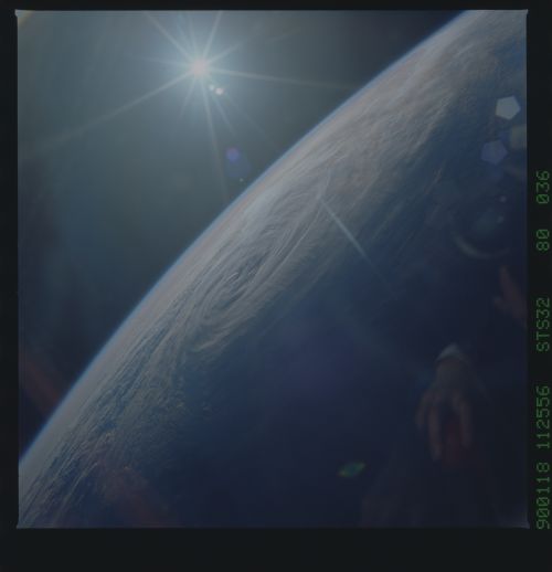
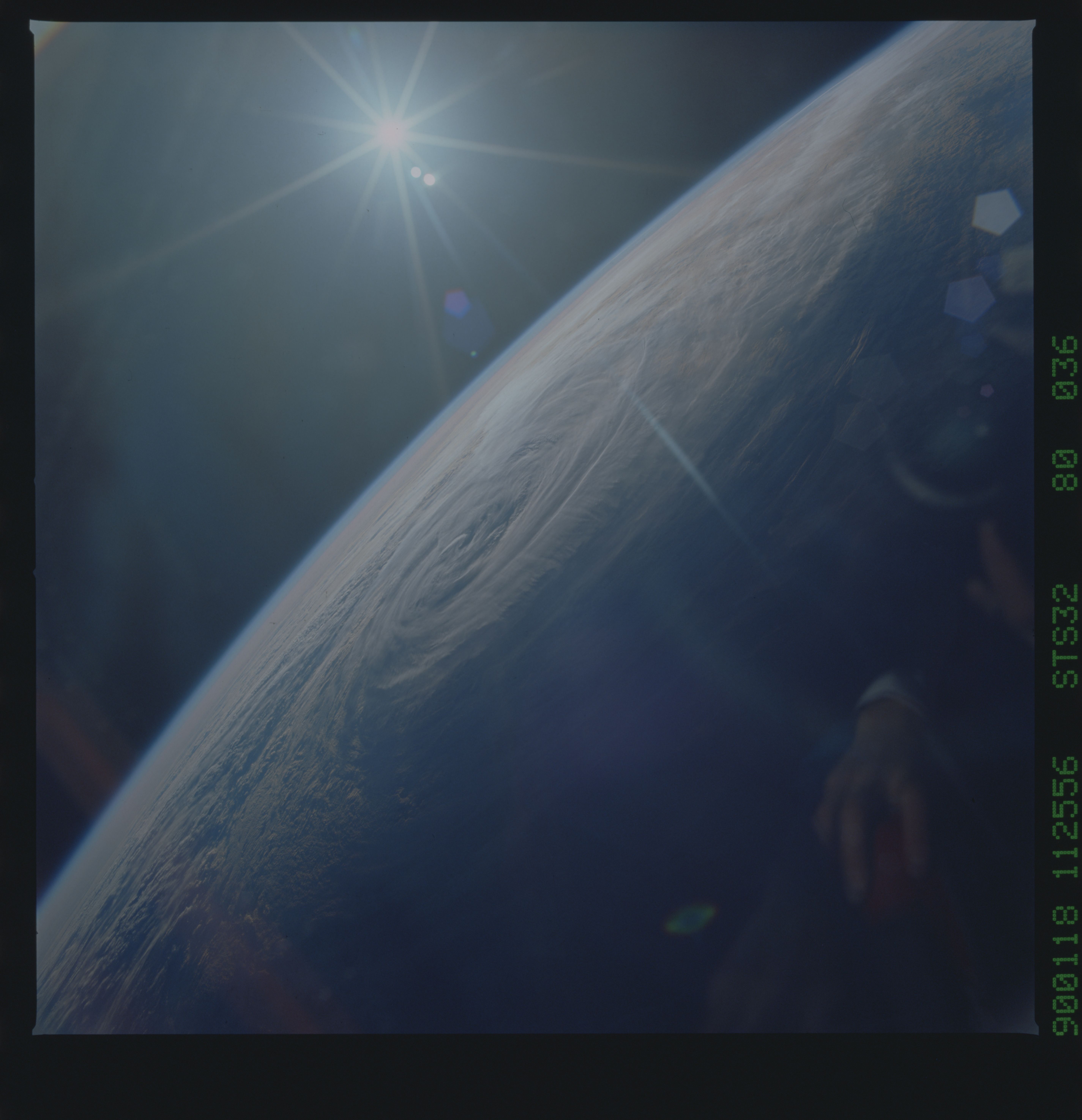
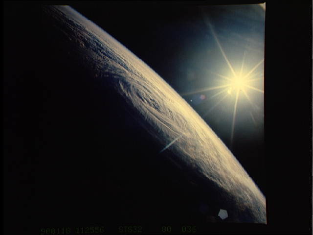
Spacecraft nadir point: 17.3° S, 111.4° E
Photo center point:
Photo center point by machine learning:
Photo center point:
Photo center point by machine learning:
Nadir to Photo Center:
Spacecraft Altitude: 180 nautical miles (333km)
Country or Geographic Name: | INDIAN OCEAN |
Features: | TC 10S (SAM) |
| Features Found Using Machine Learning: | |
Cloud Cover Percentage: | 100 (76-100)% |
Sun Elevation Angle: | -3° |
Sun Azimuth: | 247° |
Camera: | Hasselblad |
Focal Length: | 50mm |
Camera Tilt: | High Oblique |
Format: | 5017: Kodak, natural color positive, Ektachrome, X Professional, ASA 64, standard base |
Film Exposure: | Normal |
| Additional Information | |
| Width | Height | Annotated | Cropped | Purpose | Links |
|---|---|---|---|---|---|
| 5700 pixels | 5900 pixels | No | No | Download Image | |
| 500 pixels | 518 pixels | No | No | Download Image | |
| 640 pixels | 480 pixels | No | No | Download Image |
Download Packaged File
Download a Google Earth KML for this Image
View photo footprint information
Download a GeoTIFF for this photo
Image Caption: Tropical Storm Sam, Eastern Indian Ocean, exact location unknown, was begining to decay when this photograph was taken. The storm was mostly at sea for its entire duration and had little effect on land. The eye of the storm is still visible with the gyre of swirling clouds rotating clockwise. Winds aloft have begun to shear the tops of the thunderstorms associated with the storm forming a high cirrus cloud cover over the center of the storm.
