STS032-74-24
| NASA Photo ID | STS032-74-24 |
| Focal Length | 250mm |
| Date taken | 1990.01.14 |
| Time taken | 13:06:23 GMT |
Resolutions offered for this image:
5285 x 5285 pixels 639 x 639 pixels 5700 x 5900 pixels 500 x 518 pixels 640 x 480 pixels
5285 x 5285 pixels 639 x 639 pixels 5700 x 5900 pixels 500 x 518 pixels 640 x 480 pixels

Cloud masks available for this image:
Spacecraft nadir point: 25.1° S, 33.2° E
Photo center point: 26.0° S, 32.5° E
Photo center point by machine learning:
Photo center point: 26.0° S, 32.5° E
Photo center point by machine learning:
Nadir to Photo Center: Southwest
Spacecraft Altitude: 182 nautical miles (337km)
Country or Geographic Name: | MOZAMBIQUE |
Features: | BAIA DE MAPUTO |
| Features Found Using Machine Learning: | |
Cloud Cover Percentage: | 20 (11-25)% |
Sun Elevation Angle: | 46° |
Sun Azimuth: | 264° |
Camera: | Hasselblad |
Focal Length: | 250mm |
Camera Tilt: | 21 degrees |
Format: | 5036: Kodak, natural color positive, Ektachrome 5036,200 Professional, ASA 200, stand |
Film Exposure: | Normal |
| Additional Information | |
| Width | Height | Annotated | Cropped | Purpose | Links |
|---|---|---|---|---|---|
| 5285 pixels | 5285 pixels | No | No | Earth From Space collection | Download Image |
| 639 pixels | 639 pixels | No | No | Earth From Space collection | Download Image |
| 5700 pixels | 5900 pixels | No | No | Download Image | |
| 500 pixels | 518 pixels | No | No | Download Image | |
| 640 pixels | 480 pixels | No | No | Download Image |
Download Packaged File
Download a Google Earth KML for this Image
View photo footprint information
Download a GeoTIFF for this photo
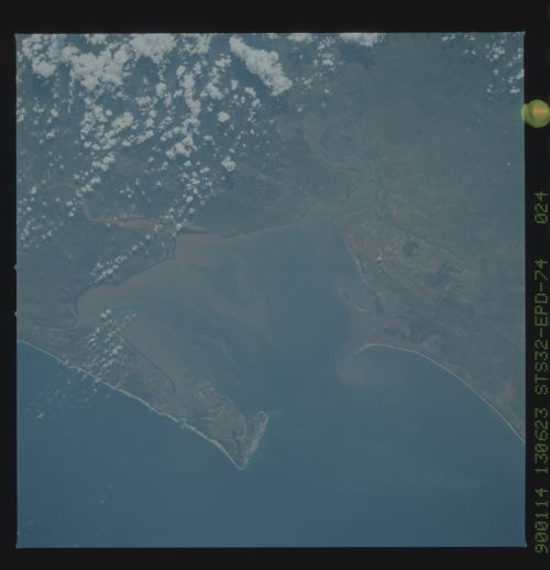
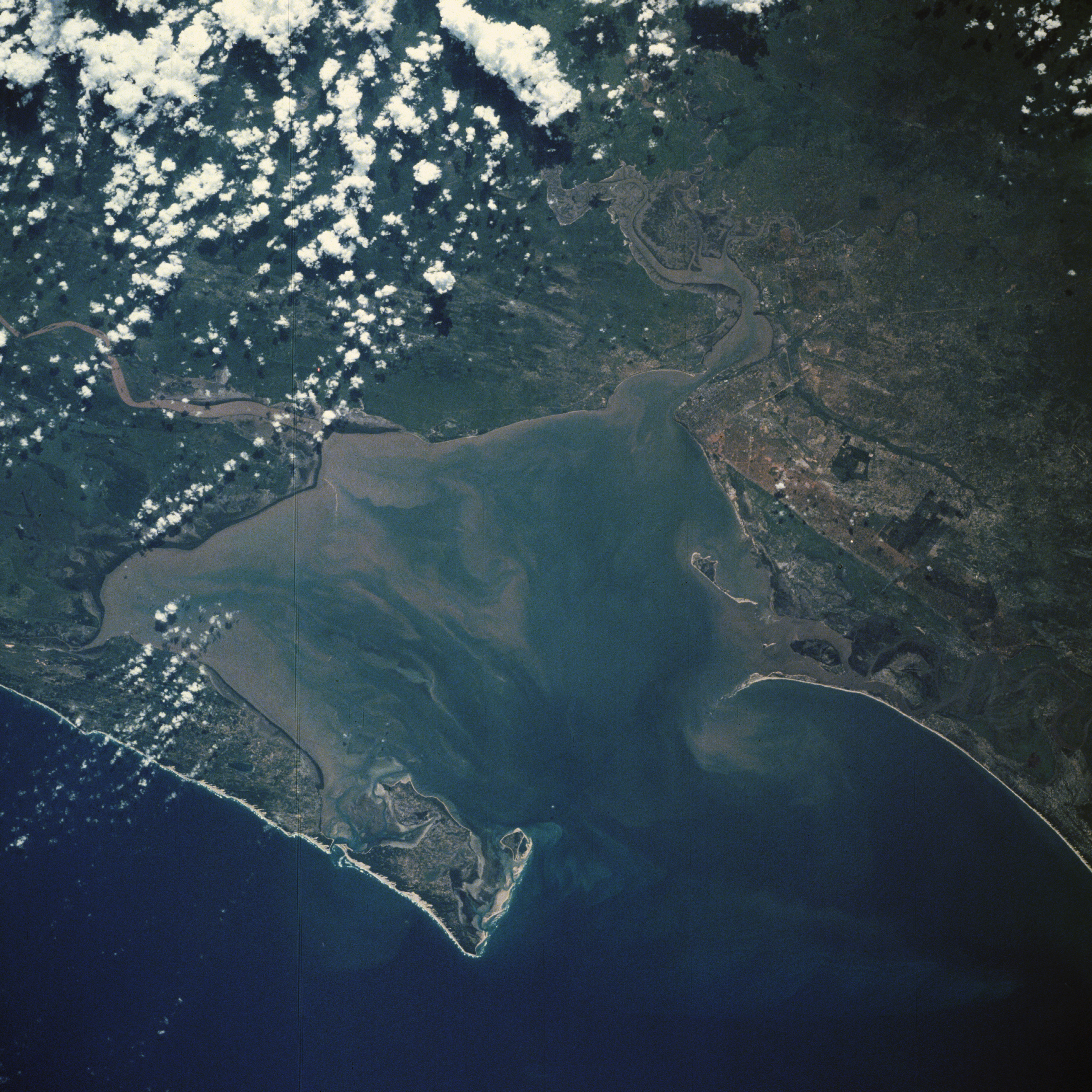
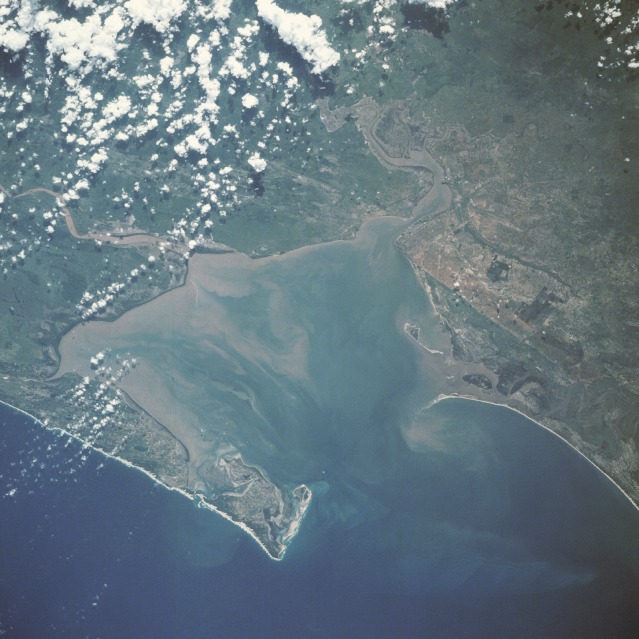
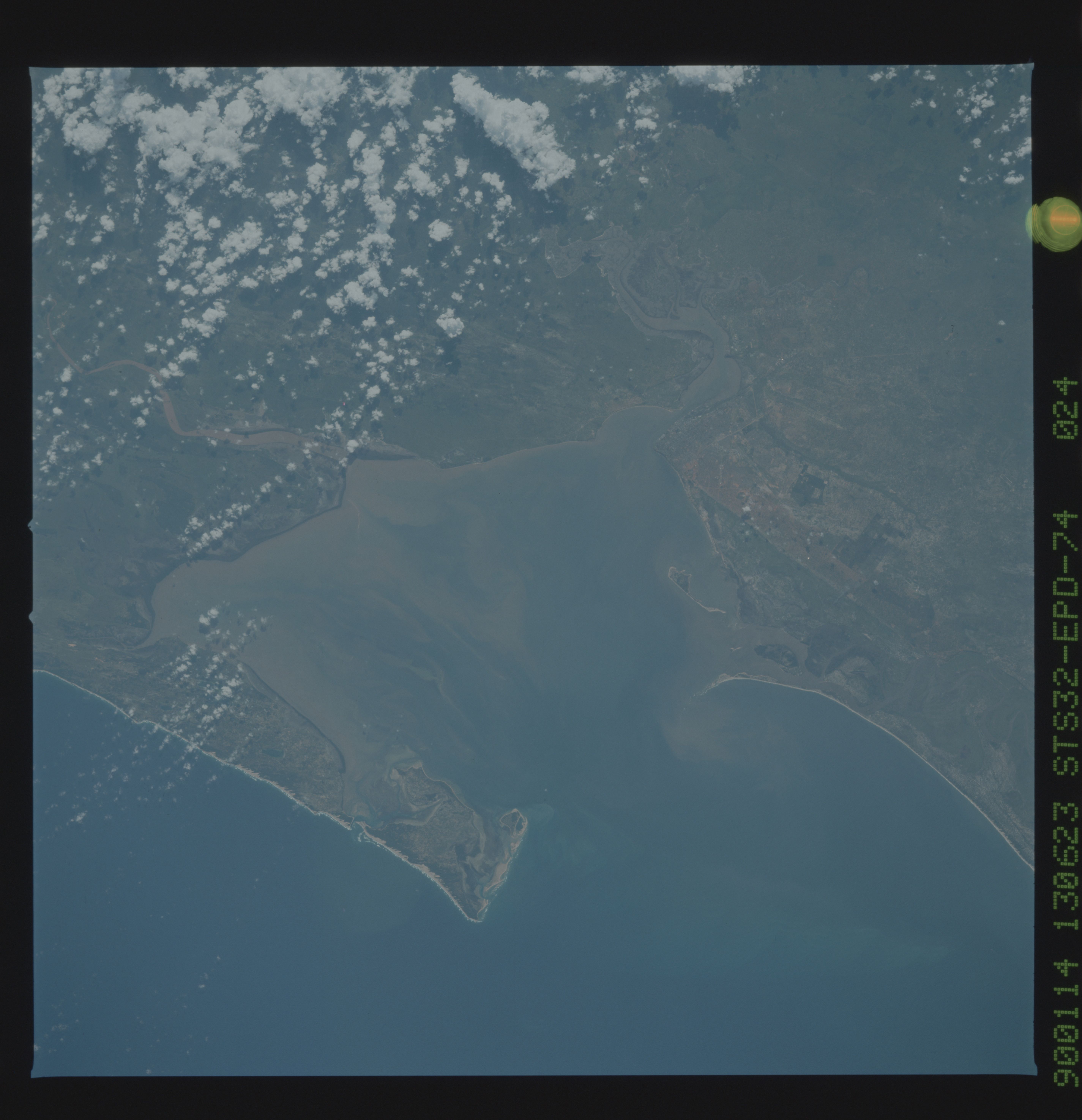
Image Caption: STS032-074-024 Maputo and Delagoa Bay, Mozambique January 1990
Maputo, the capital of Mozambique, and Delagoa Bay are visible in this southwest-looking, low-oblique photograph. Maputo, surrounded by low-lying swamps, sits on the north bank of the Maputo River, which empties into Delagoa Bay, an inlet of the Indian Ocean 55 miles (90 kilometers) long and 20 miles (32 kilometers) wide. Maputo has extensive modern port facilities and exports coal, cotton, sugar, chrome, ore, and hardwood. The city's main manufacturing products are food, beverages, cement, pottery, furniture, shoes, and rubber. Year-round temperatures are high, and rainfall is governed by monsoons.
Maputo, the capital of Mozambique, and Delagoa Bay are visible in this southwest-looking, low-oblique photograph. Maputo, surrounded by low-lying swamps, sits on the north bank of the Maputo River, which empties into Delagoa Bay, an inlet of the Indian Ocean 55 miles (90 kilometers) long and 20 miles (32 kilometers) wide. Maputo has extensive modern port facilities and exports coal, cotton, sugar, chrome, ore, and hardwood. The city's main manufacturing products are food, beverages, cement, pottery, furniture, shoes, and rubber. Year-round temperatures are high, and rainfall is governed by monsoons.
