STS031-78-017
| NASA Photo ID | STS031-78-017 |
| Focal Length | 40mm |
| Date taken | 1990.04.26 |
| Time taken | 16:23:05 GMT |

Cloud masks available for this image:
Spacecraft nadir point: 24.1° N, 118.2° W
Photo center point: 32.5° N, 118.0° W
Photo center point by machine learning:
Photo center point: 32.5° N, 118.0° W
Photo center point by machine learning:
Nadir to Photo Center: North
Spacecraft Altitude: 333 nautical miles (617km)
Country or Geographic Name: | USA-CALIFORNIA |
Features: | COAST, IMPERIAL VALLEY |
| Features Found Using Machine Learning: | |
Cloud Cover Percentage: | 60 (51-75)% |
Sun Elevation Angle: | 40° |
Sun Azimuth: | 92° |
Camera: | Hasselblad |
Focal Length: | 40mm |
Camera Tilt: | High Oblique |
Format: | 5017: Kodak, natural color positive, Ektachrome, X Professional, ASA 64, standard base |
Film Exposure: | Normal |
| Additional Information | |
| Width | Height | Annotated | Cropped | Purpose | Links |
|---|---|---|---|---|---|
| 5700 pixels | 5900 pixels | No | No | Download Image | |
| 500 pixels | 518 pixels | No | No | Download Image | |
| 640 pixels | 480 pixels | No | No | Download Image |
Download Packaged File
Download a Google Earth KML for this Image
View photo footprint information
Download a GeoTIFF for this photo
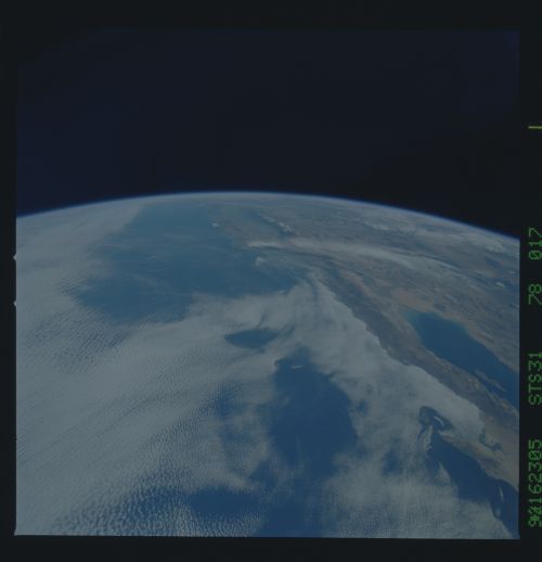
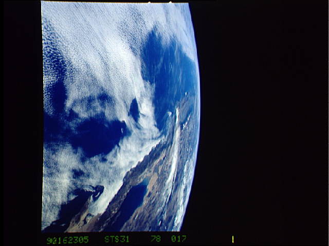
Image Caption: This view shows the west coast of the United States and Mexico (32.5N, 118.0W) and gives an indication of the range of view from orbital altitude. The visual range of this particular scene is from Skammon's Lagoon on Baja to the northern tip of California's Central Valley and Sierra Nevada, a range of over 15 degrees of latitude. Coastal fog drapes over southern California and northern Baja California. White Sands, New Mexico is at far right center.
