STS030-88-K
| NASA Photo ID | STS030-88-K |
| Focal Length | 100mm |
| Date taken | 1989.05.__ |
| Time taken | GMT |

Cloud masks available for this image:
Spacecraft nadir point:
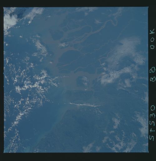
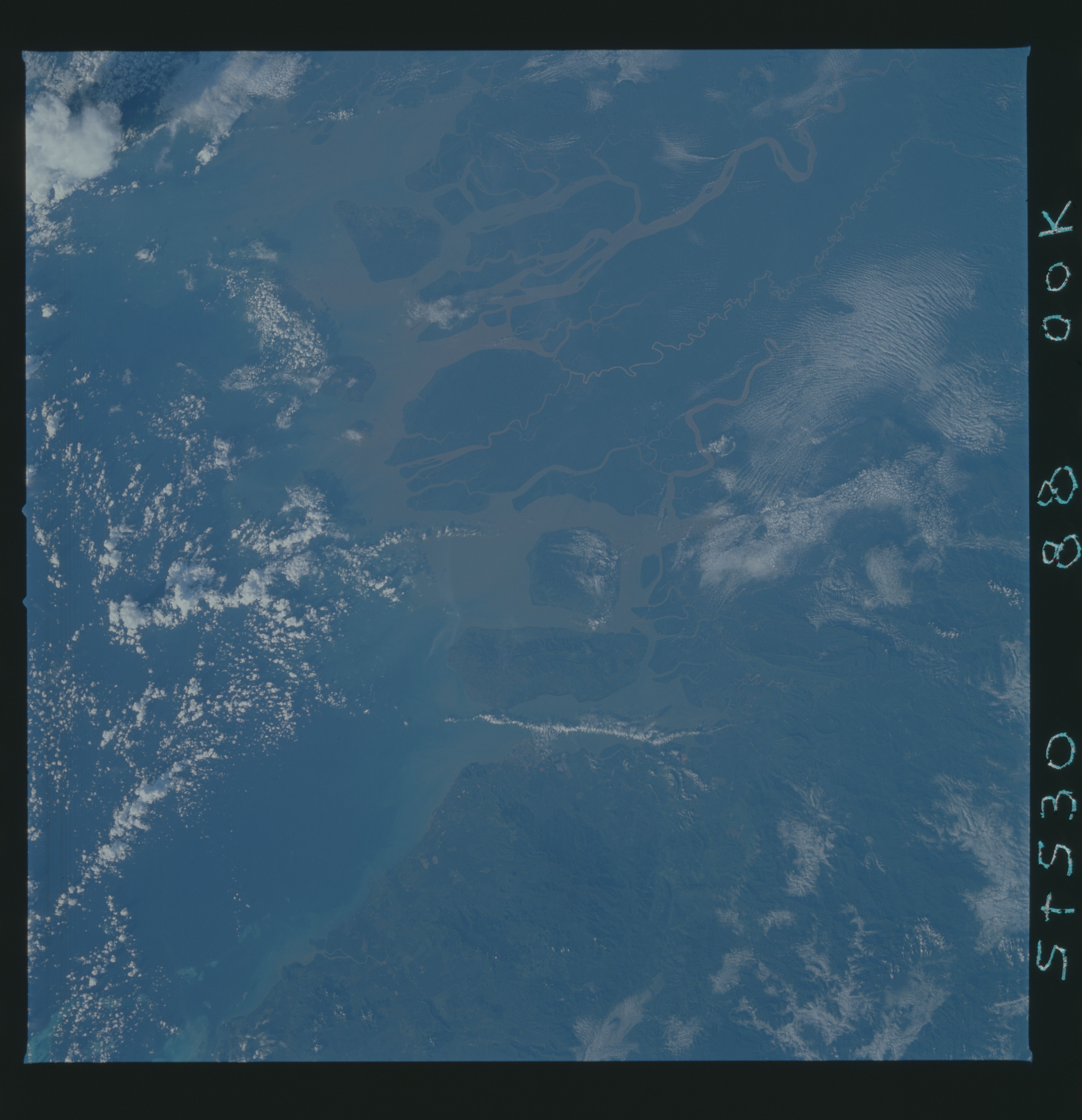
Photo center point: 4.0° N, 117.5° E
Photo center point by machine learning:
Photo center point: 4.0° N, 117.5° E
Photo center point by machine learning:
Nadir to Photo Center:
Spacecraft Altitude: nautical miles (0km)
Country or Geographic Name: | INDONESIA |
Features: | BORNEO |
| Features Found Using Machine Learning: | |
Cloud Cover Percentage: | 50 (26-50)% |
Sun Elevation Angle: | ° |
Sun Azimuth: | ° |
Camera: | Hasselblad |
Focal Length: | 100mm |
Camera Tilt: | Near Vertical |
Format: | 5017: Kodak, natural color positive, Ektachrome, X Professional, ASA 64, standard base |
Film Exposure: | Normal |
| Additional Information | |
| Width | Height | Annotated | Cropped | Purpose | Links |
|---|---|---|---|---|---|
| 5700 pixels | 5900 pixels | No | No | Download Image | |
| 500 pixels | 518 pixels | No | No | Download Image | |
| 640 pixels | 480 pixels | No | No | Download Image |
Download Packaged File
Download a Google Earth KML for this Image
View photo footprint information
Download a GeoTIFF for this photo
Image Caption: Situated on the NW coast of Borneo, the island city of Tarakan (4.0N, 117.5E) in the Kalimantan state of Borneo, Indonesia, dominates the entrance to the estuary. Like all Pacific islands, Borneo is volcanic in origin and much of it's volcanic past can still be observed today. The large volcano just to the north of the delta is Mt. Magdalena and a line of older, almost eroded volcanic features can be seen extending east and northeast to the coast.
