STS030-87-60
| NASA Photo ID | STS030-87-60 |
| Focal Length | 100mm |
| Date taken | 1989.05.08 |
| Time taken | 07:23:12 GMT |

Cloud masks available for this image:
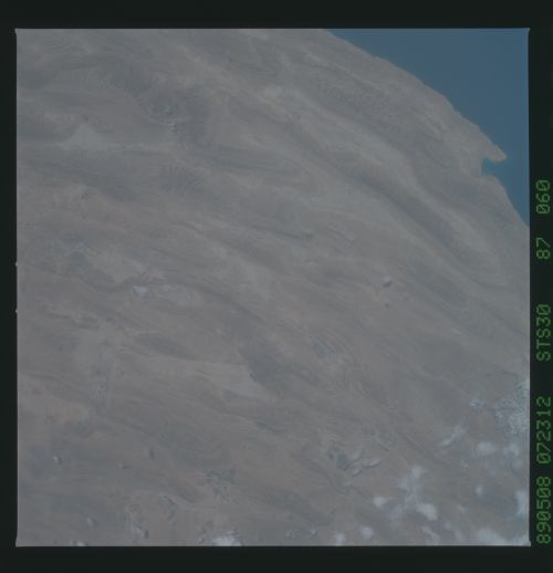
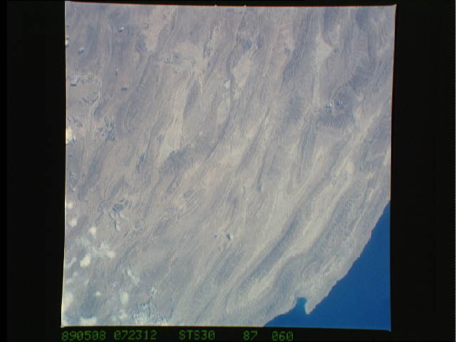
Spacecraft nadir point: 28.2° N, 53.7° E
Photo center point: 28.0° N, 53.5° E
Photo center point by machine learning:
Photo center point: 28.0° N, 53.5° E
Photo center point by machine learning:
Nadir to Photo Center: Southwest
Spacecraft Altitude: 177 nautical miles (328km)
Country or Geographic Name: | IRAN |
Features: | ZAGROS MOUNTAINS |
| Features Found Using Machine Learning: | |
Cloud Cover Percentage: | 10 (1-10)% |
Sun Elevation Angle: | 72° |
Sun Azimuth: | 126° |
Camera: | Hasselblad |
Focal Length: | 100mm |
Camera Tilt: | 5 degrees |
Format: | 5017: Kodak, natural color positive, Ektachrome, X Professional, ASA 64, standard base |
Film Exposure: | Normal |
| Additional Information | |
| Width | Height | Annotated | Cropped | Purpose | Links |
|---|---|---|---|---|---|
| 5700 pixels | 5900 pixels | No | No | Download Image | |
| 500 pixels | 518 pixels | No | No | Download Image | |
| 640 pixels | 480 pixels | No | No | Download Image |
Download Packaged File
Download a Google Earth KML for this Image
View photo footprint information
Download a GeoTIFF for this photo
Image Caption: Oblique southeastward view of the Zagros Ranges, southern Iran. Orient with the Persian Gulf to the upper right. Thick layers of limestone have been crumpled up - folded - by geological forces; the folding was aided by a layer of rock salt that underlies this area at a depth of several thousand feet. In places the salt flows to the surface in domes (for example, the elliptical dark brown patch marked by tiny clouds in the upper left). The climate is so dry that the salt is not completely dissolved by rainfall, but instead flows down the hillsides like glaciers.
