STS030-152-19
| NASA Photo ID | STS030-152-19 |
| Focal Length | 90mm |
| Date taken | 1989.05.06 |
| Time taken | 17:35:41 GMT |
Resolutions offered for this image:
640 x 480 pixels
640 x 480 pixels
Cloud masks available for this image:
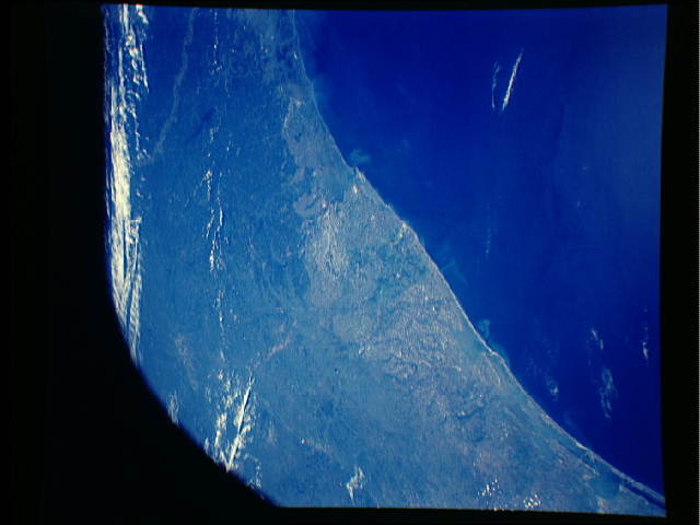
Spacecraft nadir point: 27.0° N, 95.2° W
Photo center point: 29.0° N, 95.5° W
Photo center point by machine learning:
Photo center point: 29.0° N, 95.5° W
Photo center point by machine learning:
Nadir to Photo Center: North
Spacecraft Altitude: 176 nautical miles (326km)
Country or Geographic Name: | USA-TEXAS |
Features: | GULF COAST, HOUSTON |
| Features Found Using Machine Learning: | |
Cloud Cover Percentage: | 10 (1-10)% |
Sun Elevation Angle: | 75° |
Sun Azimuth: | 134° |
Camera: | Linhof |
Focal Length: | 90mm |
Camera Tilt: | 35 degrees |
Format: | 5017: Kodak, natural color positive, Ektachrome, X Professional, ASA 64, standard base |
Film Exposure: | Normal |
| Additional Information | |
| Width | Height | Annotated | Cropped | Purpose | Links |
|---|---|---|---|---|---|
| 640 pixels | 480 pixels | No | No | ISD 1 | Download Image |
Download Packaged File
Download a Google Earth KML for this Image
View photo footprint information
Download a GeoTIFF for this photo
Image Caption: High-altitude Linhof view of the upper Texas Coast, centered on the paleo Brazos/Colorado Delta.
