STS030-151-25
| NASA Photo ID | STS030-151-25 |
| Focal Length | 90mm |
| Date taken | 1989.05.05 |
| Time taken | 19:02:45 GMT |
Resolutions offered for this image:
640 x 480 pixels
640 x 480 pixels
Cloud masks available for this image:
Spacecraft nadir point: 28.9° N, 80.6° W
Photo center point: 29.0° N, 80.5° W
Photo center point by machine learning:
Photo center point: 29.0° N, 80.5° W
Photo center point by machine learning:
Nadir to Photo Center: Northeast
Spacecraft Altitude: 172 nautical miles (319km)
Country or Geographic Name: | USA-FLORIDA |
Features: | CAPE CANAVERAL |
| Features Found Using Machine Learning: | |
Cloud Cover Percentage: | 50 (26-50)% |
Sun Elevation Angle: | 63° |
Sun Azimuth: | 248° |
Camera: | Linhof |
Focal Length: | 90mm |
Camera Tilt: | 3 degrees |
Format: | 5017: Kodak, natural color positive, Ektachrome, X Professional, ASA 64, standard base |
Film Exposure: | Normal |
| Additional Information | |
| Width | Height | Annotated | Cropped | Purpose | Links |
|---|---|---|---|---|---|
| 640 pixels | 480 pixels | No | No | ISD 1 | Download Image |
Download Packaged File
Download a Google Earth KML for this Image
View photo footprint information
Download a GeoTIFF for this photo
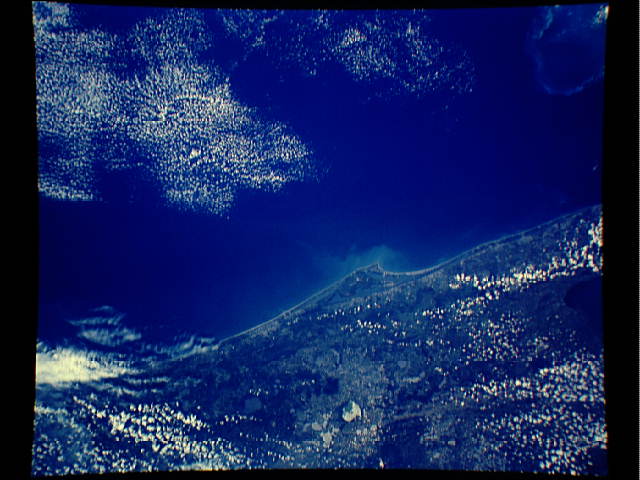
Image Caption: This overhead view of the central eastern shore of Florida shows the Cape Canaveral and Kennedy Space Center (28.5N, 80.5W), where all of the NASA manned space missions originate. Sprinkled along the jutting cape are a number of KSC launch pads and the nearby Space Shuttle Landing Facility. Merritt Island, just south of Kennedy Space Center is where the spacecraft liftoff tracking station is located. Orlando is on the left edge of photo.
