STS028-91-9
| NASA Photo ID | STS028-91-9 |
| Focal Length | 250mm |
| Date taken | 1989.08.13 |
| Time taken | 09:13:29 GMT |
Cloud masks available for this image:
Spacecraft nadir point: 46.3° N, 61.3° E
Photo center point: 46.0° N, 59.5° E
Photo center point by machine learning:
Photo center point: 46.0° N, 59.5° E
Photo center point by machine learning:
Nadir to Photo Center: West
Spacecraft Altitude: 162 nautical miles (300km)
Country or Geographic Name: | KAZAKHSTAN |
Features: | ARAL SEA |
| Features Found Using Machine Learning: | |
Cloud Cover Percentage: | 40 (26-50)% |
Sun Elevation Angle: | 55° |
Sun Azimuth: | 212° |
Camera: | Hasselblad |
Focal Length: | 250mm |
Camera Tilt: | 34 degrees |
Format: | 5017: Kodak, natural color positive, Ektachrome, X Professional, ASA 64, standard base |
Film Exposure: | Normal |
| Additional Information | |
| Width | Height | Annotated | Cropped | Purpose | Links |
|---|---|---|---|---|---|
| 5700 pixels | 5900 pixels | No | No | Download Image | |
| 500 pixels | 518 pixels | No | No | Download Image | |
| 640 pixels | 480 pixels | No | No | Download Image |
Download Packaged File
Download a Google Earth KML for this Image
View photo footprint information
Download a GeoTIFF for this photo
Image Caption:
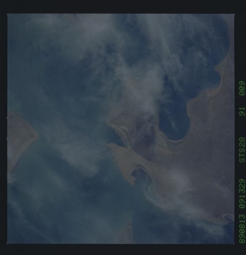
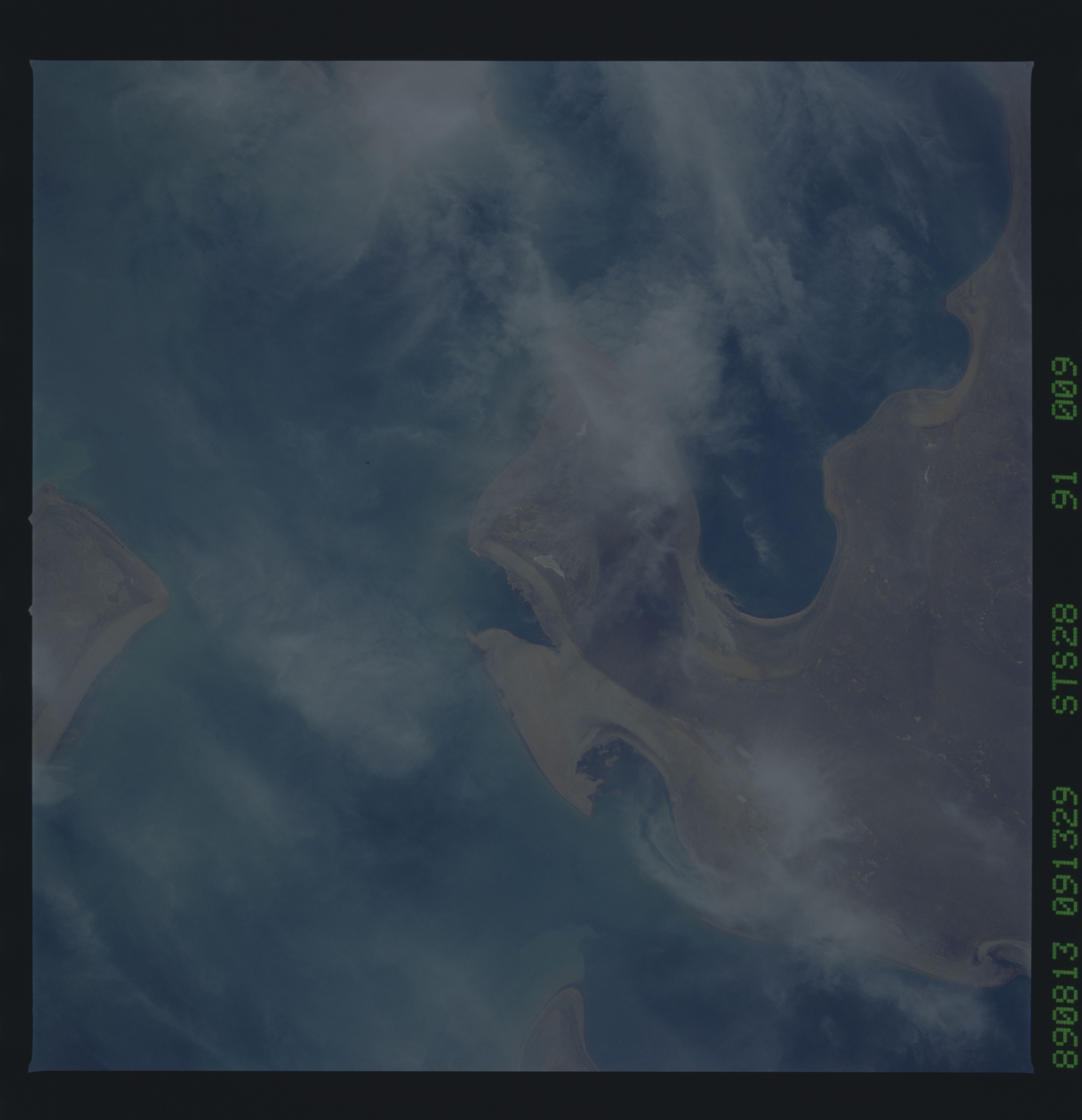
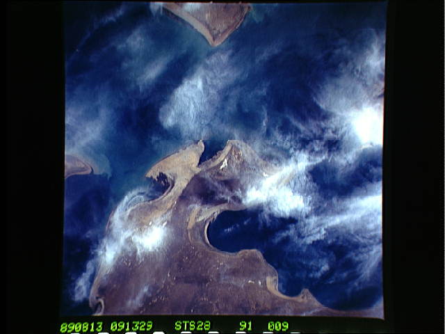
The Aral' Sea, August 1989 T124
The STS-28 crew photographed the Aral' Sea during their mission
in August 1989. The photograph to the left is a south-looking
oblique view that shows dust (probably salt and silt) blowing
from the eastern shore (1) out over the sea and from Vozrozhdeni-
ya Island (2) over the western shoreline. The top near-vertical
view depicts the older shorelines (3) along the northwestern
coast and Barsa-Kel'mes Island. The land area of the island con-
tinues to grow as water levels in the sea decrease. (S28-153-
074; S28-91-009, 010)
