STS028-87-59

| NASA Photo ID | STS028-87-59 |
| Focal Length | 100mm |
| Date taken | 1989.08.11 |
| Time taken | 10:28:01 GMT |
Resolutions offered for this image:
5700 x 5900 pixels 500 x 518 pixels 640 x 480 pixels 1190 x 1200 pixels
5700 x 5900 pixels 500 x 518 pixels 640 x 480 pixels 1190 x 1200 pixels

Cloud masks available for this image:
Spacecraft nadir point: 45.6° N, 54.9° E
Photo center point: 47.0° N, 51.5° E
Photo center point by machine learning:
Photo center point: 47.0° N, 51.5° E
Photo center point by machine learning:
Nadir to Photo Center: West
Spacecraft Altitude: 163 nautical miles (302km)
Country or Geographic Name: | KAZAKHSTAN |
Features: | CASPIAN SEA |
| Features Found Using Machine Learning: | |
Cloud Cover Percentage: | 5 (1-10)% |
Sun Elevation Angle: | 50° |
Sun Azimuth: | 230° |
Camera: | Hasselblad |
Focal Length: | 100mm |
Camera Tilt: | 54 degrees |
Format: | 5017: Kodak, natural color positive, Ektachrome, X Professional, ASA 64, standard base |
Film Exposure: | Normal |
| Additional Information | |
| Width | Height | Annotated | Cropped | Purpose | Links |
|---|---|---|---|---|---|
| 5700 pixels | 5900 pixels | No | No | Download Image | |
| 500 pixels | 518 pixels | No | No | Download Image | |
| 640 pixels | 480 pixels | No | No | Download Image | |
| 1190 pixels | 1200 pixels | Yes | No | Download Image |
Download Packaged File
Download a Google Earth KML for this Image
View photo footprint information
Download a GeoTIFF for this photo
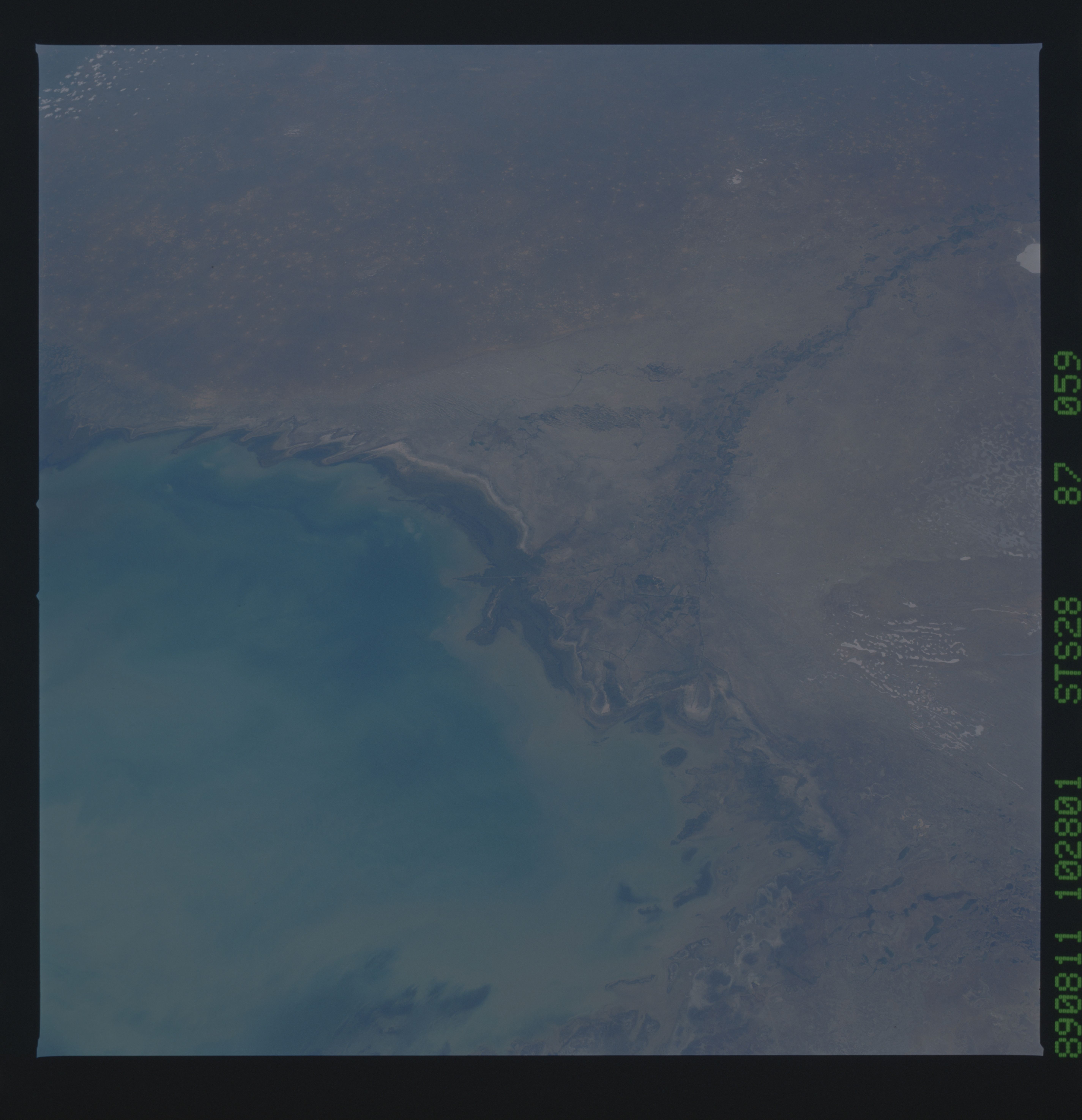
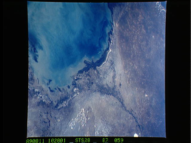
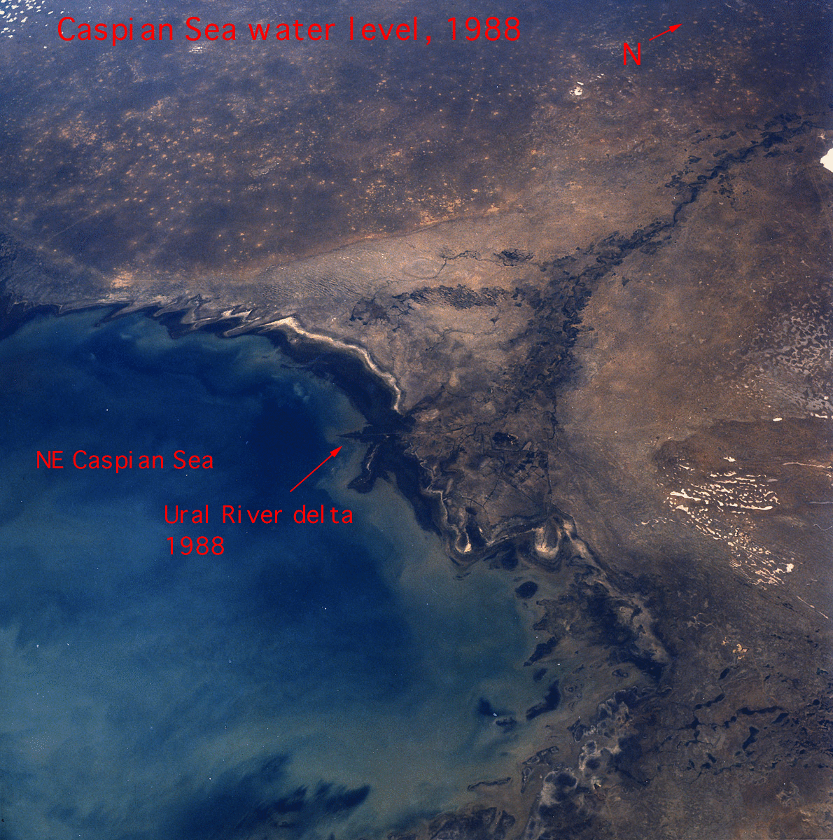
Image Caption: STS028-87-059 Compare this photograph of the Ural River Delta with the
1985 photographs. Although the water level is slightly higher, white
patches around the coast suggest that evaporation is a key element of
coastal processes. However, rapid water level rises in 1994 flooded
this region and threatened much of the industry infrastructure (roads,
etc.) in this region. W21
