STS028-82-48
| NASA Photo ID | STS028-82-48 |
| Focal Length | 250mm |
| Date taken | 1989.08.09 |
| Time taken | 19:06:12 GMT |
Resolutions offered for this image:
3898 x 3832 pixels 639 x 629 pixels 5700 x 5900 pixels 500 x 518 pixels 640 x 480 pixels
3898 x 3832 pixels 639 x 629 pixels 5700 x 5900 pixels 500 x 518 pixels 640 x 480 pixels

Cloud masks available for this image:
Spacecraft nadir point: 57.2° N, 115.0° W
Photo center point: 58.5° N, 116.0° W
Photo center point by machine learning:
Photo center point: 58.5° N, 116.0° W
Photo center point by machine learning:
Nadir to Photo Center: Northwest
Spacecraft Altitude: 162 nautical miles (300km)
Country or Geographic Name: | CANADA-A |
Features: | PEACE RIVER |
| Features Found Using Machine Learning: | |
Cloud Cover Percentage: | 5 (1-10)% |
Sun Elevation Angle: | 48° |
Sun Azimuth: | 166° |
Camera: | Hasselblad |
Focal Length: | 250mm |
Camera Tilt: | Near Vertical |
Format: | 5017: Kodak, natural color positive, Ektachrome, X Professional, ASA 64, standard base |
Film Exposure: | Normal |
| Additional Information | |
| Width | Height | Annotated | Cropped | Purpose | Links |
|---|---|---|---|---|---|
| 3898 pixels | 3832 pixels | No | No | Earth From Space collection | Download Image |
| 639 pixels | 629 pixels | No | No | Earth From Space collection | Download Image |
| 5700 pixels | 5900 pixels | No | No | Download Image | |
| 500 pixels | 518 pixels | No | No | Download Image | |
| 640 pixels | 480 pixels | No | No | Download Image |
Download Packaged File
Download a Google Earth KML for this Image
View photo footprint information
Download a GeoTIFF for this photo
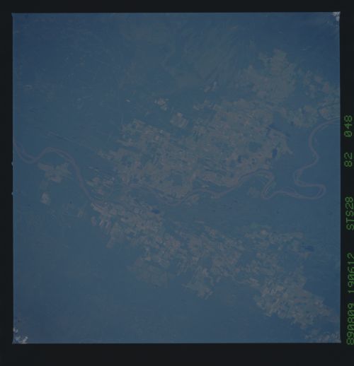
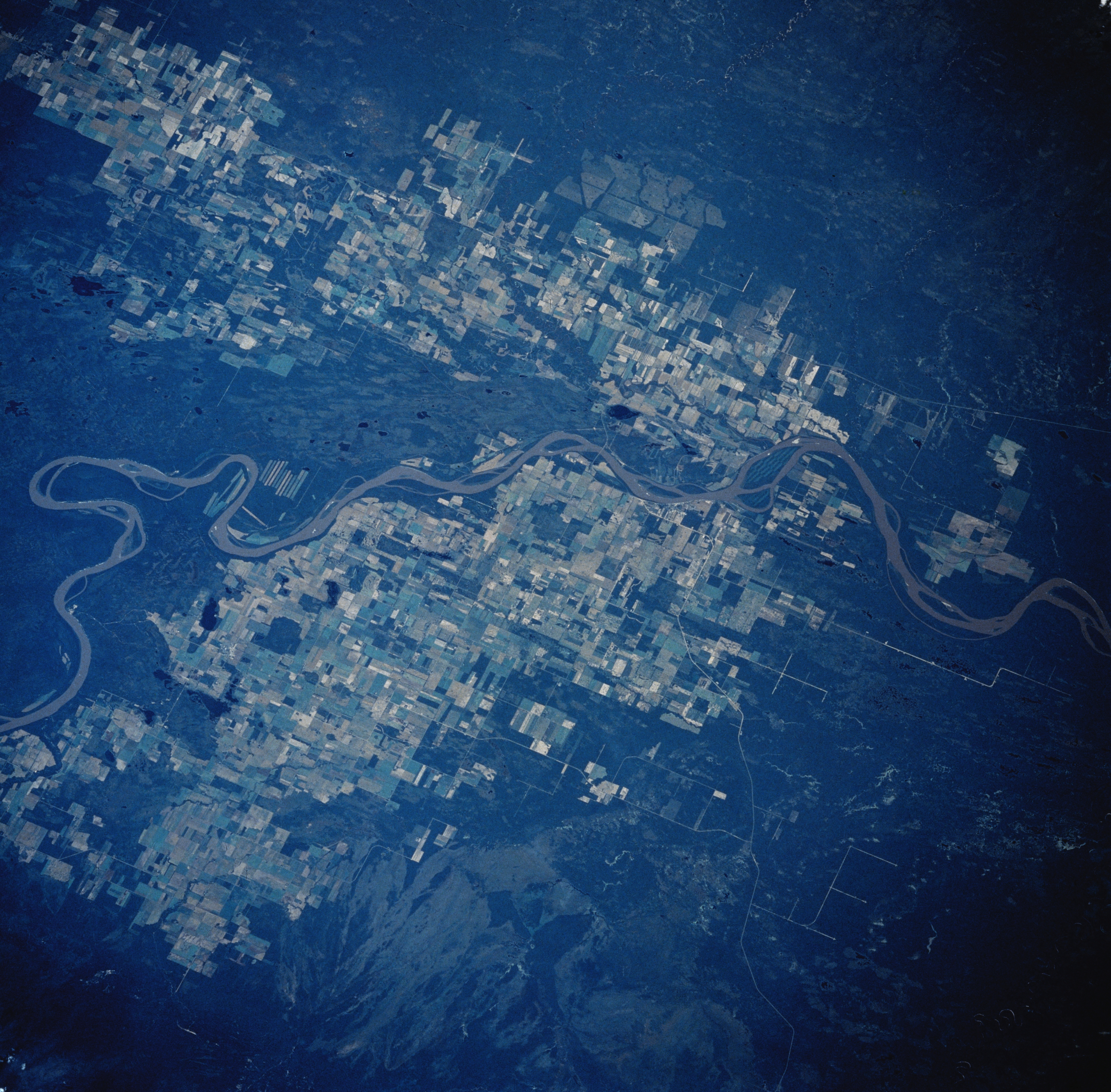
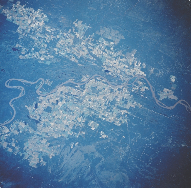
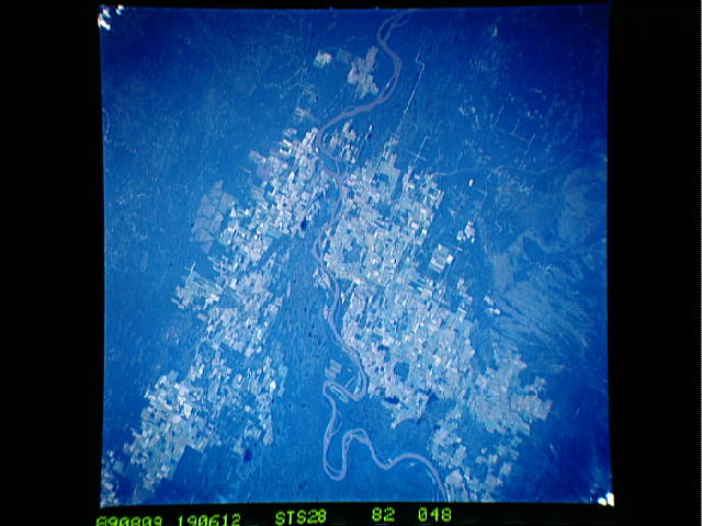
Image Caption: STS028-082-048 Fort Vermilion Area, Alberta, Canada August 1989
The meandering course of the northeasterly flowing Peace River is visible, as the river separates two agricultural areas in north central Alberta. The small, remote town of Fort Vermilion (not discernible on this image) is located slightly right of center on the south side of the Peace River. The landscape immediately north of the river is drained by a number of smaller tributary streams that enter the Peace River in the vicinity of Fort Vermilion. Large, cultivated field patterns (variety of lighter colors) dominate the landscape on both sides of the river where the terrain is fairly flat and has adequate drainage. The lighter shaded area within the forested northwest corner of the Buffalo Head Hills (bottom center) might be fire scars.
The meandering course of the northeasterly flowing Peace River is visible, as the river separates two agricultural areas in north central Alberta. The small, remote town of Fort Vermilion (not discernible on this image) is located slightly right of center on the south side of the Peace River. The landscape immediately north of the river is drained by a number of smaller tributary streams that enter the Peace River in the vicinity of Fort Vermilion. Large, cultivated field patterns (variety of lighter colors) dominate the landscape on both sides of the river where the terrain is fairly flat and has adequate drainage. The lighter shaded area within the forested northwest corner of the Buffalo Head Hills (bottom center) might be fire scars.
