STS028-81-63
| NASA Photo ID | STS028-81-63 |
| Focal Length | 100mm |
| Date taken | 1989.08.09 |
| Time taken | 17:34:03 GMT |

Cloud masks available for this image:
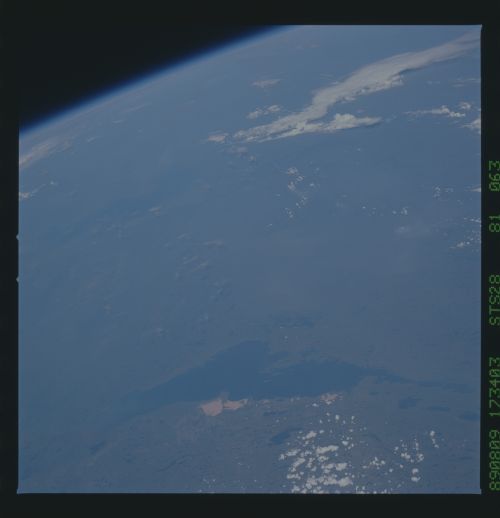
Spacecraft nadir point: 56.4° N, 104.7° W
Photo center point: 60.5° N, 110.0° W
Photo center point by machine learning:
Photo center point: 60.5° N, 110.0° W
Photo center point by machine learning:
Nadir to Photo Center: Northwest
Spacecraft Altitude: 161 nautical miles (298km)
Country or Geographic Name: | CANADA-NT |
Features: | LAKE ATHABASCA |
| Features Found Using Machine Learning: | |
Cloud Cover Percentage: | 30 (26-50)% |
Sun Elevation Angle: | 46° |
Sun Azimuth: | 148° |
Camera: | Hasselblad |
Focal Length: | 100mm |
Camera Tilt: | High Oblique |
Format: | 5017: Kodak, natural color positive, Ektachrome, X Professional, ASA 64, standard base |
Film Exposure: | Normal |
| Additional Information | |
| Width | Height | Annotated | Cropped | Purpose | Links |
|---|---|---|---|---|---|
| 5700 pixels | 5900 pixels | No | No | Download Image | |
| 500 pixels | 518 pixels | No | No | Download Image | |
| 640 pixels | 480 pixels | No | No | Download Image |
Download Packaged File
Download a Google Earth KML for this Image
View photo footprint information
Download a GeoTIFF for this photo
Image Caption: STS028-81-063 Pilot Lake Impact Crater Pilot Lake is the circular lake
(1) located half way between Lake Athabasca (2) to the southeast and
Great Slave Lake (3) to the northeast. North is the top center of the
view. Pilot Lake is 6 km in diameter and is in a remote, heavily
forested section of the Canadian Shield in the North West Territories.
Estimated age for this crater is 440 + 2 m.y. T576G
