STS028-80-60
| NASA Photo ID | STS028-80-60 |
| Focal Length | 100mm |
| Date taken | 1989.08.10 |
| Time taken | 11:49:26 GMT |
Cloud masks available for this image:
Spacecraft nadir point: 47.7° N, 35.8° E
Photo center point: 46.0° N, 35.0° E
Photo center point by machine learning:
Photo center point: 46.0° N, 35.0° E
Photo center point by machine learning:
Nadir to Photo Center: South
Spacecraft Altitude: 163 nautical miles (302km)
Country or Geographic Name: | UKRAINE |
Features: | SEA OF AZOV |
| Features Found Using Machine Learning: | |
Cloud Cover Percentage: | 40 (26-50)% |
Sun Elevation Angle: | 49° |
Sun Azimuth: | 230° |
Camera: | Hasselblad |
Focal Length: | 100mm |
Camera Tilt: | 35 degrees |
Format: | 5017: Kodak, natural color positive, Ektachrome, X Professional, ASA 64, standard base |
Film Exposure: | Normal |
| Additional Information | |
| Width | Height | Annotated | Cropped | Purpose | Links |
|---|---|---|---|---|---|
| 5700 pixels | 5900 pixels | No | No | Download Image | |
| 500 pixels | 518 pixels | No | No | Download Image | |
| 640 pixels | 480 pixels | No | No | Download Image |
Download Packaged File
Download a Google Earth KML for this Image
View photo footprint information
Download a GeoTIFF for this photo
Image Caption:
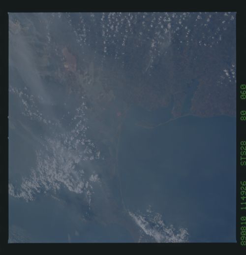
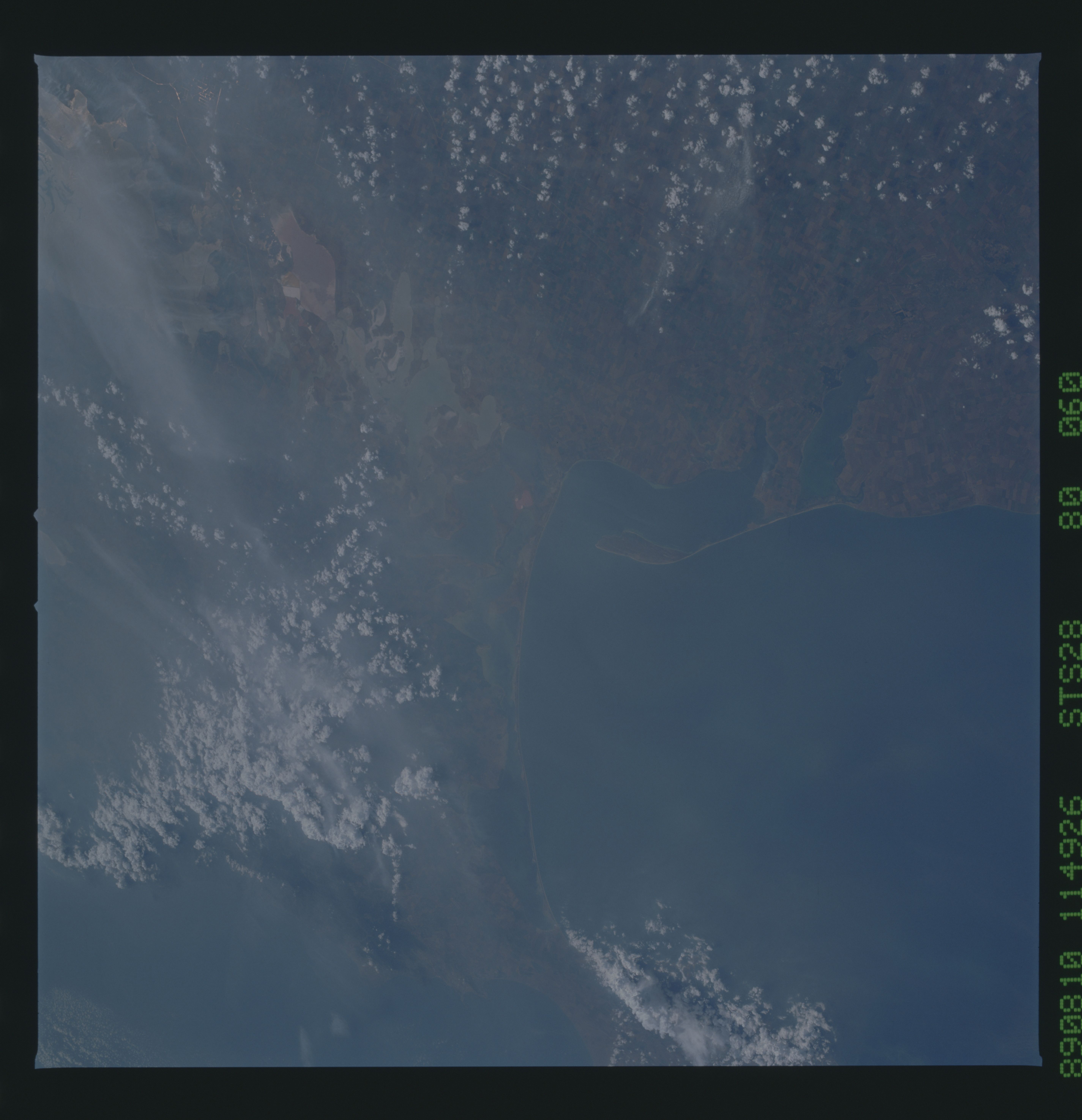
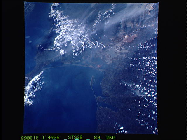
Sea of Azov, Kerch' Strait, and Putrid Sea
The southern coast of the Sea of Azov is seen in this low-
oblique, south-looking view taken in August 1989. The industrial
city of Kerch' (1) lies on the Kerch' Strait which connects the
Sea of Azov with the Black Sea (upper portion of view). The Cri-
mean Peninsula, where World War II Allied powers met in 1945
(Yalta) to discuss the surrender terms to be given to the Axis
powers, is mostly under clouds at the upper right of the view.
Also visible is the Putrid Sea (2), a salty backwater shallow
area that separates the majority of the Crimea from the Ukrainian
mainland. (STS028-80-060, 061)
