STS028-79-103
| NASA Photo ID | STS028-79-103 |
| Focal Length | 100mm |
| Date taken | 1989.08.09 |
| Time taken | 13:16:05 GMT |


Cloud masks available for this image:
Spacecraft nadir point: 34.5° N, 38.3° E
Photo center point: 32.0° N, 36.0° E
Photo center point by machine learning:
Photo center point: 32.0° N, 36.0° E
Photo center point by machine learning:
Nadir to Photo Center: Southwest
Spacecraft Altitude: 168 nautical miles (311km)
Camera: | Hasselblad |
Focal Length: | 100mm |
Camera Tilt: | 51 degrees |
Format: | 5017: Kodak, natural color positive, Ektachrome, X Professional, ASA 64, standard base |
Film Exposure: | Normal |
| Additional Information | |
| Width | Height | Annotated | Cropped | Purpose | Links |
|---|---|---|---|---|---|
| 5700 pixels | 5900 pixels | No | No | Download Image | |
| 500 pixels | 518 pixels | No | No | Download Image | |
| 640 pixels | 480 pixels | No | No | Download Image |
Download Packaged File
Download a Google Earth KML for this Image
View photo footprint information
Download a GeoTIFF for this photo
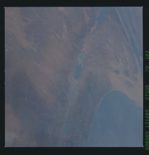
Image Caption: The surface of the Earth is always in motion. Giant blocks of the planet, called "plates," are in a constant, slow-motion dance. As the plates separate or collide and slide against or under each other, massive amounts of energy are released in the form of earthquakes, volcanoes, and other dramatic geologic activity. The boundaries where these plates drift apart or come together are called "rift" or "fault zones." These giant rifts and fault zones can easily be seen from space. Visible in this photo is the Dead Sea Rift. The faint diagonal line running from the Gulf of Aqaba through the Dead Sea to the Sea of Galilee indicates where two large continental plates are pulling apart in the Middle East. Israel and Jordan lie along the coast of the Mediterranean Sea. Egypt and the Sinai are located at the left center of the photo.
