STS028-76-54
| NASA Photo ID | STS028-76-54 |
| Focal Length | 250mm |
| Date taken | 1989.08.08 |
| Time taken | 22:05:51 GMT |
Resolutions offered for this image:
3808 x 3886 pixels 627 x 640 pixels 5700 x 5900 pixels 500 x 518 pixels 640 x 480 pixels
3808 x 3886 pixels 627 x 640 pixels 5700 x 5900 pixels 500 x 518 pixels 640 x 480 pixels


Cloud masks available for this image:
Spacecraft nadir point: 48.2° N, 110.4° W
Photo center point: 48.0° N, 109.0° W
Photo center point by machine learning:
Photo center point: 48.0° N, 109.0° W
Photo center point by machine learning:
Nadir to Photo Center: East
Spacecraft Altitude: 163 nautical miles (302km)
Country or Geographic Name: | USA-MONTANA |
Features: | MISSOURI RIVER |
| Features Found Using Machine Learning: | |
Cloud Cover Percentage: | 10 (1-10)% |
Sun Elevation Angle: | 44° |
Sun Azimuth: | 239° |
Camera: | Hasselblad |
Focal Length: | 250mm |
Camera Tilt: | 28 degrees |
Format: | 5017: Kodak, natural color positive, Ektachrome, X Professional, ASA 64, standard base |
Film Exposure: | Normal |
| Additional Information | |
| Width | Height | Annotated | Cropped | Purpose | Links |
|---|---|---|---|---|---|
| 3808 pixels | 3886 pixels | No | No | Earth From Space collection | Download Image |
| 627 pixels | 640 pixels | No | No | Earth From Space collection | Download Image |
| 5700 pixels | 5900 pixels | No | No | Download Image | |
| 500 pixels | 518 pixels | No | No | Download Image | |
| 640 pixels | 480 pixels | No | No | Download Image |
Download Packaged File
Download a Google Earth KML for this Image
View photo footprint information
Download a GeoTIFF for this photo
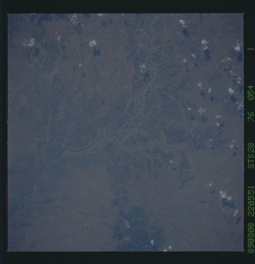
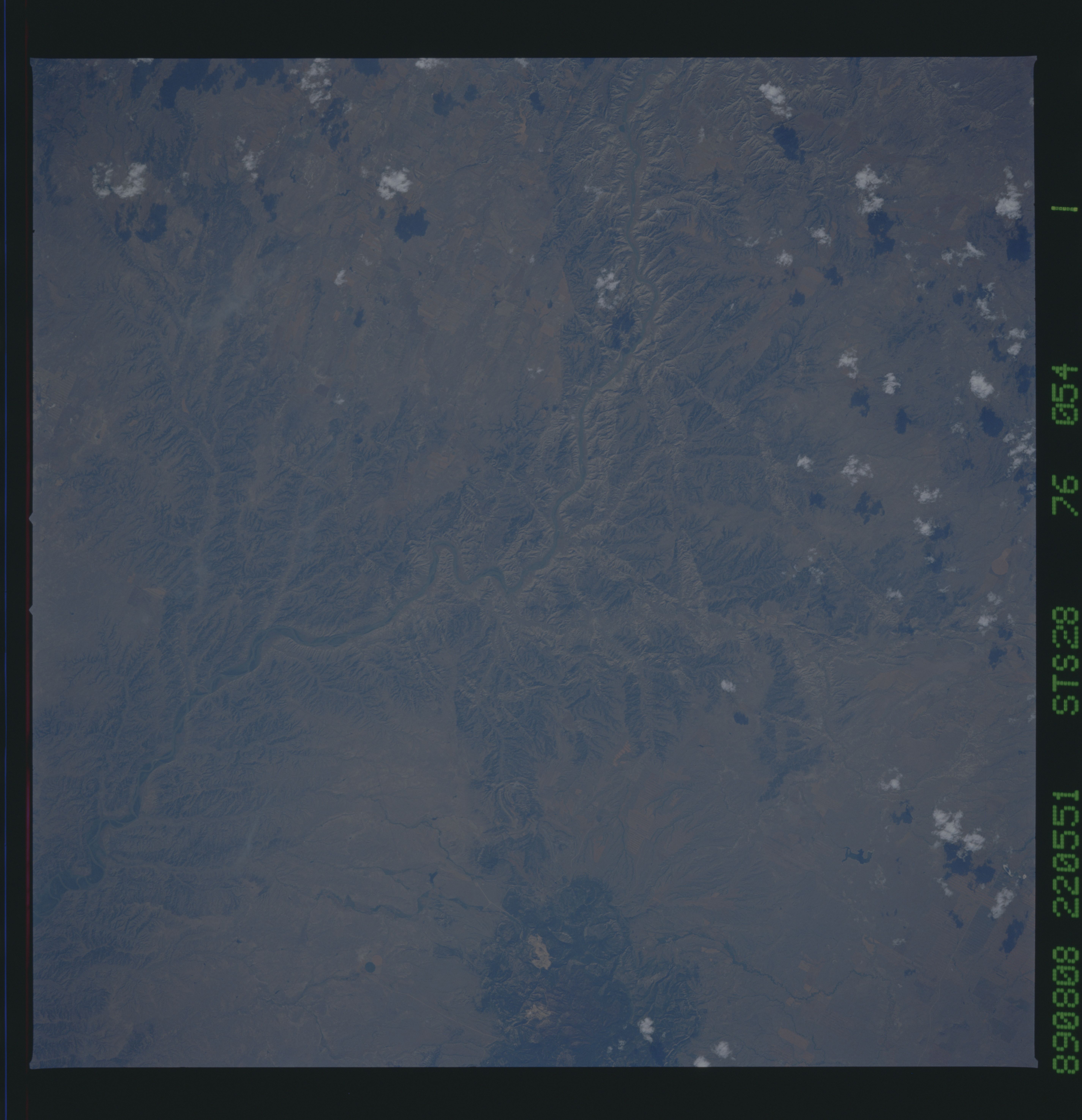
Image Caption: STS028-076-054 Missouri River and Little Rocky Mountains, Montana, U.S.A. August 1989
The Missouri River, heavy with silt and bounded in many places by steep cliffs; portions of the Little Rocky Mountains, an isolated cluster of low igneous rock peaks that were uplifted through the rocks of the high Great Plains 50 million years ago; and numerous canyonlike features are visible in this southeast-looking, low-oblique photograph. This region of the river is part of the Missouri Breaks Wild and Scenic River Area. Just below the top of the photograph, Armells Creek can be seen as it enters the Missouri River.
The Missouri River, heavy with silt and bounded in many places by steep cliffs; portions of the Little Rocky Mountains, an isolated cluster of low igneous rock peaks that were uplifted through the rocks of the high Great Plains 50 million years ago; and numerous canyonlike features are visible in this southeast-looking, low-oblique photograph. This region of the river is part of the Missouri Breaks Wild and Scenic River Area. Just below the top of the photograph, Armells Creek can be seen as it enters the Missouri River.
