STS028-74-70

| NASA Photo ID | STS028-74-70 |
| Focal Length | 250mm |
| Date taken | 1989.08.11 |
| Time taken | 14:42:23 GMT |
Resolutions offered for this image:
5303 x 5303 pixels 640 x 640 pixels 5700 x 5900 pixels 500 x 518 pixels 640 x 480 pixels
5303 x 5303 pixels 640 x 640 pixels 5700 x 5900 pixels 500 x 518 pixels 640 x 480 pixels

Cloud masks available for this image:
Spacecraft nadir point: 42.7° N, 111.9° W
Photo center point: 50.0° N, 115.0° W
Photo center point by machine learning:
Photo center point: 50.0° N, 115.0° W
Photo center point by machine learning:
Nadir to Photo Center: North
Spacecraft Altitude: 161 nautical miles (298km)
Country or Geographic Name: | CANADA-BC |
Features: | ROCKY MOUNTAINS |
| Features Found Using Machine Learning: | |
Cloud Cover Percentage: | 20 (11-25)% |
Sun Elevation Angle: | 23° |
Sun Azimuth: | 90° |
Camera: | Hasselblad |
Focal Length: | 250mm |
Camera Tilt: | Low Oblique |
Format: | 5017: Kodak, natural color positive, Ektachrome, X Professional, ASA 64, standard base |
Film Exposure: | Normal |
| Additional Information | |
| Width | Height | Annotated | Cropped | Purpose | Links |
|---|---|---|---|---|---|
| 5303 pixels | 5303 pixels | No | No | Earth From Space collection | Download Image |
| 640 pixels | 640 pixels | No | No | Earth From Space collection | Download Image |
| 5700 pixels | 5900 pixels | No | No | Download Image | |
| 500 pixels | 518 pixels | No | No | Download Image | |
| 640 pixels | 480 pixels | No | No | Download Image |
Download Packaged File
Download a Google Earth KML for this Image
View photo footprint information
Download a GeoTIFF for this photo
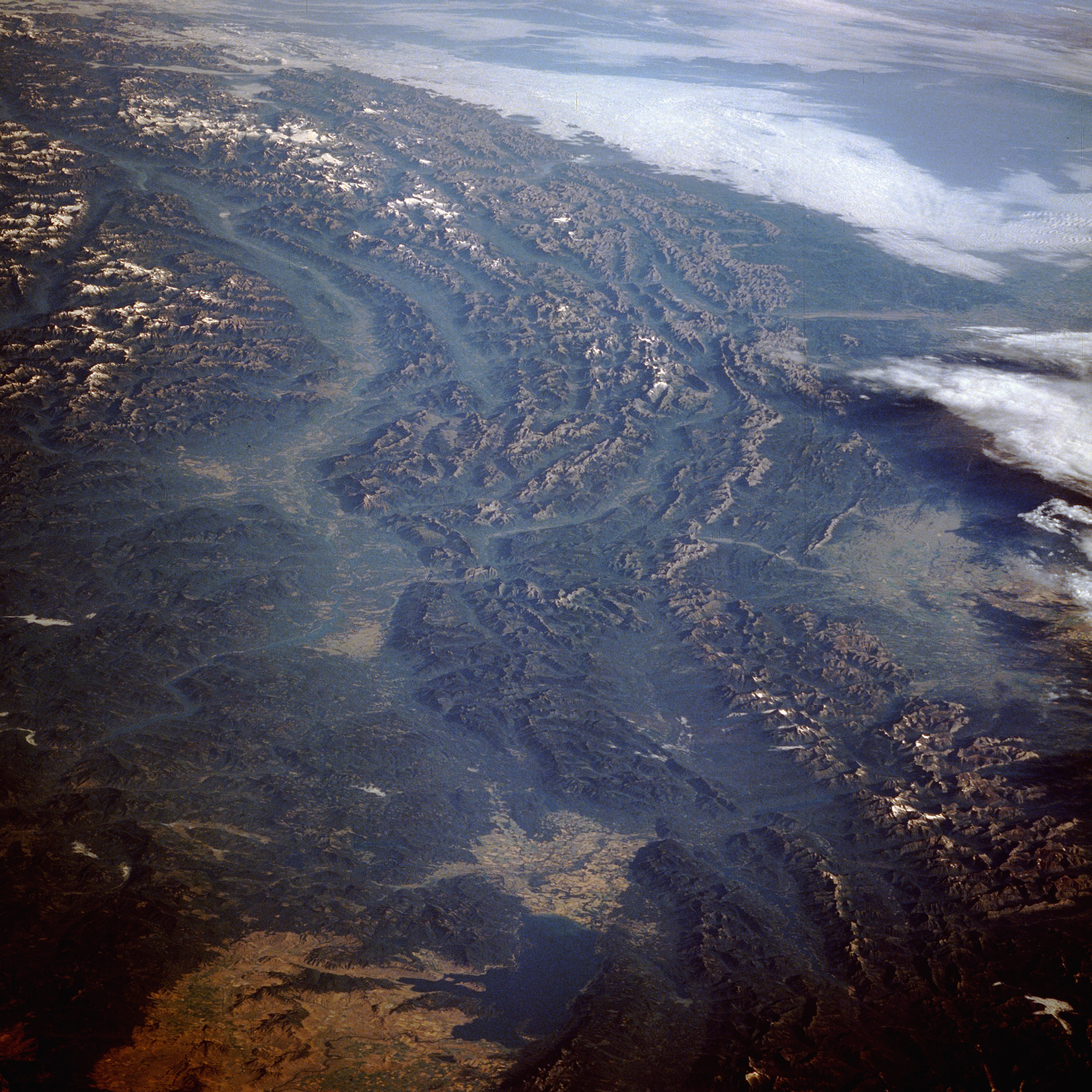
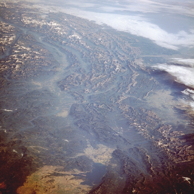
Image Caption: STS028-074-070 Rocky Mountains, Canada and United States August 1989
The southern extent of the Canadian Rocky Mountains is revealed in this low-oblique photograph, which encompasses a large geographic area centered near the junction of southeast British Columbia and northwest Montana. The northwest-southeast-trending of multiple parallel ridges and glacial valleys is obvious. Even though the photograph was made in the summer, there is snow on many of the elevated peaks and ridge lines, primarily on those farther north in Canada. Visible near the northwestern side of the photograph is the large U-shaped valley of the Kootenay River, a south-flowing river that eventually empties into the Columbia River. Fairly large cultivated field patterns are observed in the valley north of Flathead Lake (discernible near the south edge of the photograph) near Kalispell, Montana.
The southern extent of the Canadian Rocky Mountains is revealed in this low-oblique photograph, which encompasses a large geographic area centered near the junction of southeast British Columbia and northwest Montana. The northwest-southeast-trending of multiple parallel ridges and glacial valleys is obvious. Even though the photograph was made in the summer, there is snow on many of the elevated peaks and ridge lines, primarily on those farther north in Canada. Visible near the northwestern side of the photograph is the large U-shaped valley of the Kootenay River, a south-flowing river that eventually empties into the Columbia River. Fairly large cultivated field patterns are observed in the valley north of Flathead Lake (discernible near the south edge of the photograph) near Kalispell, Montana.
