STS028-72-51
| NASA Photo ID | STS028-72-51 |
| Focal Length | 250mm |
| Date taken | 1989.08.08 |
| Time taken | 17:21:55 GMT |
Resolutions offered for this image:
3904 x 3844 pixels 639 x 630 pixels 5700 x 5900 pixels 500 x 518 pixels 640 x 480 pixels
3904 x 3844 pixels 639 x 630 pixels 5700 x 5900 pixels 500 x 518 pixels 640 x 480 pixels

Cloud masks available for this image:
Spacecraft nadir point: 51.5° N, 117.8° W
Photo center point: 52.0° N, 118.0° W
Photo center point by machine learning:
Photo center point: 52.0° N, 118.0° W
Photo center point by machine learning:
Nadir to Photo Center: North
Spacecraft Altitude: 161 nautical miles (298km)
Country or Geographic Name: | CANADA-BC |
Features: | COLUMBIA RIVER |
| Features Found Using Machine Learning: | |
Cloud Cover Percentage: | 0 (no clouds present) |
Sun Elevation Angle: | 43° |
Sun Azimuth: | 124° |
Camera: | Hasselblad |
Focal Length: | 250mm |
Camera Tilt: | 11 degrees |
Format: | 5017: Kodak, natural color positive, Ektachrome, X Professional, ASA 64, standard base |
Film Exposure: | Normal |
| Additional Information | |
| Width | Height | Annotated | Cropped | Purpose | Links |
|---|---|---|---|---|---|
| 3904 pixels | 3844 pixels | No | No | Earth From Space collection | Download Image |
| 639 pixels | 630 pixels | No | No | Earth From Space collection | Download Image |
| 5700 pixels | 5900 pixels | No | No | Download Image | |
| 500 pixels | 518 pixels | No | No | Download Image | |
| 640 pixels | 480 pixels | No | No | Download Image |
Download Packaged File
Download a Google Earth KML for this Image
View photo footprint information
Download a GeoTIFF for this photo
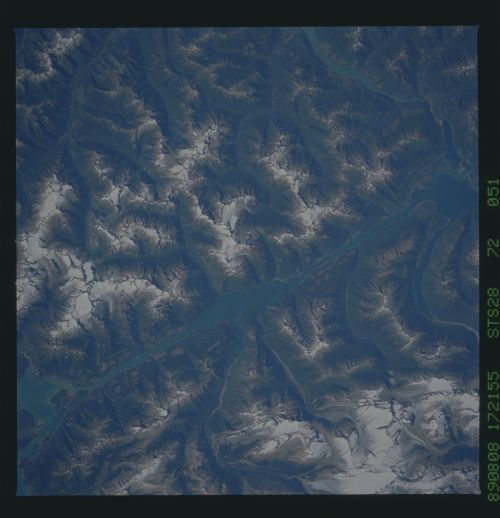
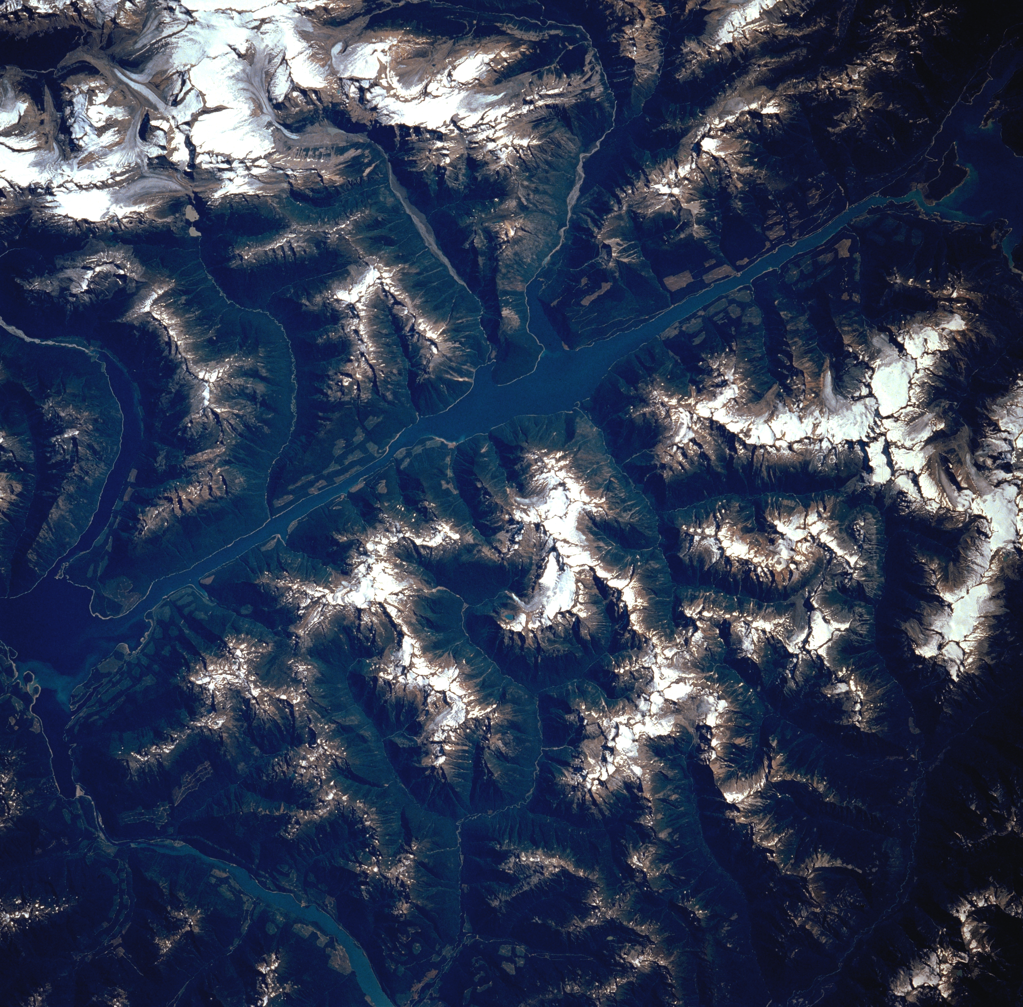
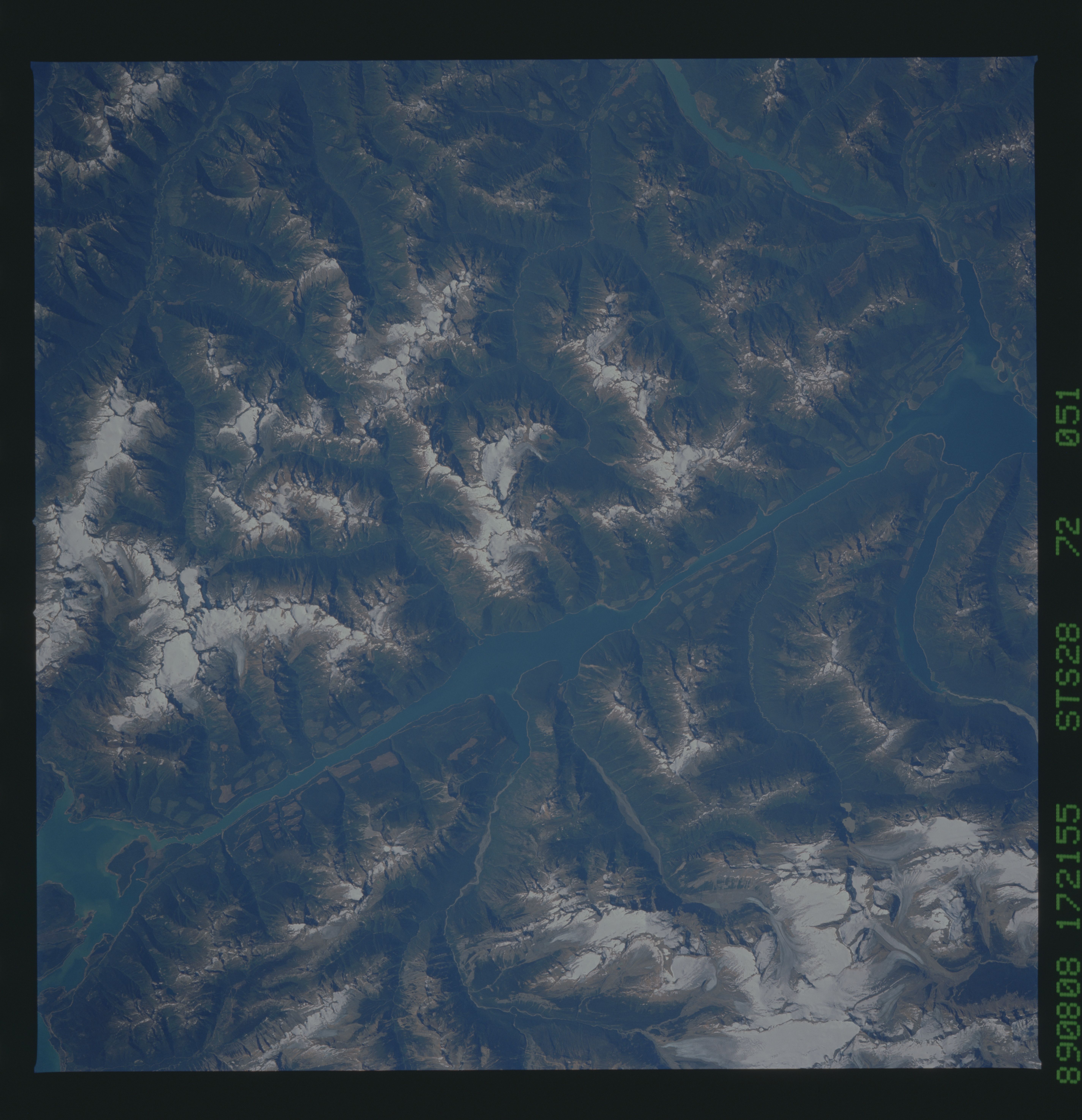
Image Caption: STS028-072-051 McNaughton Lake, British Columbia, Canada August 1989
Most of the snow capped (white) rugged terrain in this section of the Canadian Rocky Mountains exceeds 10000 feet (3048 meters) in elevation above sea level. The large cluster of white features in the upper left corner of the image show the location of the Clemenceau and Columbia ice fields. The snow capped Selkirk Mountains, located southwest (right-center) of the linear Columbia River Valley, also shows smaller areas of ice and snow on the higher peaks and ridges. This section of the Columbia River Valley, called Kinbasket Lake, has angular looking patterns in the valley near the river where logging activities (clear cutting) has occurred.
Most of the snow capped (white) rugged terrain in this section of the Canadian Rocky Mountains exceeds 10000 feet (3048 meters) in elevation above sea level. The large cluster of white features in the upper left corner of the image show the location of the Clemenceau and Columbia ice fields. The snow capped Selkirk Mountains, located southwest (right-center) of the linear Columbia River Valley, also shows smaller areas of ice and snow on the higher peaks and ridges. This section of the Columbia River Valley, called Kinbasket Lake, has angular looking patterns in the valley near the river where logging activities (clear cutting) has occurred.
