STS028-71-16

| NASA Photo ID | STS028-71-16 |
| Focal Length | 100mm |
| Date taken | 1989.08.08 |
| Time taken | 17:20:41 GMT |
Resolutions offered for this image:
5227 x 5227 pixels 640 x 640 pixels 5700 x 5900 pixels 500 x 518 pixels 640 x 480 pixels
5227 x 5227 pixels 640 x 640 pixels 5700 x 5900 pixels 500 x 518 pixels 640 x 480 pixels


Cloud masks available for this image:
Spacecraft nadir point: 48.7° N, 124.5° W
Photo center point: 49.0° N, 122.5° W
Photo center point by machine learning:
Photo center point: 49.0° N, 122.5° W
Photo center point by machine learning:
Nadir to Photo Center: East
Spacecraft Altitude: 161 nautical miles (298km)
Country or Geographic Name: | CANADA-BC |
Features: | VANCOUVER |
| Features Found Using Machine Learning: | |
Cloud Cover Percentage: | 10 (1-10)% |
Sun Elevation Angle: | 41° |
Sun Azimuth: | 115° |
Camera: | Hasselblad |
Focal Length: | 100mm |
Camera Tilt: | 37 degrees |
Format: | 5017: Kodak, natural color positive, Ektachrome, X Professional, ASA 64, standard base |
Film Exposure: | Normal |
| Additional Information | |
| Width | Height | Annotated | Cropped | Purpose | Links |
|---|---|---|---|---|---|
| 5227 pixels | 5227 pixels | No | No | Earth From Space collection | Download Image |
| 640 pixels | 640 pixels | No | No | Earth From Space collection | Download Image |
| 5700 pixels | 5900 pixels | No | No | Download Image | |
| 500 pixels | 518 pixels | No | No | Download Image | |
| 640 pixels | 480 pixels | No | No | Download Image |
Download Packaged File
Download a Google Earth KML for this Image
View photo footprint information
Download a GeoTIFF for this photo
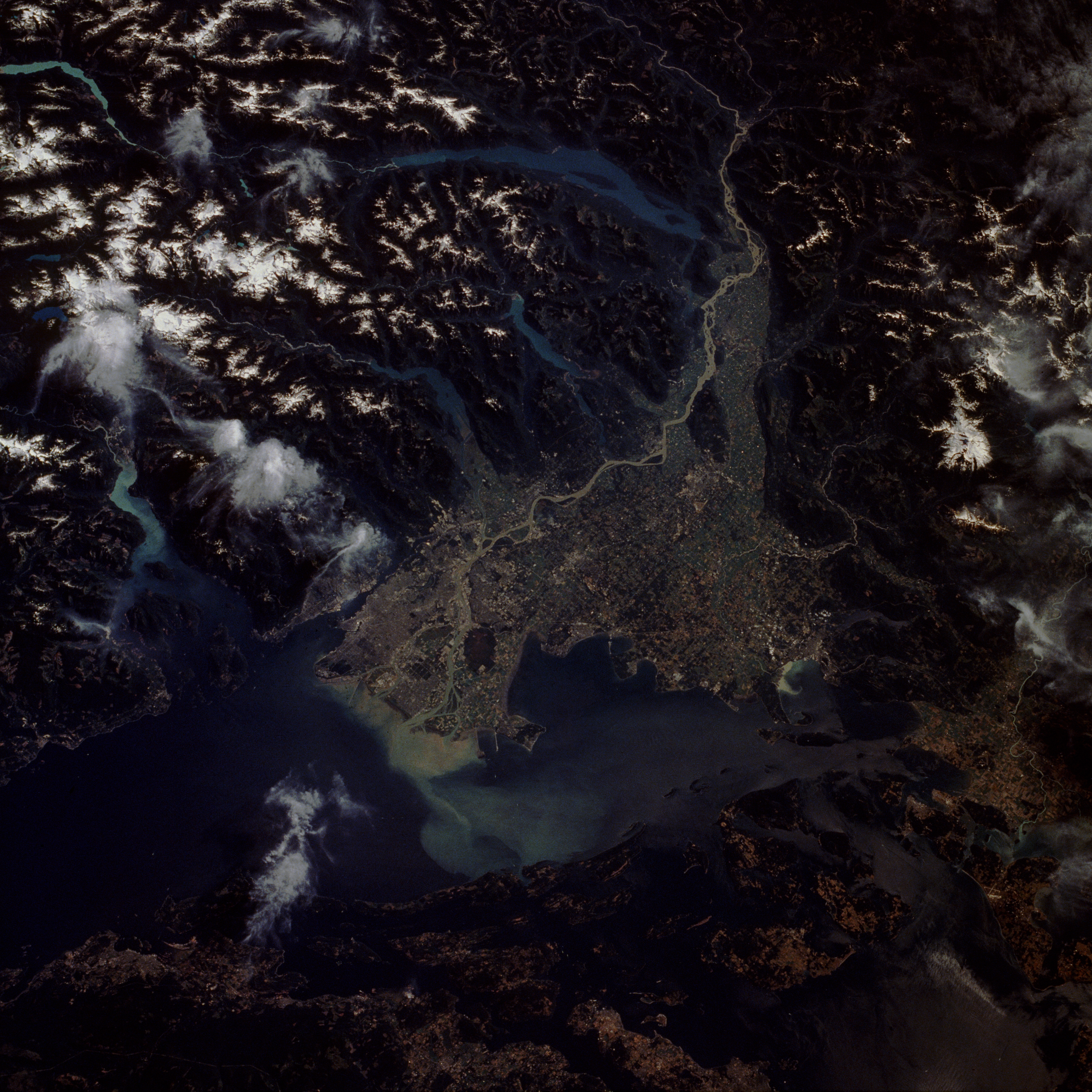
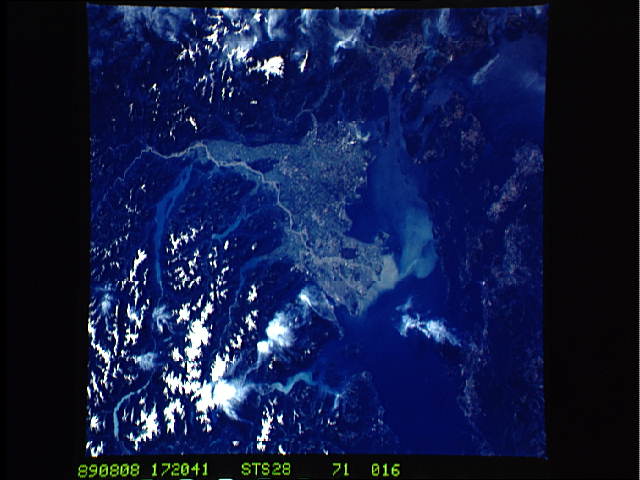
Image Caption: STS028-071-016 Vancouver Area, British Columbia, Canada August 1989
The picturesque city of Vancouver, with a population of more than 1.6 million, is situated on the Fraser River delta. The silt-laden Fraser River can be traced as it passes through canyons of the Coast Mountains to the large sediment plume in the Strait of Georgia, which separates the mainland from Vancouver Island. Several elongated, generally north-south-oriented lakes (Harrison Lake is the longest lake to the east) appear northeast of the city, and east and north of Vancouver are snow-covered mountain peaks, whose elevations generally exceed 7000 feet (2135 meters) above sea level. The American city of Bellingham, Washington, is visible along the coast approximately 40 miles (65 kilometers) southeast of downtown Vancouver. Careful study of the small peninsula that forms the western extent of Boundary Bay reveals the 49th parallel, the United States-Canada border, which then zigzags between the numerous islands south of Boundary Bay. On the Canadian side of the border these islands are called the Gulf Islands; on the U.S. side they are known as the San Juan Islands. (Refer to STS-028-072-044 for a closeup view of the city of Vancouver.)
The picturesque city of Vancouver, with a population of more than 1.6 million, is situated on the Fraser River delta. The silt-laden Fraser River can be traced as it passes through canyons of the Coast Mountains to the large sediment plume in the Strait of Georgia, which separates the mainland from Vancouver Island. Several elongated, generally north-south-oriented lakes (Harrison Lake is the longest lake to the east) appear northeast of the city, and east and north of Vancouver are snow-covered mountain peaks, whose elevations generally exceed 7000 feet (2135 meters) above sea level. The American city of Bellingham, Washington, is visible along the coast approximately 40 miles (65 kilometers) southeast of downtown Vancouver. Careful study of the small peninsula that forms the western extent of Boundary Bay reveals the 49th parallel, the United States-Canada border, which then zigzags between the numerous islands south of Boundary Bay. On the Canadian side of the border these islands are called the Gulf Islands; on the U.S. side they are known as the San Juan Islands. (Refer to STS-028-072-044 for a closeup view of the city of Vancouver.)
