STS028-153-78
| NASA Photo ID | STS028-153-78 |
| Focal Length | 90mm |
| Date taken | 1989.08.12 |
| Time taken | 14:51:35 GMT |
Resolutions offered for this image:
640 x 480 pixels
640 x 480 pixels
Cloud masks available for this image:
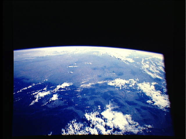
Spacecraft nadir point: 44.7° N, 116.7° W
Photo center point: 47.5° N, 111.5° W
Photo center point by machine learning:
Photo center point: 47.5° N, 111.5° W
Photo center point by machine learning:
Nadir to Photo Center: Northeast
Spacecraft Altitude: 160 nautical miles (296km)
Country or Geographic Name: | USA-MONTANA |
Features: | MO R, GR. PLAINS, AGR. |
| Features Found Using Machine Learning: | |
Cloud Cover Percentage: | 30 (26-50)% |
Sun Elevation Angle: | 21° |
Sun Azimuth: | 89° |
Camera: | Linhof |
Focal Length: | 90mm |
Camera Tilt: | High Oblique |
Format: | 5017: Kodak, natural color positive, Ektachrome, X Professional, ASA 64, standard base |
Film Exposure: | Normal |
| Additional Information | |
| Width | Height | Annotated | Cropped | Purpose | Links |
|---|---|---|---|---|---|
| 640 pixels | 480 pixels | No | No | ISD 1 | Download Image |
Download Packaged File
Download a Google Earth KML for this Image
View photo footprint information
Download a GeoTIFF for this photo
Image Caption: none
