STS028-153-68
| NASA Photo ID | STS028-153-68 |
| Focal Length | 90mm |
| Date taken | 1989.08.12 |
| Time taken | 07:36:24 GMT |
Resolutions offered for this image:
640 x 480 pixels
640 x 480 pixels
Cloud masks available for this image:
Spacecraft nadir point: 43.1° N, 97.1° E
Photo center point: 43.0° N, 97.5° E
Photo center point by machine learning:
Photo center point: 43.0° N, 97.5° E
Photo center point by machine learning:
Nadir to Photo Center: East
Spacecraft Altitude: 163 nautical miles (302km)
Country or Geographic Name: | CHINA |
Features: | GOBI DESERT, PAERHKU MTN |
| Features Found Using Machine Learning: | |
Cloud Cover Percentage: | 20 (11-25)% |
Sun Elevation Angle: | 52° |
Sun Azimuth: | 232° |
Camera: | Linhof |
Focal Length: | 90mm |
Camera Tilt: | 9 degrees |
Format: | 5017: Kodak, natural color positive, Ektachrome, X Professional, ASA 64, standard base |
Film Exposure: | Normal |
| Additional Information | |
| Width | Height | Annotated | Cropped | Purpose | Links |
|---|---|---|---|---|---|
| 640 pixels | 480 pixels | No | No | ISD 1 | Download Image |
Download Packaged File
Download a Google Earth KML for this Image
View photo footprint information
Download a GeoTIFF for this photo
Image Caption:
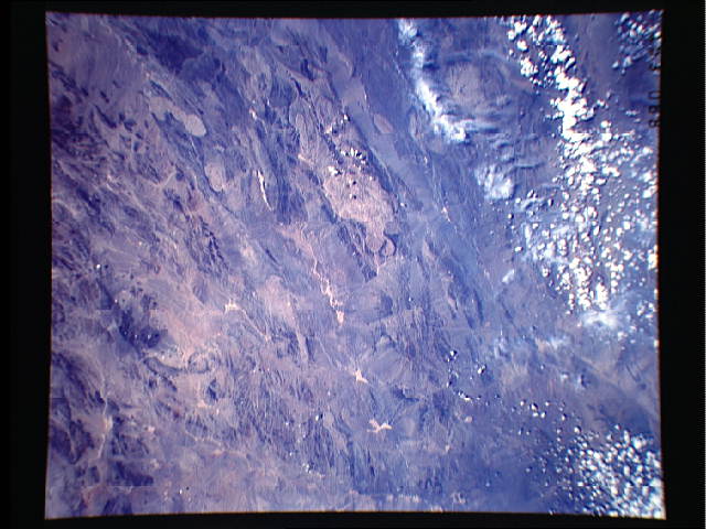
The Southwestern Gobi Desert
This low oblique view shows great detail of the rugged terrain of
the southwestern Gobi Desert. Scattered linear ridges and es-
carpments interlaced with gravel filled valleys and plains make
up the features of this region of the Gobi Desert. The area is
also very dry and experiences extreme temperatures from season to
season. (S28-153-068)
