STS028-152-152
| NASA Photo ID | STS028-152-152 |
| Focal Length | 250mm |
| Date taken | 1989.08.__ |
| Time taken | GMT |

Cloud masks available for this image:
Spacecraft nadir point:
Photo center point: 49.0° N, 59.5° W
Photo center point by machine learning:
Photo center point: 49.0° N, 59.5° W
Photo center point by machine learning:
Nadir to Photo Center:
Spacecraft Altitude: nautical miles (0km)
Country or Geographic Name: | CANADA-N |
Features: | STEPHENVILLE, ST, GEORGE P |
| Features Found Using Machine Learning: | |
Cloud Cover Percentage: | 15 (11-25)% |
Sun Elevation Angle: | ° |
Sun Azimuth: | ° |
Camera: | Linhof |
Focal Length: | 250mm |
Camera Tilt: | Near Vertical |
Format: | QX868: Kodak, natural color positive, Ektachrome QX868(5017 emulsion), ASA 64, thin base |
Film Exposure: | Normal |
| Additional Information | |
| Width | Height | Annotated | Cropped | Purpose | Links |
|---|---|---|---|---|---|
| 4096 pixels | 5184 pixels | No | No | Earth From Space collection | Download Image |
| 505 pixels | 640 pixels | No | No | Earth From Space collection | Download Image |
| 640 pixels | 480 pixels | No | No | ISD 1 | Download Image |
Download Packaged File
Download a Google Earth KML for this Image
View photo footprint information
Download a GeoTIFF for this photo
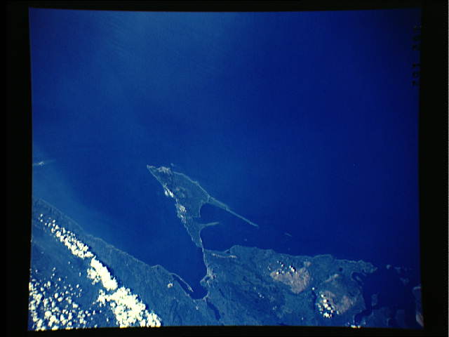
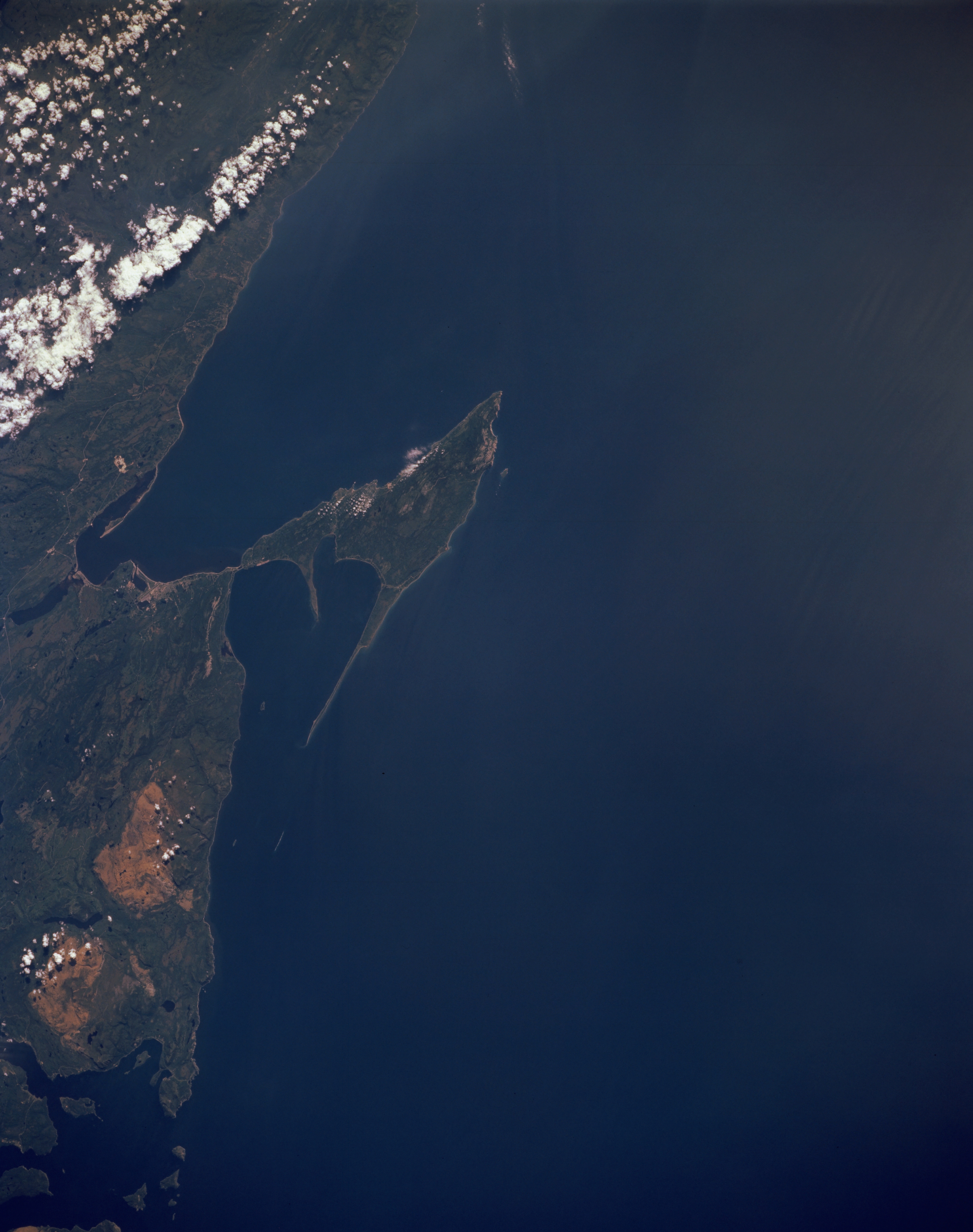
Image Caption: STS028-152-152 Stephenville, Newfoundland, Canada August 1989
The angular looking peninsula that extends into the Gulf of St. Lawrence is west of Stephenville, one of Newfoundland's many fishing villages. Stephenville is the small light colored area along the northeast coast of St. George Bay, the larger bay south of the peninsula. The smaller bay northeast of the peninsula is Port-Au-Port Bay. The larger lighter colored areas near the coast and north of Stephenville are known as the Lewis Hills. They appear to be areas where the natural vegetation has been removed by mining, logging, or forest fires.
The angular looking peninsula that extends into the Gulf of St. Lawrence is west of Stephenville, one of Newfoundland's many fishing villages. Stephenville is the small light colored area along the northeast coast of St. George Bay, the larger bay south of the peninsula. The smaller bay northeast of the peninsula is Port-Au-Port Bay. The larger lighter colored areas near the coast and north of Stephenville are known as the Lewis Hills. They appear to be areas where the natural vegetation has been removed by mining, logging, or forest fires.
