STS027-44-71
| NASA Photo ID | STS027-44-71 |
| Focal Length | 250mm |
| Date taken | 1988.12.06 |
| Time taken | 15:16:47 GMT |

Cloud masks available for this image:
Spacecraft nadir point: 39.9° N, 100.0° W
Photo center point: 38.0° N, 108.0° W
Photo center point by machine learning:
Photo center point: 38.0° N, 108.0° W
Photo center point by machine learning:
Nadir to Photo Center: West
Spacecraft Altitude: 240 nautical miles (444km)
Country or Geographic Name: | USA-COLORADO |
Features: | SAN JUAN MTS |
| Features Found Using Machine Learning: | |
Cloud Cover Percentage: | 10 (1-10)% |
Sun Elevation Angle: | 13° |
Sun Azimuth: | 135° |
Camera: | Hasselblad |
Focal Length: | 250mm |
Camera Tilt: | High Oblique |
Format: | 5036: Kodak, natural color positive, Ektachrome 5036,200 Professional, ASA 200, stand |
Film Exposure: | Normal |
| Additional Information | |
| Width | Height | Annotated | Cropped | Purpose | Links |
|---|---|---|---|---|---|
| 5700 pixels | 5900 pixels | No | No | Download Image | |
| 500 pixels | 518 pixels | No | No | Download Image | |
| 640 pixels | 480 pixels | No | No | Download Image |
Download Packaged File
Download a Google Earth KML for this Image
View photo footprint information
Download a GeoTIFF for this photo
Image Caption:
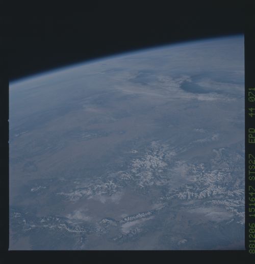
Colorado Plateau: Wooded High Ground and Sage Brush Valley
Floors
The site occupies the left middle ground of this oblique, west-
looking view. Only the northern half of the site is visible. In
this dry part of the Colorado Plateau, higher ground (above 6000
feet) supports pine and pion juniper forest and appears dark
green. (Even higher parts are snow covered--foreground). Val-
leys are dun-colored and support grass and brush vegetation. The
Chuska Mountains in the Navajo Reservation are a prominent
feature in the site (peaks above 9000 feet) (1) with the spike-
shaped Shiprock just visible at the base (arrow).
The junction of the states of Arizona, New Mexico, Colorado and
Utah is known as the Four Corners Country and lies close to the
small trading post of Teec Nos Pos (2). Black Mesa (3) is anoth-
er area of wooded higher country in the Navajo/Hopi Reservations,
a center of coal and uranium mining. No major centers occupy
this remote area, Gallup, New Mexico, being the only larger town
(4). Extensive, recent lava beds occurred in this part of the
site and appear as black areas. Albuquerque, New Mexico, lies
just outside the view (bottom left) and Colorado Springs, Colora-
do, just outside the bottom right corner. Los Alamos, New Mexico,
(5) lies to the east and the Grand Canyon of Arizona (6, partly
under clouds) lies to the west of the site. Flagstaff, Arizona,
lies at the foot of the 12,000-foot high San Francisco Peaks (7).
The Gulf of California is dimly visible (top left). (S27-44-071)
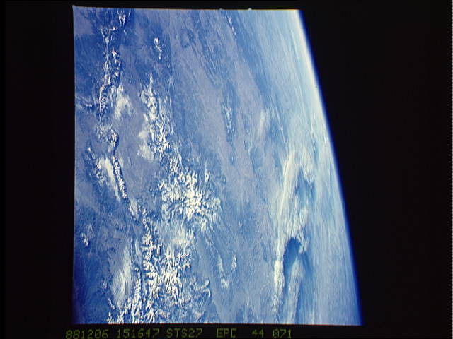
