STS027-35-43

| NASA Photo ID | STS027-35-43 |
| Focal Length | 250mm |
| Date taken | 1988.12.05 |
| Time taken | 00:15:52 GMT |

Cloud masks available for this image:
Spacecraft nadir point: 31.5° N, 124.5° E
Photo center point: 38.0° N, 128.0° E
Photo center point by machine learning:
Photo center point: 38.0° N, 128.0° E
Photo center point by machine learning:
Nadir to Photo Center: Northeast
Spacecraft Altitude: 239 nautical miles (443km)
Country or Geographic Name: | SOUTH KOREA |
Features: | KOREAN PENINSULA |
| Features Found Using Machine Learning: | |
Cloud Cover Percentage: | 30 (26-50)% |
Sun Elevation Angle: | 19° |
Sun Azimuth: | 132° |
Camera: | Hasselblad |
Focal Length: | 250mm |
Camera Tilt: | High Oblique |
Format: | 5017: Kodak, natural color positive, Ektachrome, X Professional, ASA 64, standard base |
Film Exposure: | Normal |
| Additional Information | |
| Width | Height | Annotated | Cropped | Purpose | Links |
|---|---|---|---|---|---|
| 5700 pixels | 5900 pixels | No | No | Download Image | |
| 500 pixels | 518 pixels | No | No | Download Image | |
| 640 pixels | 480 pixels | No | No | Download Image |
Download Packaged File
Download a Google Earth KML for this Image
View photo footprint information
Download a GeoTIFF for this photo
Image Caption:
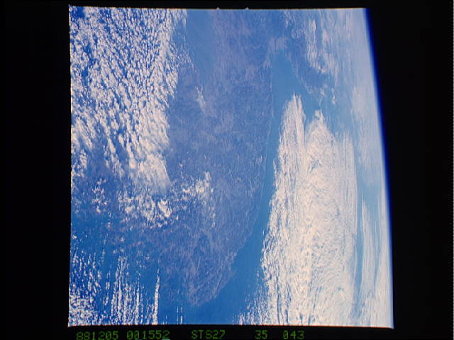
Both Koreas are visible in this north-looking view of the Korean
Peninsula, excluding the far west of N. Korea. The Kyongi Gulf
of the Yellow Sea and the cities of Inchon (1) and Seoul (2) are
visible to the west and the Sea of Japan to the east. Major UN
forces landed at Inchon during the Korean War. Fishing is the ma-
jor industry off the extremely indented, island-studded southern
coast (bottom right). (S27-35-043)
