STS027-152-66
| NASA Photo ID | STS027-152-66 |
| Focal Length | 90mm |
| Date taken | 1988.12.05 |
| Time taken | 03:22:05 GMT |

Cloud masks available for this image:
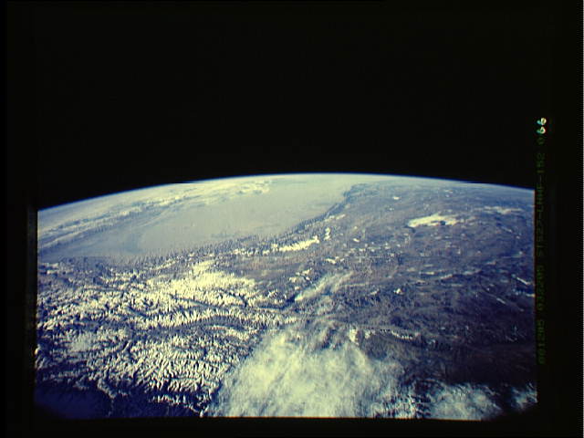
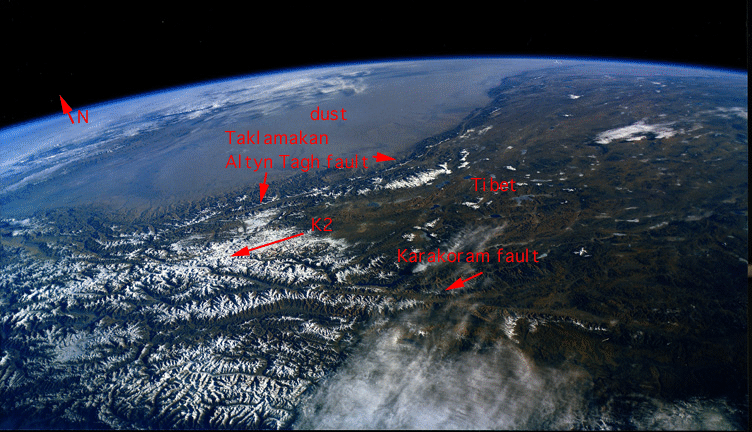
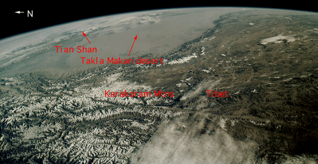
Spacecraft nadir point: 29.7° N, 75.6° E
Photo center point: 37.0° N, 81.0° E
Photo center point by machine learning:
Photo center point: 37.0° N, 81.0° E
Photo center point by machine learning:
Nadir to Photo Center: Northeast
Spacecraft Altitude: 239 nautical miles (443km)
Country or Geographic Name: | CHINA |
Features: | TAKLIMAKAN DESERT |
| Features Found Using Machine Learning: | |
Cloud Cover Percentage: | 30 (26-50)% |
Sun Elevation Angle: | 18° |
Sun Azimuth: | 130° |
Camera: | Linhof |
Focal Length: | 90mm |
Camera Tilt: | High Oblique |
Format: | 5017: Kodak, natural color positive, Ektachrome, X Professional, ASA 64, standard base |
Film Exposure: | Normal |
| Additional Information | |
| Width | Height | Annotated | Cropped | Purpose | Links |
|---|---|---|---|---|---|
| 640 pixels | 480 pixels | No | No | ISD 1 | Download Image |
| 752 pixels | 432 pixels | Yes | No | Download Image | |
| 632 pixels | 325 pixels | Yes | No | Download Image |
Download Packaged File
Download a Google Earth KML for this Image
View photo footprint information
Download a GeoTIFF for this photo
Image Caption: none
