STS027-152-36
| NASA Photo ID | STS027-152-36 |
| Focal Length | 90mm |
| Date taken | 1988.12.04 |
| Time taken | 15:05:30 GMT |
Resolutions offered for this image:
640 x 480 pixels
640 x 480 pixels
Cloud masks available for this image:
Spacecraft nadir point: 55.7° N, 47.8° W
Photo center point:
Photo center point by machine learning:
Photo center point:
Photo center point by machine learning:
Nadir to Photo Center:
Spacecraft Altitude: 240 nautical miles (444km)
Country or Geographic Name: | CLOUDS |
Features: | CLOUDS |
| Features Found Using Machine Learning: | |
Cloud Cover Percentage: | 90 (76-100)% |
Sun Elevation Angle: | 12° |
Sun Azimuth: | 181° |
Camera: | Linhof |
Focal Length: | 90mm |
Camera Tilt: | High Oblique |
Format: | 5017: Kodak, natural color positive, Ektachrome, X Professional, ASA 64, standard base |
Film Exposure: | Normal |
| Additional Information | |
| Width | Height | Annotated | Cropped | Purpose | Links |
|---|---|---|---|---|---|
| 640 pixels | 480 pixels | No | No | ISD 1 | Download Image |
Download Packaged File
Download a Google Earth KML for this Image
View photo footprint information
Download a GeoTIFF for this photo
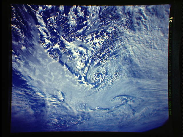
Image Caption: Small scale low pressure systems over low level open cell clouds. The lows we just talked about can be 100s of miles in diameter. Here is an example of a polar jet in the north Pacific spawning weak low pressure systems that are only about 60 miles in diameter. Notice the lower level open cell clouds under the thin cirrus clouds of the jet stream. Open cell clouds often indicate cyclonic motion which is associated with a low pressure trough or circulation. The cirrus and being able to view the clouds underneath is the type of detail which we can document from the orbiter that often can not be seen using regular 4 km or 1 km weather satellite data.

