STS026-42-3
| NASA Photo ID | STS026-42-3 |
| Focal Length | 250mm |
| Date taken | 1988.10.01 |
| Time taken | 10:10:02 GMT |

Cloud masks available for this image:
Spacecraft nadir point: 21.2° N, 33.4° E
Photo center point: 24.0° N, 33.0° E
Photo center point by machine learning:
Photo center point: 24.0° N, 33.0° E
Photo center point by machine learning:
Nadir to Photo Center: North
Spacecraft Altitude: 168 nautical miles (311km)
Country or Geographic Name: | EGYPT |
Features: | LAKE NASSER |
| Features Found Using Machine Learning: | |
Cloud Cover Percentage: | 0 (no clouds present) |
Sun Elevation Angle: | 64° |
Sun Azimuth: | 199° |
Camera: | Hasselblad |
Focal Length: | 250mm |
Camera Tilt: | Near Vertical |
Format: | 5017: Kodak, natural color positive, Ektachrome, X Professional, ASA 64, standard base |
Film Exposure: | Normal |
| Additional Information | |
| Width | Height | Annotated | Cropped | Purpose | Links |
|---|---|---|---|---|---|
| 5700 pixels | 5900 pixels | No | No | Download Image | |
| 500 pixels | 518 pixels | No | No | Download Image | |
| 640 pixels | 480 pixels | No | No | Download Image |
Download Packaged File
Download a Google Earth KML for this Image
View photo footprint information
Download a GeoTIFF for this photo
Image Caption:
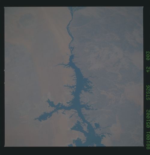
Aswan Dam, Lake Nasser T42
The Aswan Dam (1) and Lake Nasser are shown in these two photo-
graphs taken in September 1988. Water levels in the lake de-
creased in the decade of the 1980's by as much as 30 meters. Old
shorelines (2) are scattered throughout the scene. Sand streaks
(3) at the top of the mosaic show wind directions of strong
modern winds, here from the north. It appears tht the Nile
catches much of this moving sand since the streaks do not every-
where continue on the downwind side of the Nile. (S26-42-003,
004)
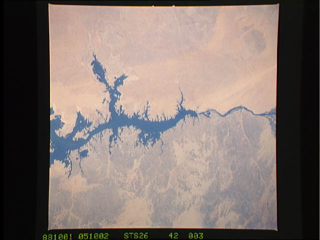
