STS026-41-58
| NASA Photo ID | STS026-41-58 |
| Focal Length | 250mm |
| Date taken | 1988.10.01 |
| Time taken | 08:33:21 GMT |
Resolutions offered for this image:
5239 x 5239 pixels 640 x 640 pixels 5700 x 5900 pixels 500 x 518 pixels 640 x 480 pixels
5239 x 5239 pixels 640 x 640 pixels 5700 x 5900 pixels 500 x 518 pixels 640 x 480 pixels
Cloud masks available for this image:
Spacecraft nadir point: 27.2° N, 33.0° E
Photo center point: 26.0° N, 32.5° E
Photo center point by machine learning:
Photo center point: 26.0° N, 32.5° E
Photo center point by machine learning:
Nadir to Photo Center: South
Spacecraft Altitude: 171 nautical miles (317km)
Country or Geographic Name: | EGYPT |
Features: | NILE RIVER, LUXOR BEND |
| Features Found Using Machine Learning: | |
Cloud Cover Percentage: | 0 (no clouds present) |
Sun Elevation Angle: | 55° |
Sun Azimuth: | 150° |
Camera: | Hasselblad |
Focal Length: | 250mm |
Camera Tilt: | 24 degrees |
Format: | 5017: Kodak, natural color positive, Ektachrome, X Professional, ASA 64, standard base |
Film Exposure: | Normal |
| Additional Information | |
| Width | Height | Annotated | Cropped | Purpose | Links |
|---|---|---|---|---|---|
| 5239 pixels | 5239 pixels | No | No | Earth From Space collection | Download Image |
| 640 pixels | 640 pixels | No | No | Earth From Space collection | Download Image |
| 5700 pixels | 5900 pixels | No | No | Download Image | |
| 500 pixels | 518 pixels | No | No | Download Image | |
| 640 pixels | 480 pixels | No | No | Download Image |
Download Packaged File
Download a Google Earth KML for this Image
View photo footprint information
Download a GeoTIFF for this photo
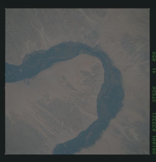
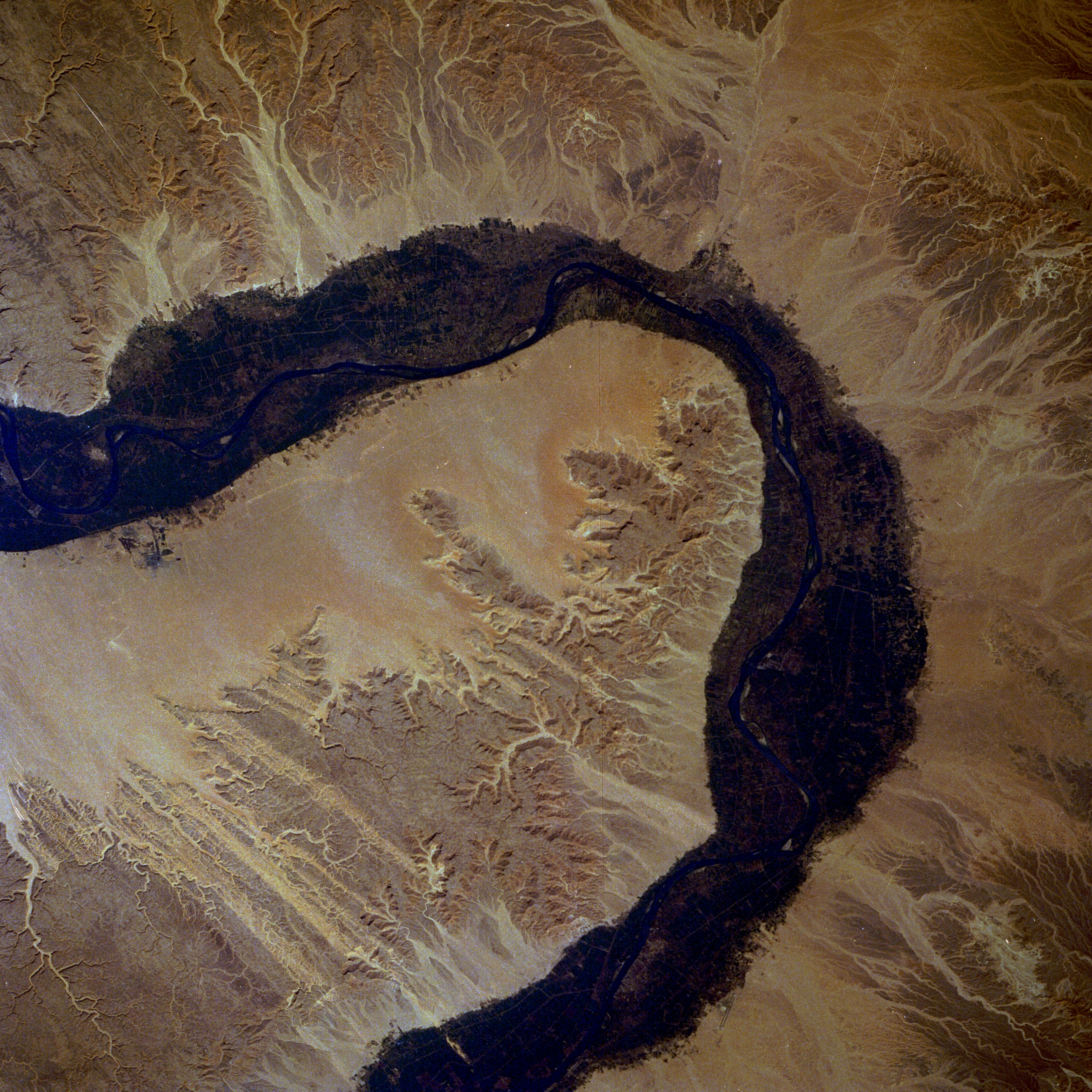
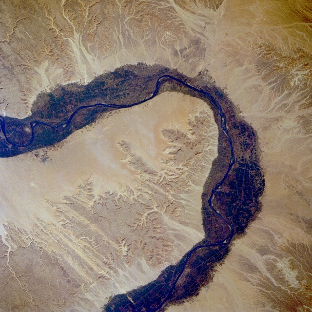
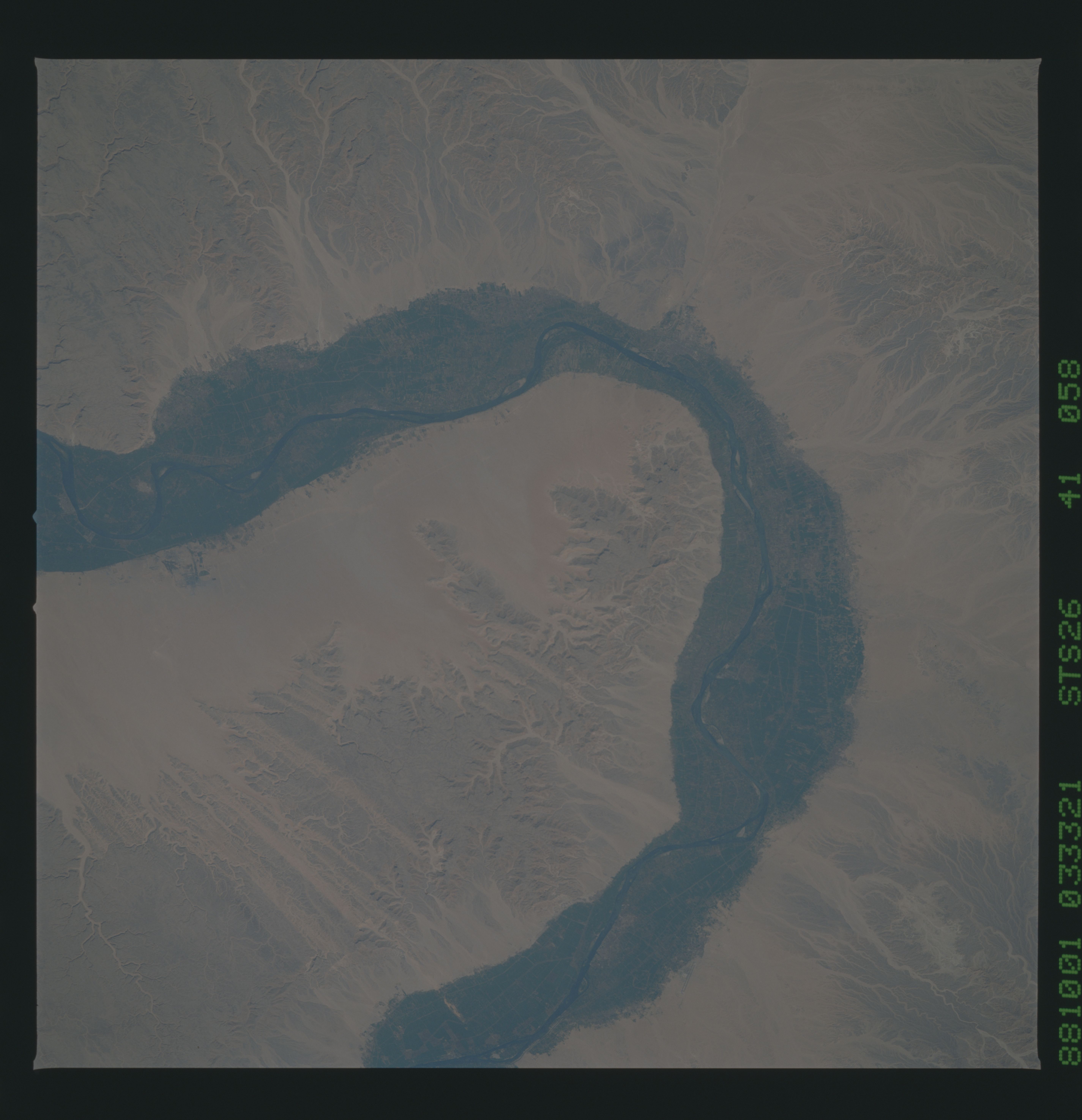
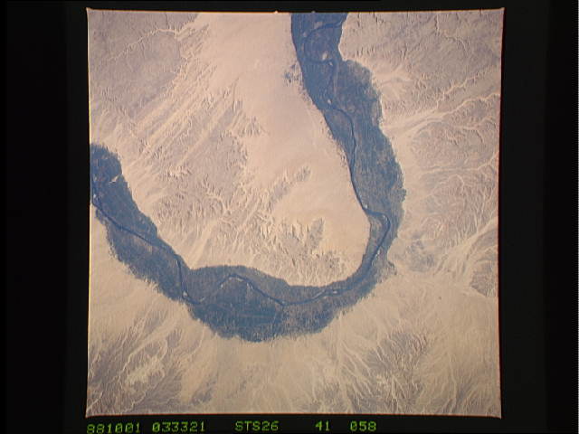
Image Caption: STS026-041-058 Valley of the Kings, Southern Egypt October 1988
Arid landforms comprise much of this nearly vertical view of a portion of the Nile River. These desert landforms include eroded valleys and wadis (watercourses). The fertile and highly productive green Nile River Valley stands out in marked contrast to the tan desert landscape on either side. This part of the Nile Valley varies in width from 4 to 9 miles (6 to 14 kilometers). Near the southern edge of this photograph, the city of Luxor can be ascertained along the eastern bank of the Nile. The narrow, linear runways of the airport are visible on the edge of the desert east of the city. This particular bend in the Nile River is the home of many historical points of interest--Valley of the Kings, Valley of the Queens, Temple of Luxor, Tomb of Tutankhamen, and Necropolis of Thebes.
Arid landforms comprise much of this nearly vertical view of a portion of the Nile River. These desert landforms include eroded valleys and wadis (watercourses). The fertile and highly productive green Nile River Valley stands out in marked contrast to the tan desert landscape on either side. This part of the Nile Valley varies in width from 4 to 9 miles (6 to 14 kilometers). Near the southern edge of this photograph, the city of Luxor can be ascertained along the eastern bank of the Nile. The narrow, linear runways of the airport are visible on the edge of the desert east of the city. This particular bend in the Nile River is the home of many historical points of interest--Valley of the Kings, Valley of the Queens, Temple of Luxor, Tomb of Tutankhamen, and Necropolis of Thebes.
