STS026-40-55
| NASA Photo ID | STS026-40-55 |
| Focal Length | 250mm |
| Date taken | 1988.10.02 |
| Time taken | 21:15:35 GMT |
Resolutions offered for this image:
5239 x 5239 pixels 640 x 640 pixels 5700 x 5900 pixels 500 x 518 pixels 640 x 480 pixels
5239 x 5239 pixels 640 x 640 pixels 5700 x 5900 pixels 500 x 518 pixels 640 x 480 pixels

Cloud masks available for this image:
Spacecraft nadir point: 14.5° S, 71.5° W
Photo center point: 15.5° S, 72.0° W
Photo center point by machine learning:
Photo center point: 15.5° S, 72.0° W
Photo center point by machine learning:
Nadir to Photo Center: South
Spacecraft Altitude: 163 nautical miles (302km)
Country or Geographic Name: | PERU |
Features: | NEVADA AMPATO |
| Features Found Using Machine Learning: | |
Cloud Cover Percentage: | 0 (no clouds present) |
Sun Elevation Angle: | 20° |
Sun Azimuth: | 271° |
Camera: | Hasselblad |
Focal Length: | 250mm |
Camera Tilt: | 22 degrees |
Format: | 5017: Kodak, natural color positive, Ektachrome, X Professional, ASA 64, standard base |
Film Exposure: | Normal |
| Additional Information | |
| Width | Height | Annotated | Cropped | Purpose | Links |
|---|---|---|---|---|---|
| 5239 pixels | 5239 pixels | No | No | Earth From Space collection | Download Image |
| 640 pixels | 640 pixels | No | No | Earth From Space collection | Download Image |
| 5700 pixels | 5900 pixels | No | No | Download Image | |
| 500 pixels | 518 pixels | No | No | Download Image | |
| 640 pixels | 480 pixels | No | No | Download Image |
Download Packaged File
Download a Google Earth KML for this Image
View photo footprint information
Download a GeoTIFF for this photo
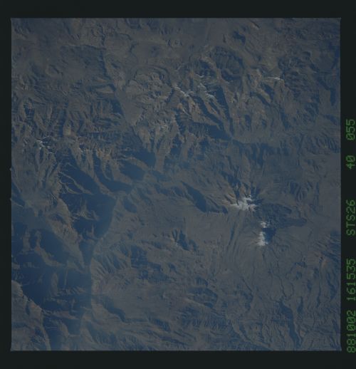
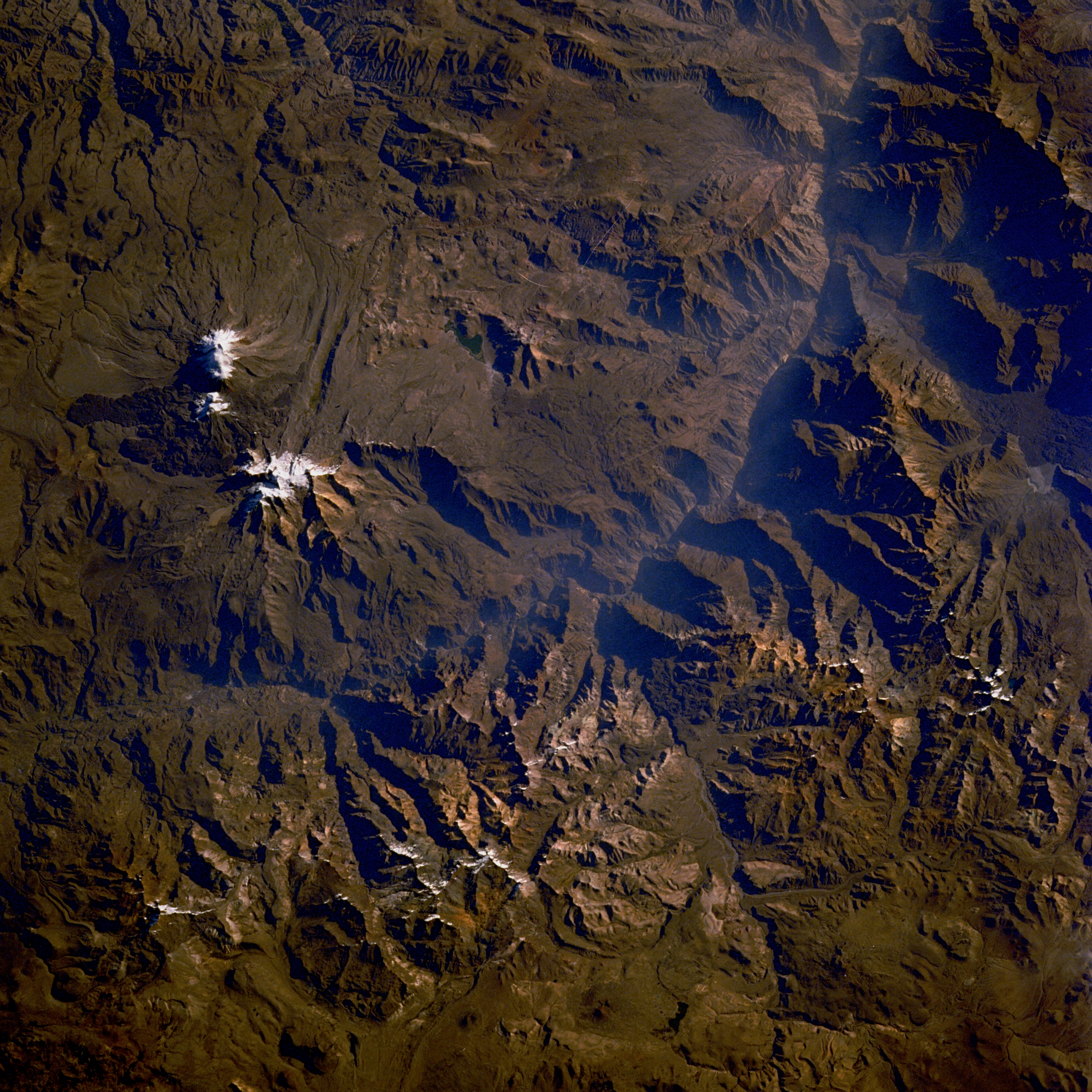
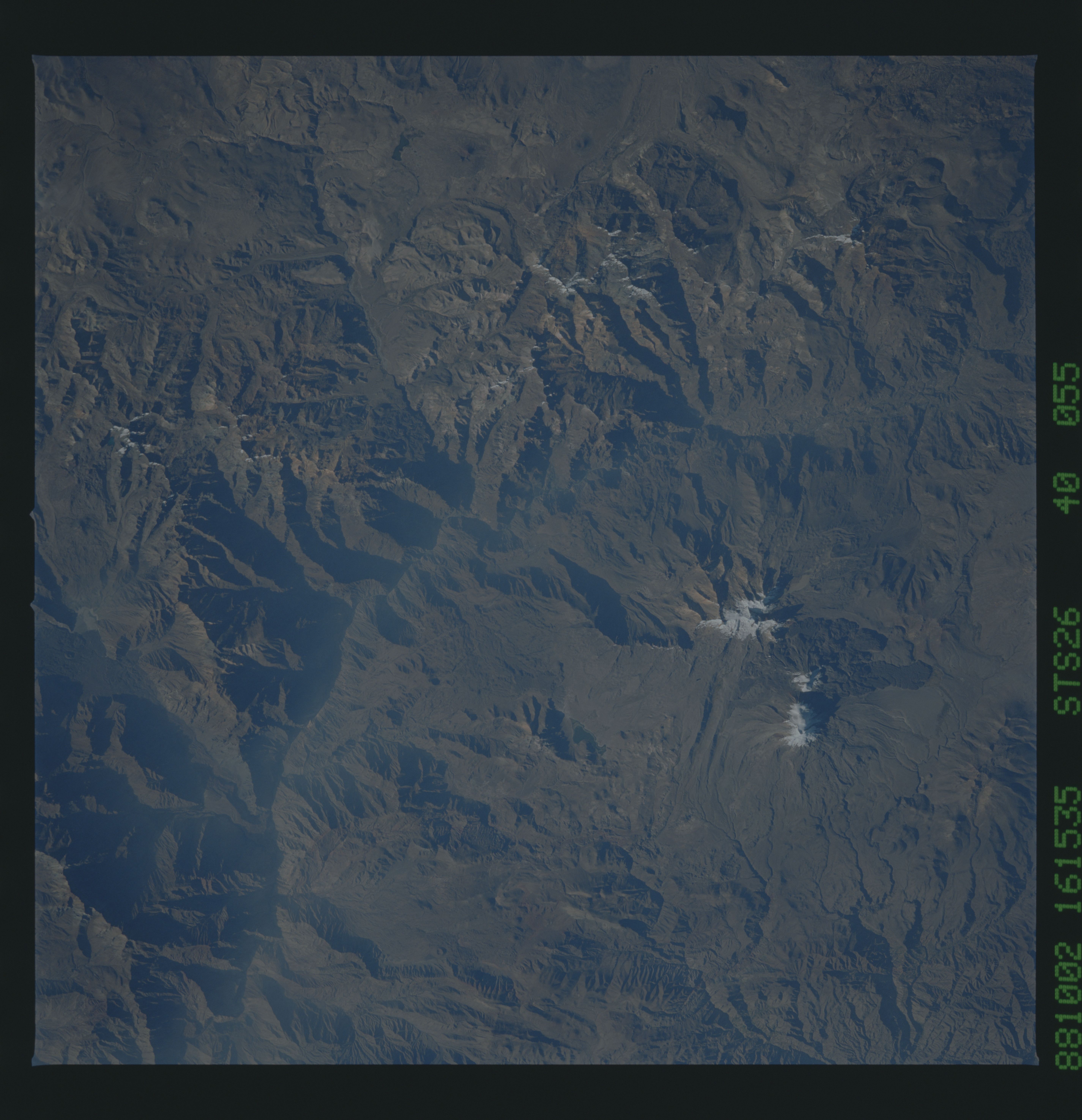
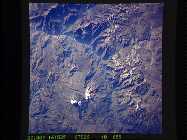
Image Caption: STS026-040-055 Ampato Volcano, Peru October 1988
The Andes Mountains region of South America is known as the Avenue of the Volcanoes. Thousands of volcanoes are scattered throughout the 4500-mile (7200-kilometer) length of the Andes from Panama to the southern tip of Chile (Tierra del Fuego). This photograph shows two major snowcapped volcanoes in the Arequipa Department of southern Peru. Southernmost Ampato Volcano rises more than 20 700 feet (6310 meters) above sea level. A vent developed on the northeast side of Ampato Volcano where a flank eruption occurred, as evidenced by the extensive, darker lava flow, which is almost always indicative of more recent flows. Many of the volcanoes exhibit the pronounced, classic, radial drainage pattern. The deeply shadowed canyon northwest of Ampato Volcano is part of the Colca River Valley, whose river eventually empties into the Pacific Ocean. Most of the rivers flowing through this part of Peru are short and flow intermittently. This mountainous region is part of the Western Cordillera where the climate is extremely arid, with most areas receiving less than 10 inches (25 centimeters) of precipitation annually; therefore, vegetation is sparse. The Peruvian coastal mountains are under the influence of a dry air mass that is stabilized by the cold Peru Current.
The Andes Mountains region of South America is known as the Avenue of the Volcanoes. Thousands of volcanoes are scattered throughout the 4500-mile (7200-kilometer) length of the Andes from Panama to the southern tip of Chile (Tierra del Fuego). This photograph shows two major snowcapped volcanoes in the Arequipa Department of southern Peru. Southernmost Ampato Volcano rises more than 20 700 feet (6310 meters) above sea level. A vent developed on the northeast side of Ampato Volcano where a flank eruption occurred, as evidenced by the extensive, darker lava flow, which is almost always indicative of more recent flows. Many of the volcanoes exhibit the pronounced, classic, radial drainage pattern. The deeply shadowed canyon northwest of Ampato Volcano is part of the Colca River Valley, whose river eventually empties into the Pacific Ocean. Most of the rivers flowing through this part of Peru are short and flow intermittently. This mountainous region is part of the Western Cordillera where the climate is extremely arid, with most areas receiving less than 10 inches (25 centimeters) of precipitation annually; therefore, vegetation is sparse. The Peruvian coastal mountains are under the influence of a dry air mass that is stabilized by the cold Peru Current.
