STS026-35-87
| NASA Photo ID | STS026-35-87 |
| Focal Length | 250mm |
| Date taken | 1988.09.30 |
| Time taken | 20:49:11 GMT |
Cloud masks available for this image:
Spacecraft nadir point: 5.5° S, 66.0° W
Photo center point:
Photo center point by machine learning:
Photo center point:
Photo center point by machine learning:
Nadir to Photo Center:
Spacecraft Altitude: 162 nautical miles (300km)
Camera: | Hasselblad |
Focal Length: | 250mm |
Camera Tilt: | |
Format: | 5017: Kodak, natural color positive, Ektachrome, X Professional, ASA 64, standard base |
Film Exposure: | Normal |
| Additional Information | |
| Width | Height | Annotated | Cropped | Purpose | Links |
|---|---|---|---|---|---|
| 5700 pixels | 5900 pixels | No | No | Download Image | |
| 500 pixels | 518 pixels | No | No | Download Image | |
| 640 pixels | 480 pixels | No | No | Download Image |
Download Packaged File
Download a Google Earth KML for this Image
View photo footprint information
Download a GeoTIFF for this photo
Image Caption: STS026-35-87
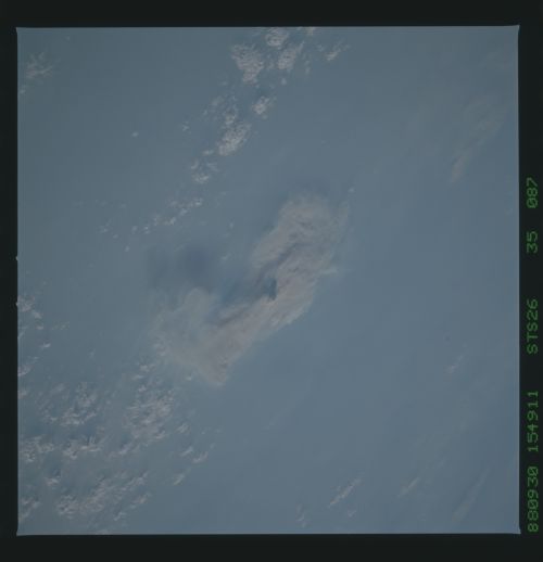
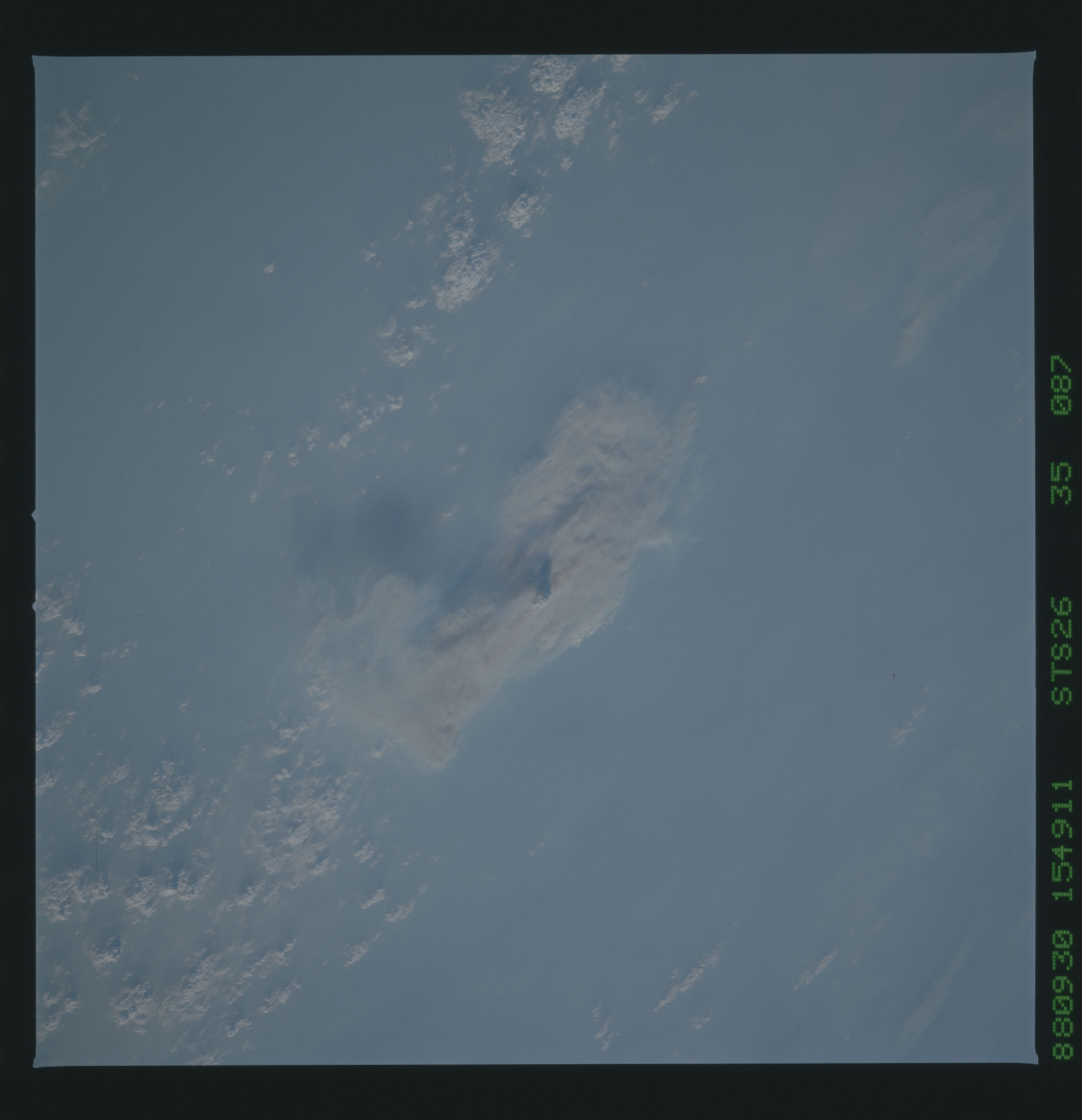
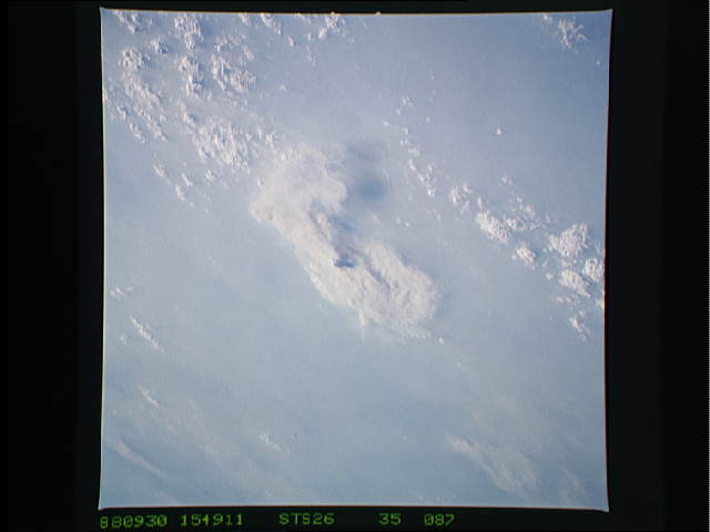
A portion of the smoke pall was photographed over the Brazilian Amazon during the late afternoon of September 30, 1988. The nadir point under the Discovery (flying at 163 n. mi.) at this time was 5.5 deg. S, 66.1 deg. W, and the view is to the south. The 60-km-wide smoke cloud in the center (one of many photographed over Brazil during the mission) is capped by a small cumulus cloud over the heat plume. This huge forest fire is located between Ro Purus and Ro Madeira near Brazilian Road 364, in the Polonoroeste Project of Rondonia State. If these fires had been burning in the United States, say in Yellowstone Park, the resulting smoke pall would have covered most of the area from the Rockies to the Atlantic seaboard and from the Gulf of Mexico to the Great Lakes.
A portion of the smoke pall was photographed over the Brazilian Amazon during the late afternoon of September 30, 1988. The nadir point under the Discovery (flying at 163 n. mi.) at this time was 5.5 deg. S, 66.1 deg. W, and the view is to the south. The 60-km-wide smoke cloud in the center (one of many photographed over Brazil during the mission) is capped by a small cumulus cloud over the heat plume. This huge forest fire is located between Ro Purus and Ro Madeira near Brazilian Road 364, in the Polonoroeste Project of Rondonia State. If these fires had been burning in the United States, say in Yellowstone Park, the resulting smoke pall would have covered most of the area from the Rockies to the Atlantic seaboard and from the Gulf of Mexico to the Great Lakes.
