STS009-49-2272
| NASA Photo ID | STS009-49-2272 |
| Focal Length | 100mm |
| Date taken | 1983.__.__ |
| Time taken | GMT |

Cloud masks available for this image:
Spacecraft nadir point:
Photo center point: 34.0° N, 75.0° E
Photo center point by machine learning:
Photo center point: 34.0° N, 75.0° E
Photo center point by machine learning:
Nadir to Photo Center:
Spacecraft Altitude: nautical miles (0km)
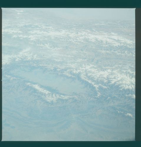
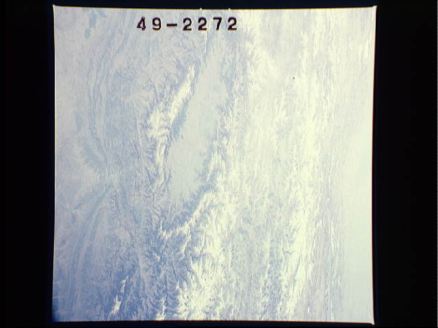
Country or Geographic Name: | INDIA |
Features: | HIMALAYA RANGE/SRINAGAR |
| Features Found Using Machine Learning: | |
Cloud Cover Percentage: | 20 (11-25)% |
Sun Elevation Angle: | ° |
Sun Azimuth: | ° |
Camera: | Hasselblad |
Focal Length: | 100mm |
Camera Tilt: | Low Oblique |
Format: | 6017: Kodak Ektachrome 64, 220 Roll Format |
Film Exposure: | Normal |
| Additional Information | |
| Width | Height | Annotated | Cropped | Purpose | Links |
|---|---|---|---|---|---|
| 4393 pixels | 4600 pixels | No | No | Download Image | |
| 478 pixels | 500 pixels | No | No | Download Image | |
| 640 pixels | 480 pixels | No | No | Download Image |
Download Packaged File
Download a Google Earth KML for this Image
View photo footprint information
Download a GeoTIFF for this photo
Image Caption: STS009-49-2272 Vale of Kashmir This oblique northeast-looking view
shows the mountainous Vale of Kashmir and the peaks of the rugged
Karakoram Range. The valley, perched at an elevation of 1600 meters,
is 135 km long and 32 km wide. Mountain peaks surrounding the valley
range from 3600 to over 4900 meters. The Jhelum River meanders through
the heart of the valley. Fertile alluvial soil of the valley floor
produces rich yields of rice, corn, fruits, and vegetables. Once a
large shallow lake, the valley today is fed by meltwater from snow on
the surrounding peaks.
