STS008-50-1844
| NASA Photo ID | STS008-50-1844 |
| Focal Length | 250mm |
| Date taken | 1983.__.__ |
| Time taken | GMT |
Resolutions offered for this image:
3904 x 3904 pixels 639 x 639 pixels 4393 x 4600 pixels 478 x 500 pixels 640 x 480 pixels
3904 x 3904 pixels 639 x 639 pixels 4393 x 4600 pixels 478 x 500 pixels 640 x 480 pixels

Cloud masks available for this image:
Spacecraft nadir point:
Photo center point: 13.0° S, 133.5° E
Photo center point by machine learning:
Photo center point: 13.0° S, 133.5° E
Photo center point by machine learning:
Nadir to Photo Center:
Spacecraft Altitude: nautical miles (0km)
Country or Geographic Name: | AUSTRALIA |
Features: | ARNHEM LAND, DIKES |
| Features Found Using Machine Learning: | |
Cloud Cover Percentage: | 0 (no clouds present) |
Sun Elevation Angle: | ° |
Sun Azimuth: | ° |
Camera: | Hasselblad |
Focal Length: | 250mm |
Camera Tilt: | Near Vertical |
Format: | 6017: Kodak Ektachrome 64, 220 Roll Format |
Film Exposure: | Under Exposed |
| Additional Information | |
| Width | Height | Annotated | Cropped | Purpose | Links |
|---|---|---|---|---|---|
| 3904 pixels | 3904 pixels | No | No | Earth From Space collection | Download Image |
| 639 pixels | 639 pixels | No | No | Earth From Space collection | Download Image |
| 4393 pixels | 4600 pixels | No | No | Download Image | |
| 478 pixels | 500 pixels | No | No | Download Image | |
| 640 pixels | 480 pixels | No | No | Download Image |
Download Packaged File
Download a Google Earth KML for this Image
View photo footprint information
Download a GeoTIFF for this photo
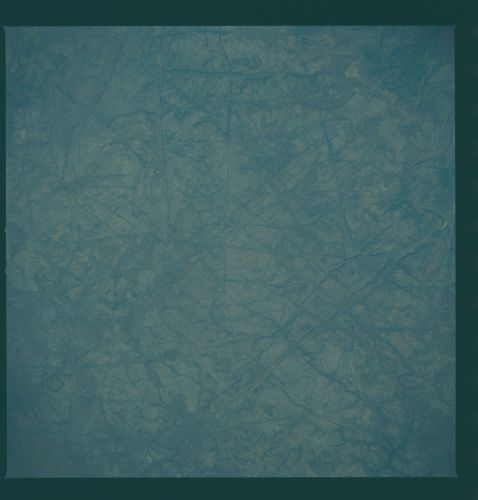
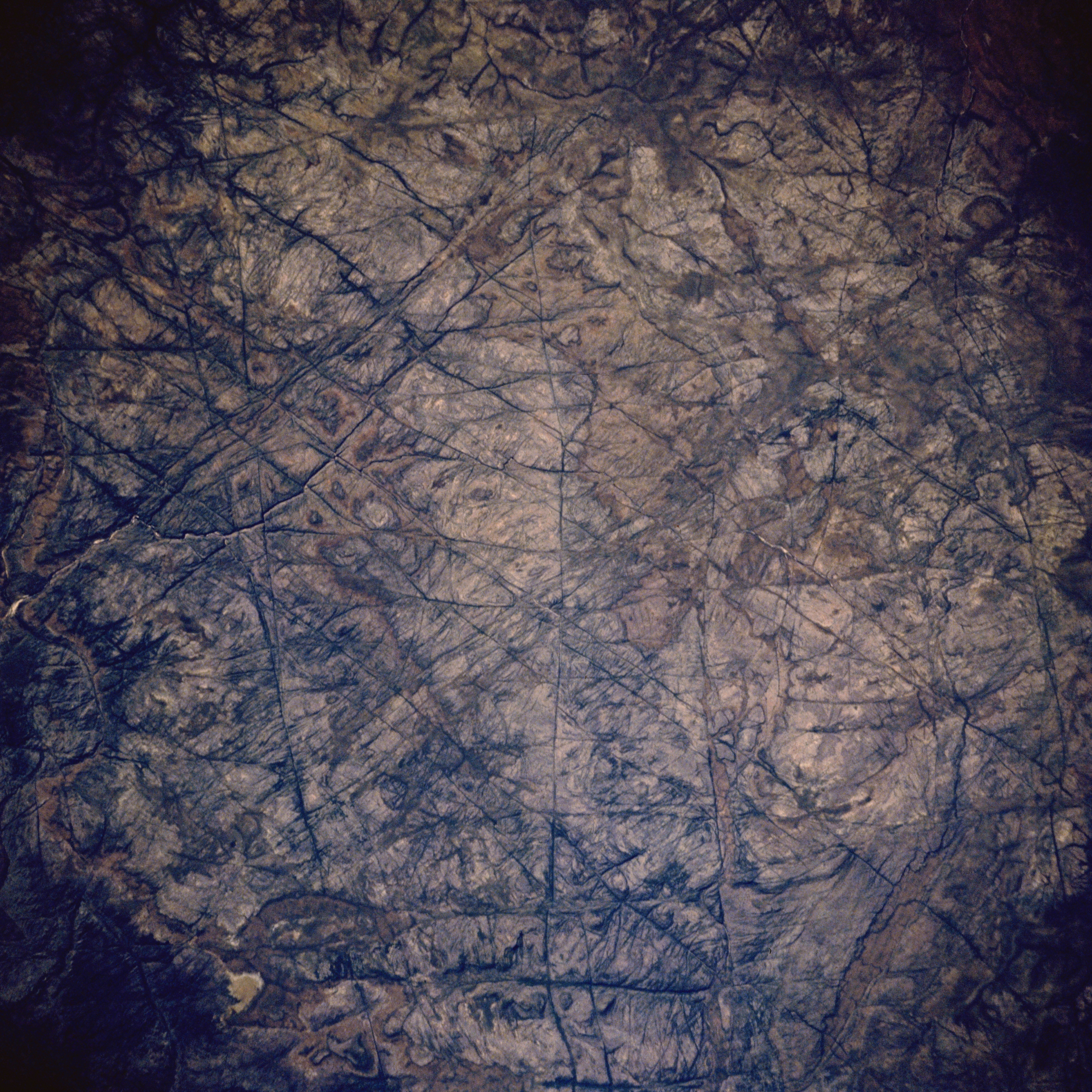
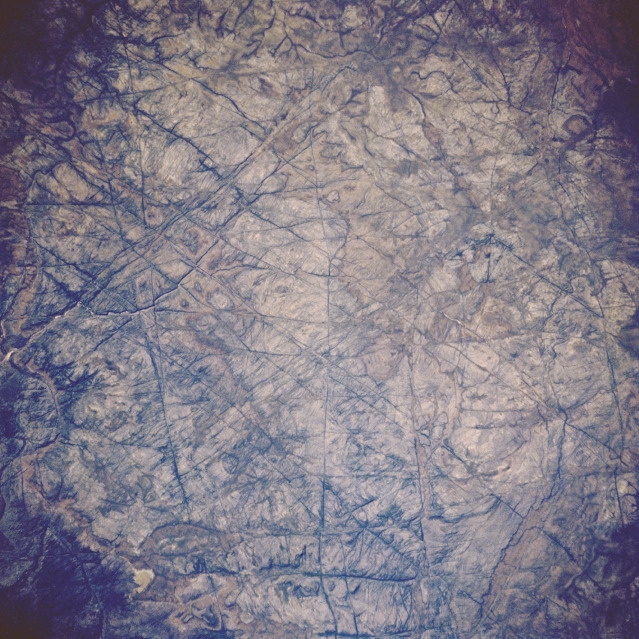
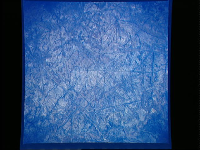
Image Caption: STS008-50-1844 Arnhem Land, Northern Territory, Australia September 1983
The northeastern peninsula of the Northern Territory is known as Arnhem Land. This plateau, located southeast of Van Diemen Gulf, is made up of some of the oldest rocks on Earth. As seen in this close-up view, the plateau is cut by numerous gorges created by the facturing and faulting of the Earth's crust over millions of years. Fracture patterns in the Arnhem Land rocks display dramatic intersecting patterns created by lateral and vertical tectonic stresses.
The northeastern peninsula of the Northern Territory is known as Arnhem Land. This plateau, located southeast of Van Diemen Gulf, is made up of some of the oldest rocks on Earth. As seen in this close-up view, the plateau is cut by numerous gorges created by the facturing and faulting of the Earth's crust over millions of years. Fracture patterns in the Arnhem Land rocks display dramatic intersecting patterns created by lateral and vertical tectonic stresses.
