STS007-22-1127
| NASA Photo ID | STS007-22-1127 |
| Focal Length | 250mm |
| Date taken | 1983.06.__ |
| Time taken | GMT |

Cloud masks available for this image:
Spacecraft nadir point:
Photo center point: 28.5° N, 178.5° W
Photo center point by machine learning:
Photo center point: 28.5° N, 178.5° W
Photo center point by machine learning:
Nadir to Photo Center:
Spacecraft Altitude: nautical miles (0km)
Country or Geographic Name: | USA-HAWAII |
Features: | KURE ISLAND |
| Features Found Using Machine Learning: | |
Cloud Cover Percentage: | 10 (1-10)% |
Sun Elevation Angle: | ° |
Sun Azimuth: | ° |
Camera: | Hasselblad |
Focal Length: | 250mm |
Camera Tilt: | Near Vertical |
Format: | 5017: Kodak, natural color positive, Ektachrome, X Professional, ASA 64, standard base |
Film Exposure: | Normal |
| Additional Information | |
| Width | Height | Annotated | Cropped | Purpose | Links |
|---|---|---|---|---|---|
| 640 pixels | 480 pixels | No | No | ISD 1 | Download Image |
| 2640 pixels | 2608 pixels | Yes | ReefBase 1 | Download Image | |
| 948 pixels | 833 pixels | No | Yes | ReefBase 1 | Download Image |
Download Packaged File
Download a Google Earth KML for this Image
View photo footprint information
Download a GeoTIFF for this photo
Image Caption:
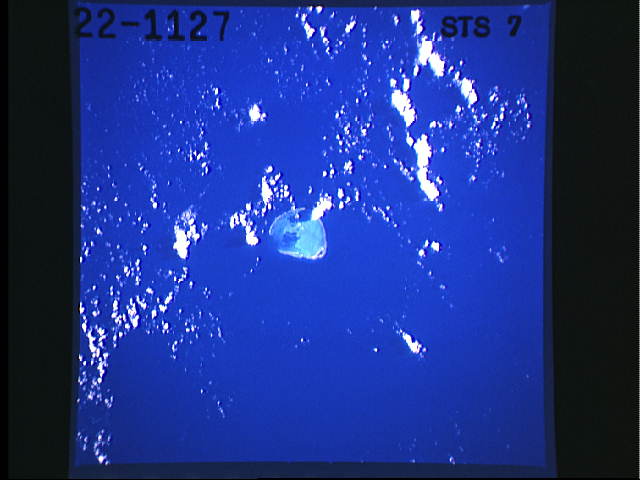
Kure Island, Midway Islands
Kure Island, the western most island of the Island Seamount
Chain, is seen in this near- vertical view. Most all of the once
volcanic island has subsided below the sea, leaving only the
frining coral reef barely visible above sea level. (S07-22-1127)
Kure Island, Midway Islands
Kure Island, the western most island of the Island Seamount
Chain, is seen in this near- vertical view. Most all of the once
volcanic island has subsided below the sea, leaving only the
frining coral reef barely visible above sea level. (S07-22-1127)
