STS006-45-75
| NASA Photo ID | STS006-45-75 |
| Focal Length | 100mm |
| Date taken | 1983.04.__ |
| Time taken | GMT |
Cloud masks available for this image:
Spacecraft nadir point:
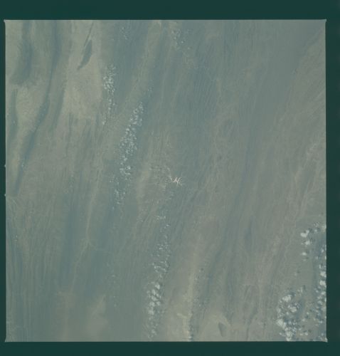
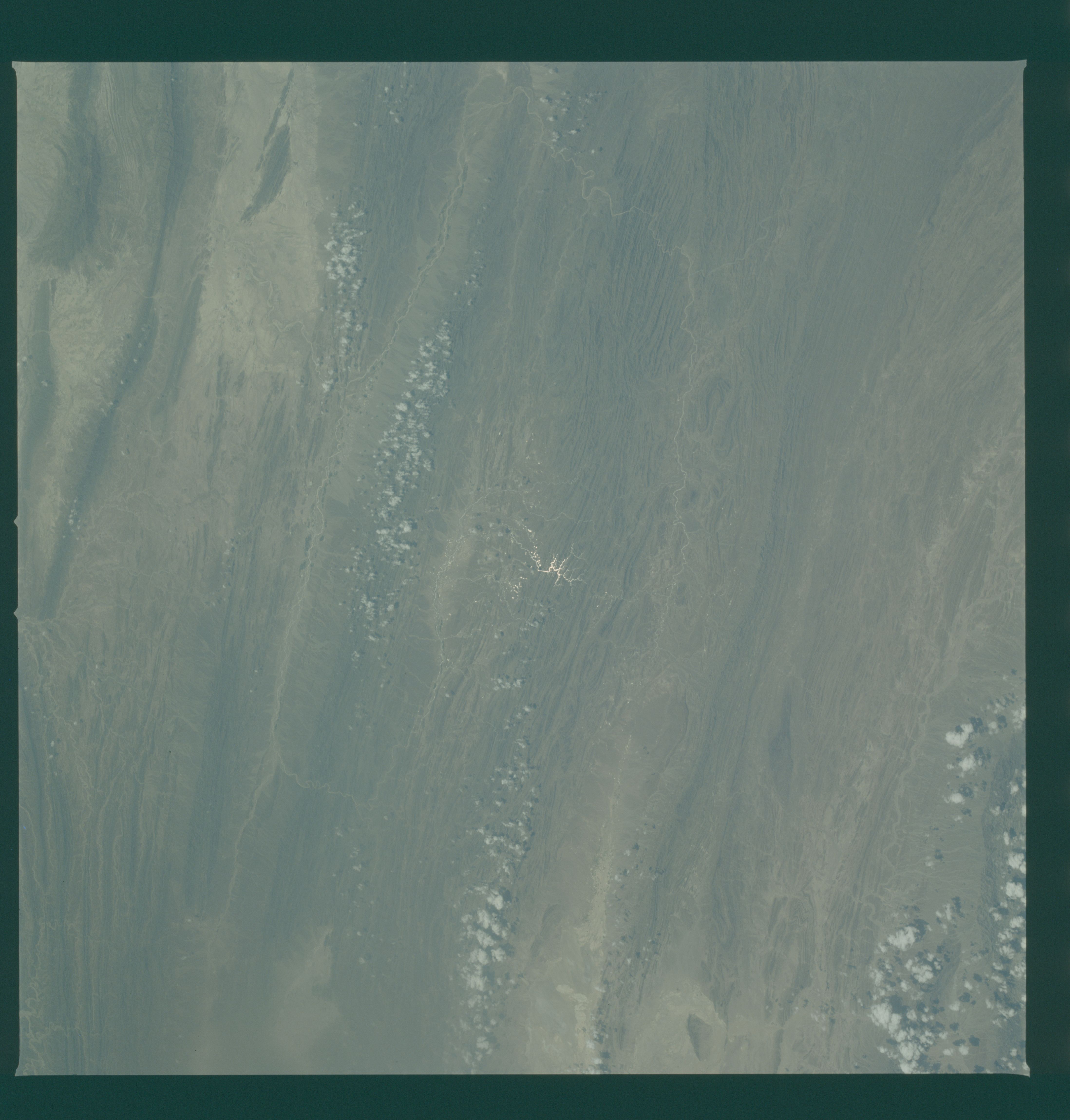
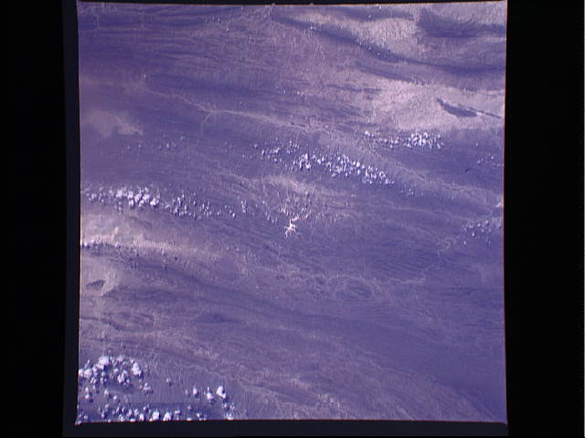
Photo center point: 26.5° N, 63.0° E
Photo center point by machine learning:
Photo center point: 26.5° N, 63.0° E
Photo center point by machine learning:
Nadir to Photo Center:
Spacecraft Altitude: nautical miles (0km)
Country or Geographic Name: | PAKISTAN |
Features: | MAKRAN RANGE |
| Features Found Using Machine Learning: | |
Cloud Cover Percentage: | 10 (1-10)% |
Sun Elevation Angle: | ° |
Sun Azimuth: | ° |
Camera: | Hasselblad |
Focal Length: | 100mm |
Camera Tilt: | Near Vertical |
Format: | 5017: Kodak, natural color positive, Ektachrome, X Professional, ASA 64, standard base |
Film Exposure: | Normal |
| Additional Information | |
| Width | Height | Annotated | Cropped | Purpose | Links |
|---|---|---|---|---|---|
| 4393 pixels | 4600 pixels | No | No | Download Image | |
| 478 pixels | 500 pixels | No | No | Download Image | |
| 640 pixels | 480 pixels | No | No | Download Image |
Download Packaged File
Download a Google Earth KML for this Image
View photo footprint information
Download a GeoTIFF for this photo
Image Caption: The long folded mountain ridges and valleys of the coastal Makran Ranges of Iran and Pakistan (26.0N, 63.0E) illustrate the classical Trellis type of drainage pattern, common in this region. The Dasht River and its tributaries is the principal drainage network for this area. To the left, the continental drift of the northward bound Indian sub-continent has caused the east/west parallel ranges to bend in a great northward arc.
