STS006-43-290
| NASA Photo ID | STS006-43-290 |
| Focal Length | 100mm |
| Date taken | 1983.04.__ |
| Time taken | GMT |

Cloud masks available for this image:
Spacecraft nadir point:
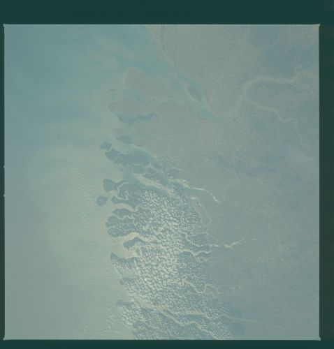
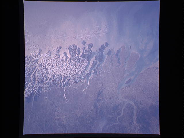
Photo center point: 22.0° N, 88.5° E
Photo center point by machine learning:
Photo center point: 22.0° N, 88.5° E
Photo center point by machine learning:
Nadir to Photo Center:
Spacecraft Altitude: nautical miles (0km)
Country or Geographic Name: | INDIA |
Features: | MOUTHS OF GANGES |
| Features Found Using Machine Learning: | |
Cloud Cover Percentage: | 10 (1-10)% |
Sun Elevation Angle: | ° |
Sun Azimuth: | ° |
Camera: | Hasselblad |
Focal Length: | 100mm |
Camera Tilt: | Near Vertical |
Format: | 5017: Kodak, natural color positive, Ektachrome, X Professional, ASA 64, standard base |
Film Exposure: | Normal |
| Additional Information | |
| Width | Height | Annotated | Cropped | Purpose | Links |
|---|---|---|---|---|---|
| 4393 pixels | 4600 pixels | No | No | Download Image | |
| 478 pixels | 500 pixels | No | No | Download Image | |
| 640 pixels | 480 pixels | No | No | Download Image |
Download Packaged File
Download a Google Earth KML for this Image
View photo footprint information
Download a GeoTIFF for this photo
Image Caption: The mouths of the Hooghly and Ganges Rivers, India (22.0N, 89.0E) merge to form a delta or marshland at the Bay of Bengal. The dark toned area just behind the coast is a mangrove swamp where the salt water tolerant plants form a thick entanglement of roots to trap and retain riverborne sediments. The city of Calcutta on the Hooghly is above the delta and the adjacent area is some of the most densly populated agricultural areas of the world.
