STS005-39-1075
| NASA Photo ID | STS005-39-1075 |
| Focal Length | 100mm |
| Date taken | 1982.11.__ |
| Time taken | GMT |

Cloud masks available for this image:
Spacecraft nadir point:
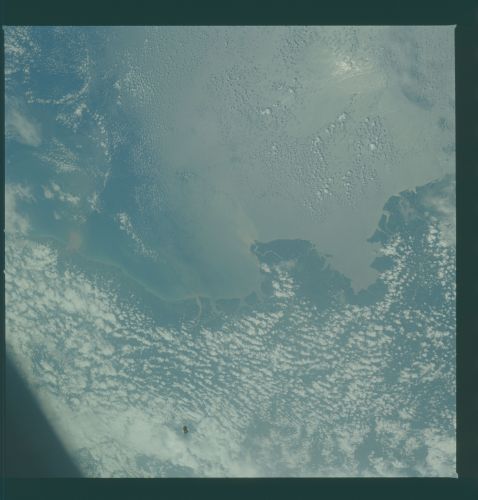
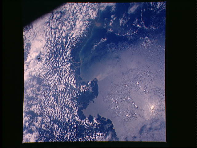
Photo center point: 1.6° N, 79.1° W
Photo center point by machine learning:
Photo center point: 1.6° N, 79.1° W
Photo center point by machine learning:
Nadir to Photo Center:
Spacecraft Altitude: nautical miles (0km)
Camera: | Hasselblad |
Focal Length: | 100mm |
Camera Tilt: | Low Oblique |
Format: | 5017: Kodak, natural color positive, Ektachrome, X Professional, ASA 64, standard base |
Film Exposure: | Normal |
| Additional Information | |
| Width | Height | Annotated | Cropped | Purpose | Links |
|---|---|---|---|---|---|
| 4393 pixels | 4600 pixels | No | No | Download Image | |
| 478 pixels | 500 pixels | No | No | Download Image | |
| 640 pixels | 480 pixels | No | No | Download Image |
Download Packaged File
Download a Google Earth KML for this Image
View photo footprint information
Download a GeoTIFF for this photo
Image Caption: Numerous rivers in Ecuador and Columbia stand out in this South American Pacific coastal scene (1.5N, 79.0W). This region has one of the highest rainfalls in the world with the consequent heavy cloud cover and it is rare to be able to photograph the surface. The Pacific mountain drainage area is small but produces a large volume of runoff and sediment flow into the ocean.
