STS005-39-1022
| NASA Photo ID | STS005-39-1022 |
| Focal Length | 100mm |
| Date taken | 1982.11.__ |
| Time taken | GMT |
Resolutions offered for this image:
4393 x 4600 pixels 478 x 500 pixels 640 x 480 pixels 2608 x 2564 pixels 1304 x 1282 pixels
4393 x 4600 pixels 478 x 500 pixels 640 x 480 pixels 2608 x 2564 pixels 1304 x 1282 pixels

Cloud masks available for this image:
Spacecraft nadir point:
Photo center point: 13.7° N, 13.8° E
Photo center point by machine learning:
Photo center point: 13.7° N, 13.8° E
Photo center point by machine learning:
Nadir to Photo Center:
Spacecraft Altitude: nautical miles (0km)
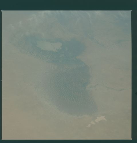
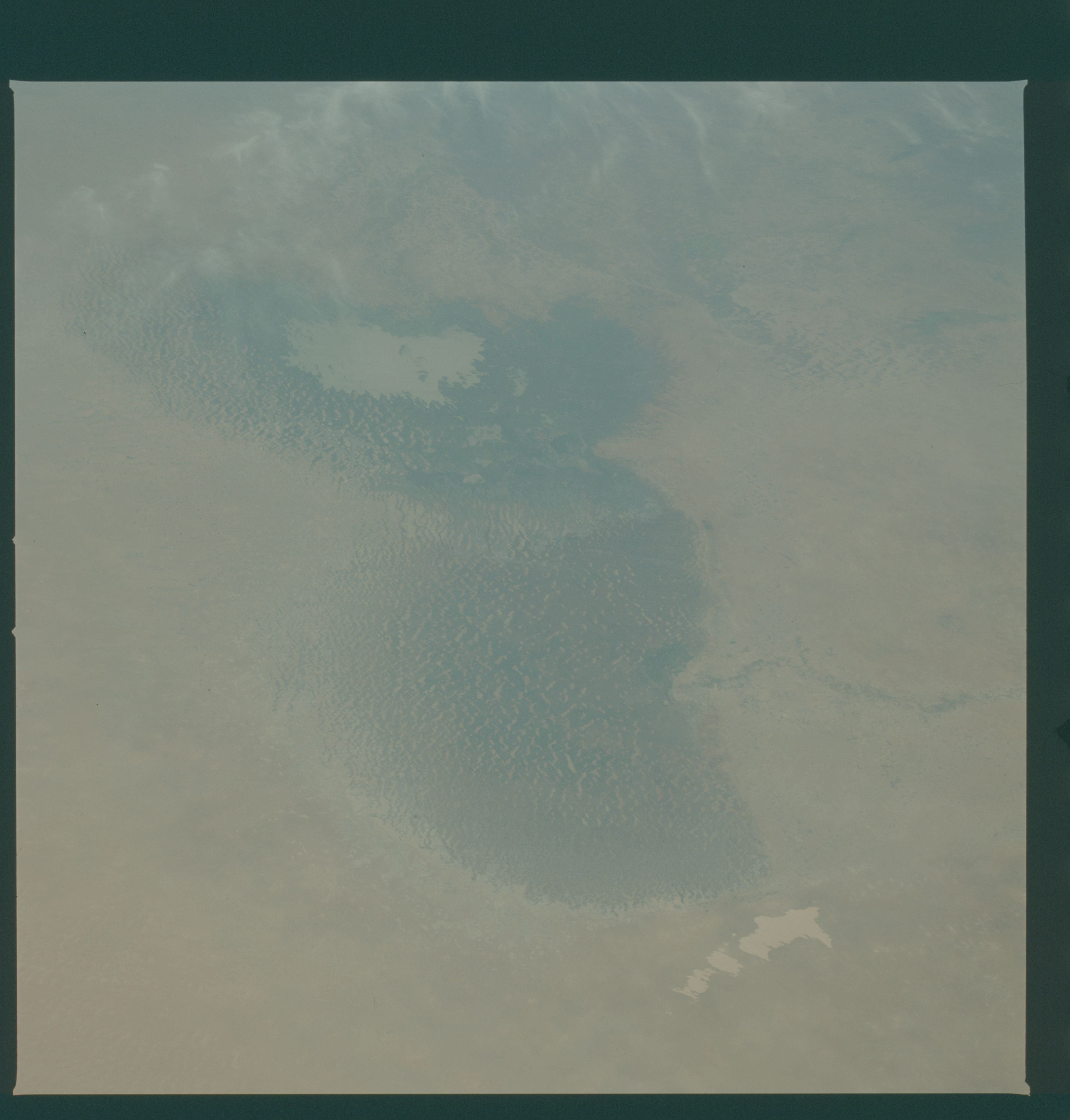
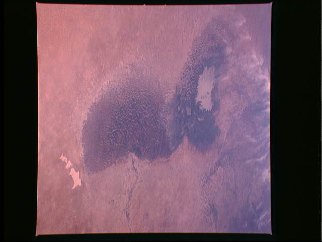
Country or Geographic Name: | CHAD |
Features: | LAKE CHAD |
| Features Found Using Machine Learning: | |
Cloud Cover Percentage: | 5 (1-10)% |
Sun Elevation Angle: | ° |
Sun Azimuth: | ° |
Camera: | Hasselblad |
Focal Length: | 100mm |
Camera Tilt: | Low Oblique |
Format: | 5017: Kodak, natural color positive, Ektachrome, X Professional, ASA 64, standard base |
Film Exposure: | Normal |
| Additional Information | |
| Width | Height | Annotated | Cropped | Purpose | Links |
|---|---|---|---|---|---|
| 4393 pixels | 4600 pixels | No | No | Download Image | |
| 478 pixels | 500 pixels | No | No | Download Image | |
| 640 pixels | 480 pixels | No | No | Download Image | |
| 2608 pixels | 2564 pixels | No | No | Download Image | |
| 1304 pixels | 1282 pixels | No | No | Download Image |
Download Packaged File
Download a Google Earth KML for this Image
View photo footprint information
Download a GeoTIFF for this photo
Image Caption: Once a great inland lake, Lake Chad (13.0N, 14.0E) in the Sahara Desert at the intersection of the African nations of Chad, Niger, Nigeria and Cameroon, is now in decline. The larger northern lobe is almost totally dry and slowly filling in with encroaching sand dunes. The southern lobe, still retains some water in the lower center but the water surface area is less than 2000 square kilometers and sand dunes are filling in the north end.
