STS005-37-839
| NASA Photo ID | STS005-37-839 |
| Focal Length | 250mm |
| Date taken | 1982.11.__ |
| Time taken | GMT |

Cloud masks available for this image:
Spacecraft nadir point:
Photo center point: 23.5° N, 76.5° W
Photo center point by machine learning:
Photo center point: 23.5° N, 76.5° W
Photo center point by machine learning:
Nadir to Photo Center:
Spacecraft Altitude: nautical miles (0km)
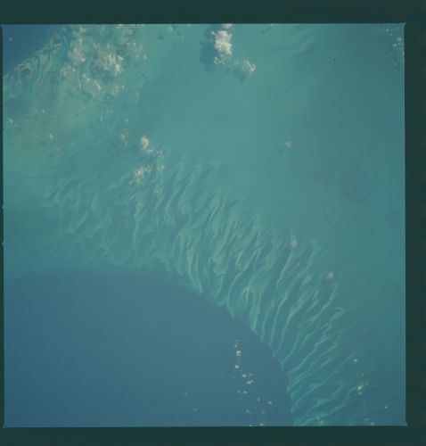
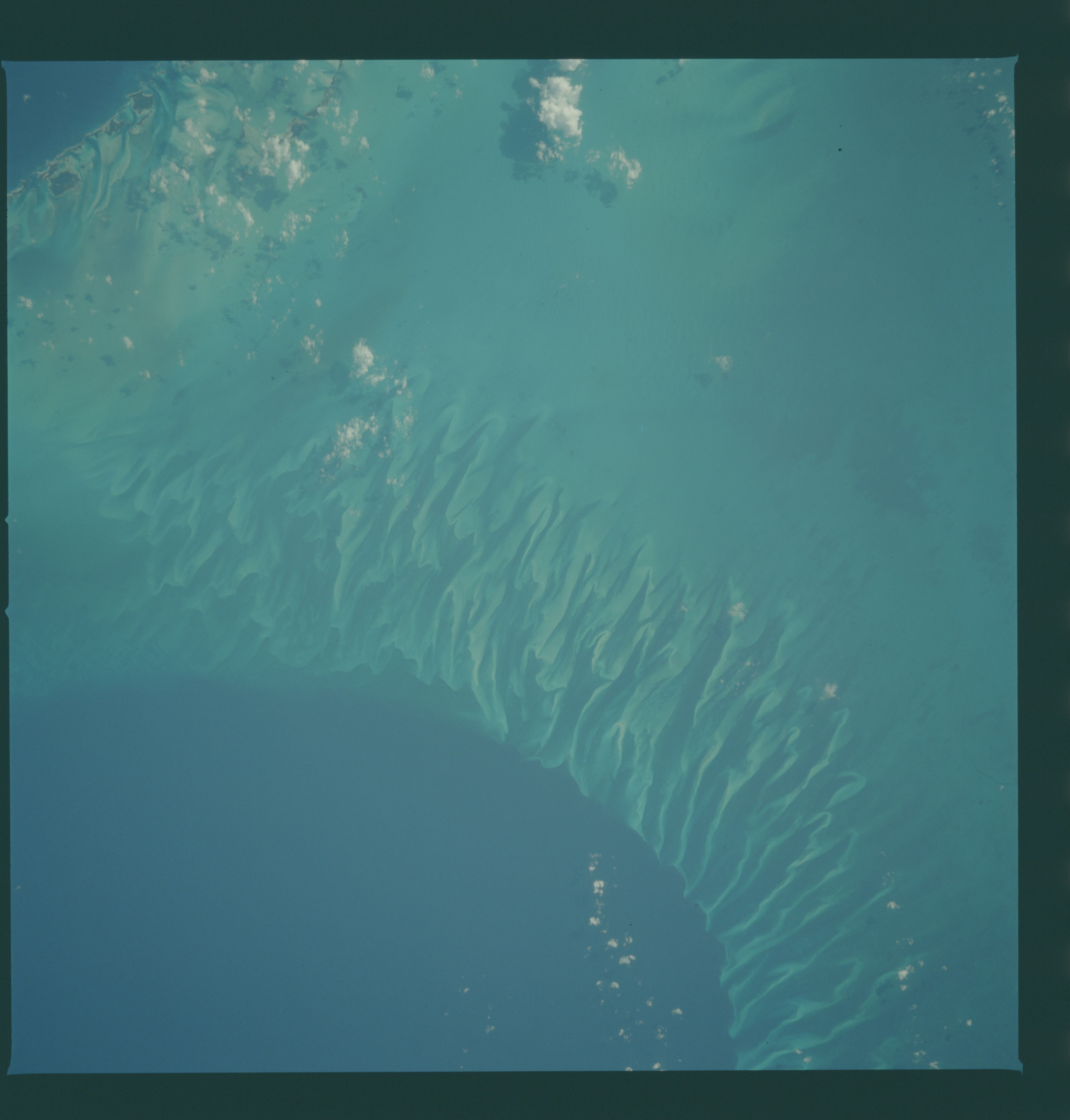
Country or Geographic Name: | BAHAMAS |
Features: | TONGUE OF THE OCEAN, BANK |
| Features Found Using Machine Learning: | |
Cloud Cover Percentage: | 5 (1-10)% |
Sun Elevation Angle: | ° |
Sun Azimuth: | ° |
Camera: | Hasselblad |
Focal Length: | 250mm |
Camera Tilt: | |
Format: | 5017: Kodak, natural color positive, Ektachrome, X Professional, ASA 64, standard base |
Film Exposure: | Normal |
| Additional Information | |
| Width | Height | Annotated | Cropped | Purpose | Links |
|---|---|---|---|---|---|
| 4393 pixels | 4600 pixels | No | No | Download Image | |
| 478 pixels | 500 pixels | No | No | Download Image | |
| 640 pixels | 480 pixels | No | No | Download Image |
Download Packaged File
Download a Google Earth KML for this Image
View photo footprint information
Download a GeoTIFF for this photo
Image Caption: A portion of the tongue of the ocean (24.0N, 77.0W), and the Bahamas Bank, Bahamas Archipelago. The light blue region is the shalow sea bottom where the Bahama Bank is no more than 30 ft. deep. At the contact between light and dark blue, an underwater shear cliff drops over a mile in depth. The wavey lines of various shades of blue are caused by the differential coral growth relative to the warm/cool water transfer in and out of the tongue.
