STS003-10-613
| NASA Photo ID | STS003-10-613 |
| Focal Length | 100mm |
| Date taken | 1982.03.__ |
| Time taken | GMT |
Resolutions offered for this image:
5287 x 5287 pixels 640 x 640 pixels 4393 x 4600 pixels 478 x 500 pixels 640 x 480 pixels
5287 x 5287 pixels 640 x 640 pixels 4393 x 4600 pixels 478 x 500 pixels 640 x 480 pixels

Cloud masks available for this image:
Spacecraft nadir point:
Photo center point: 33.0° N, 106.0° W
Photo center point by machine learning:
Photo center point: 33.0° N, 106.0° W
Photo center point by machine learning:
Nadir to Photo Center:
Spacecraft Altitude: nautical miles (0km)
Country or Geographic Name: | USA-NEW MEXICO |
Features: | WHITE SANDS |
| Features Found Using Machine Learning: | |
Cloud Cover Percentage: | 10 (1-10)% |
Sun Elevation Angle: | ° |
Sun Azimuth: | ° |
Camera: | Hasselblad |
Focal Length: | 100mm |
Camera Tilt: | Near Vertical |
Format: | 2448: Fine Grain Aerochrome II color-reversal camera film, 70mm, process EA-5 |
Film Exposure: | Normal |
| Additional Information | |
| Width | Height | Annotated | Cropped | Purpose | Links |
|---|---|---|---|---|---|
| 5287 pixels | 5287 pixels | No | No | Earth From Space collection | Download Image |
| 640 pixels | 640 pixels | No | No | Earth From Space collection | Download Image |
| 4393 pixels | 4600 pixels | No | No | Download Image | |
| 478 pixels | 500 pixels | No | No | Download Image | |
| 640 pixels | 480 pixels | No | No | Download Image |
Download Packaged File
Download a Google Earth KML for this Image
View photo footprint information
Download a GeoTIFF for this photo
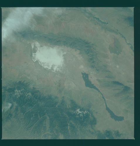
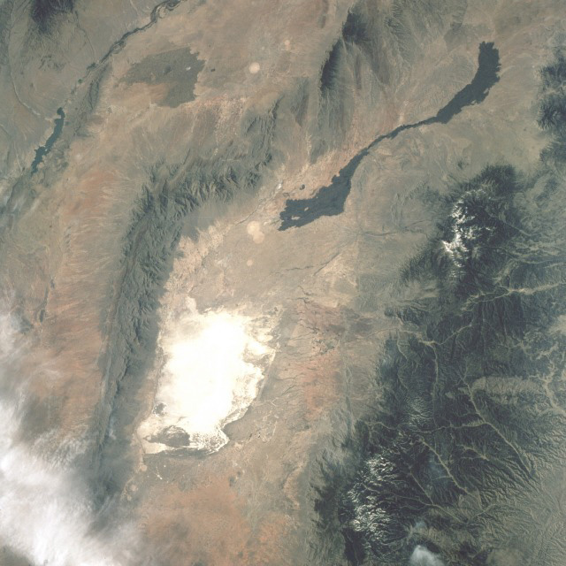
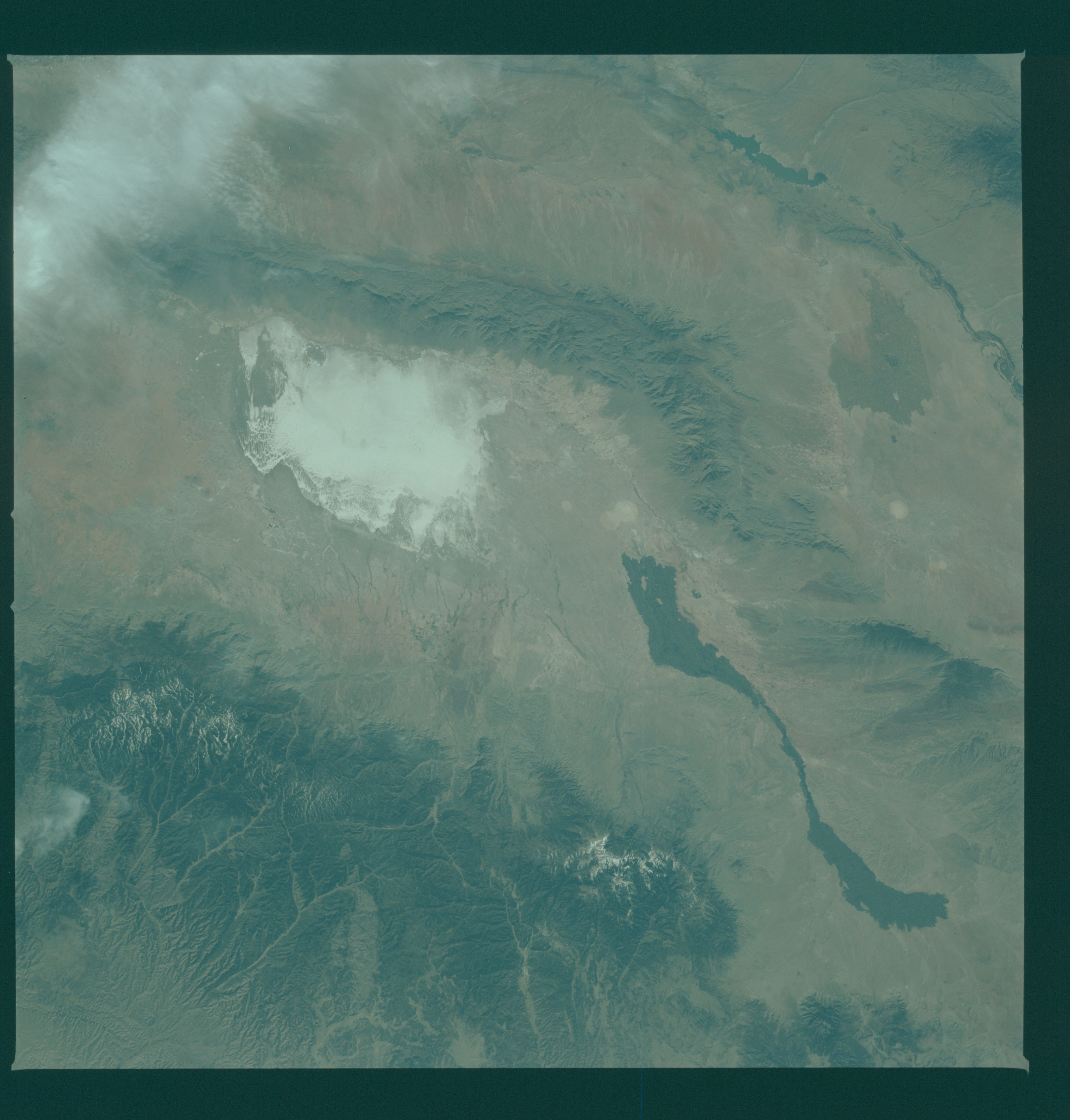
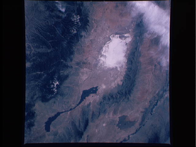
Image Caption: STS003-10-0613 White Sands, New Mexico, U.S.A March 1982White Sands, a region of sand dunes made white by their high gypsum content in south-central New Mexico, is seen in this low-oblique, north-looking photograph. This is an alternate Shuttle landing site (in fact, STS-003 landed here). North of White Sands in the same valley between the San Andres Mountains on the west and the Sacramento Mountains on the east, two long, narrow, young lava flows emanate in separate directions from a fissure that is not discernible on the photograph. One can observe the Rio Grande rift system along the western edge of this photograph. Elephant Butte Reservoir is the elongated dark feature within the rift valley. The areas that appear as white circles south and west of the lava flows were cleared for possible use as sites for atomic weapons testing during World War II.
A truly remarkable view of White Sands and the nearby Carrizozo Lava Beds in southeast NM (33.5N, 106.5W). White Sands, site of the WW II atomic bomb development and testing facility and later post war nuclear weapons testing that can still be seen in the cleared circular patterns on the ground. Space Shuttle Columbia, this mission, landed at the White Sands alternate landing site because of bad weather at Edwards AFB, CA.
A truly remarkable view of White Sands and the nearby Carrizozo Lava Beds in southeast NM (33.5N, 106.5W). White Sands, site of the WW II atomic bomb development and testing facility and later post war nuclear weapons testing that can still be seen in the cleared circular patterns on the ground. Space Shuttle Columbia, this mission, landed at the White Sands alternate landing site because of bad weather at Edwards AFB, CA.
