STS001-12-322

| NASA Photo ID | STS001-12-322 |
| Focal Length | 250mm |
| Date taken | 1981.04.__ |
| Time taken | GMT |
Cloud masks available for this image:
Spacecraft nadir point:
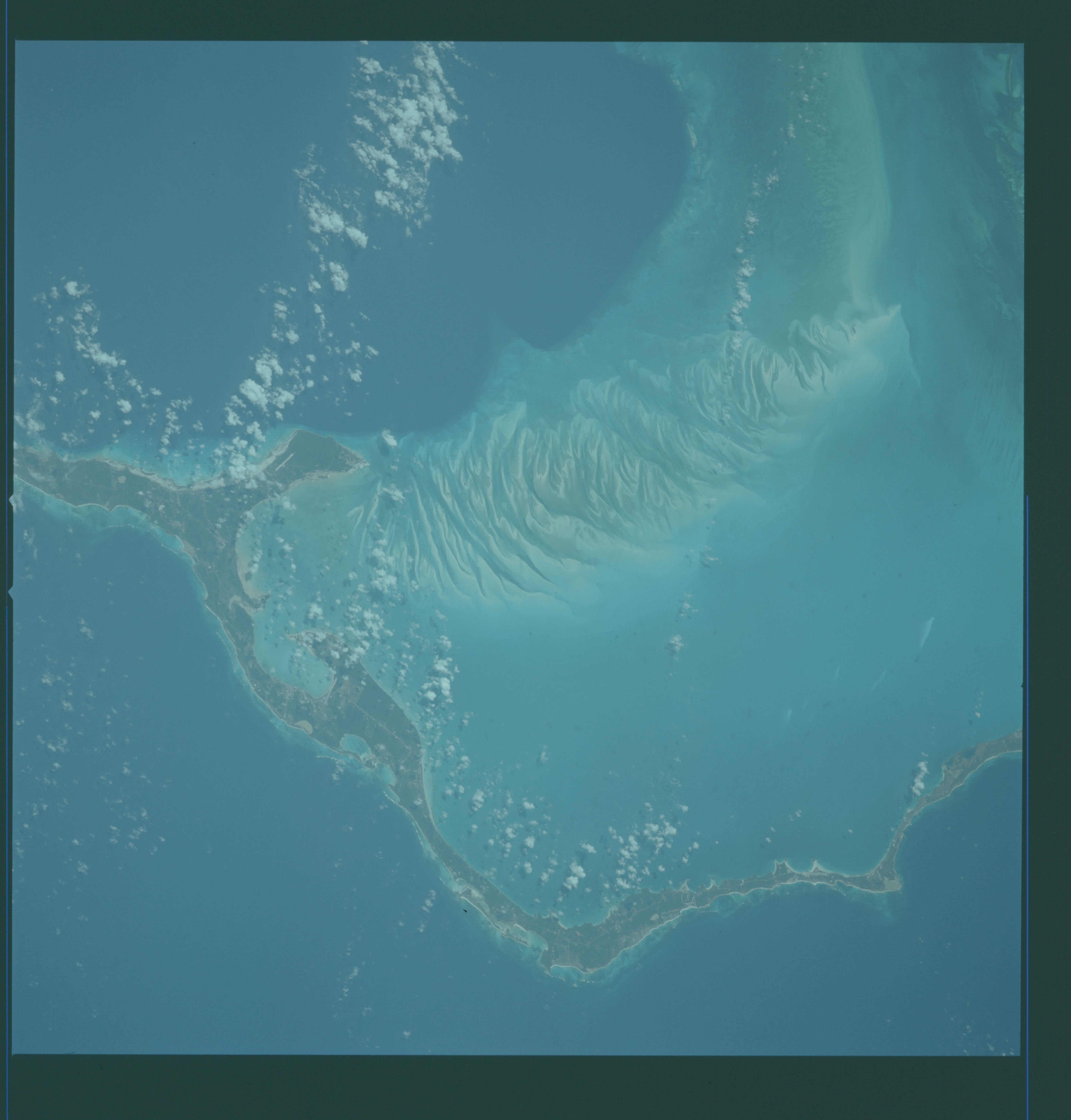
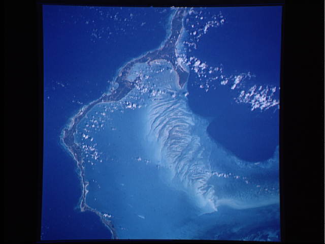
Photo center point: 25.0° N, 76.5° W
Photo center point by machine learning:
Photo center point: 25.0° N, 76.5° W
Photo center point by machine learning:
Nadir to Photo Center:
Spacecraft Altitude: nautical miles (0km)
Country or Geographic Name: | BAHAMAS |
Features: | ELEUTHERA ISLAND |
| Features Found Using Machine Learning: | |
Cloud Cover Percentage: | 20 (11-25)% |
Sun Elevation Angle: | ° |
Sun Azimuth: | ° |
Camera: | Hasselblad |
Focal Length: | 250mm |
Camera Tilt: | Near Vertical |
Format: | QX807: SO368 film (fine-grain Ektachrome) with yellow dye layer equivalent to Wratten 2A |
Film Exposure: | Normal |
| Additional Information | |
| Width | Height | Annotated | Cropped | Purpose | Links |
|---|---|---|---|---|---|
| 4400 pixels | 4600 pixels | No | No | Download Image | |
| 478 pixels | 500 pixels | No | No | Download Image | |
| 640 pixels | 480 pixels | No | No | Download Image |
Download Packaged File
Download a Google Earth KML for this Image
View photo footprint information
Download a GeoTIFF for this photo
Image Caption: Eleuthera Island, (24.5N, 76.0W) Bahamas Island Group, is one of several within the archipelago surrounded by shallow seas, visible here as light blue. Mosaic patterns of sand waves built by sea bottom currents in the shallows stand out in stark contrast to the deep blue of the ocean depths of a thousand feet in the Exuma Sound.
