SL4-141-4340
| NASA Photo ID | SL4-141-4340 |
| Focal Length | 100mm |
| Date taken | |
| Time taken | GMT |

Cloud masks available for this image:
Spacecraft nadir point:
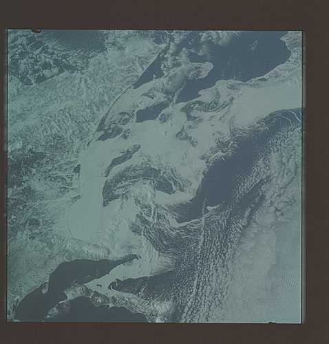
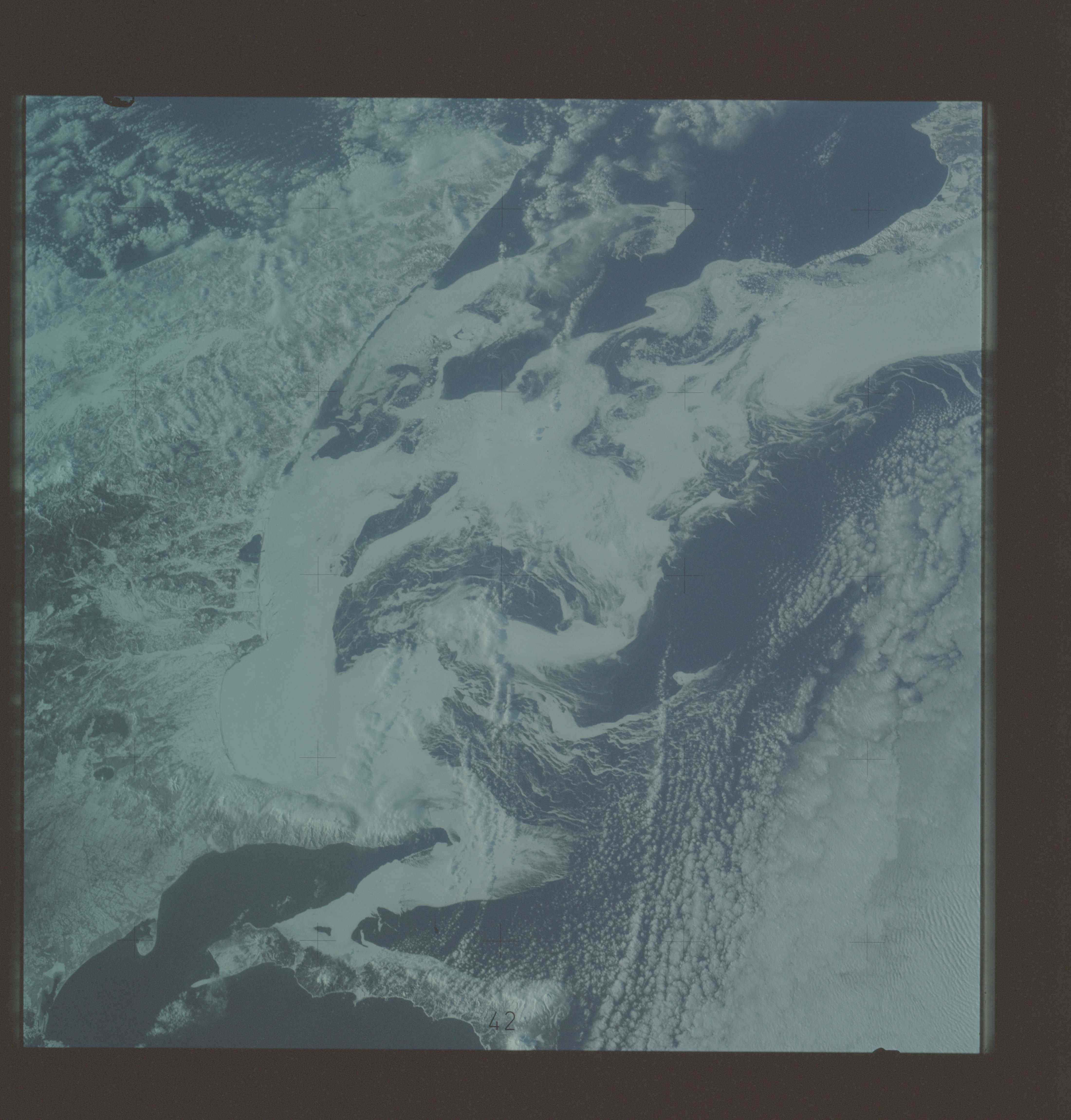
Photo center point: 45.0° N, 144.0° E
Photo center point by machine learning:
Photo center point: 45.0° N, 144.0° E
Photo center point by machine learning:
Nadir to Photo Center:
Spacecraft Altitude: nautical miles (0km)
Camera: | Hasselblad |
Focal Length: | 100mm |
Camera Tilt: | Low Oblique |
Format: | SO368: Kodak Ektachrome MS, equivalent to 2448 Kodak Aerochrome, ASA64, thin base, fine grain |
Film Exposure: | Normal |
| Additional Information | |
| Width | Height | Annotated | Cropped | Purpose | Links |
|---|---|---|---|---|---|
| 4400 pixels | 4600 pixels | No | No | Download Image | |
| 4400 pixels | 4600 pixels | No | No | Original file from film scan | Download Image |
| 478 pixels | 500 pixels | No | No | Download Image |
Download Packaged File
Download a Google Earth KML for this Image
View photo footprint information
Download a GeoTIFF for this photo
Image Caption: An oblique view of the southern part of the Sea of Okhotsk, north of Japan, (45.0N,144.0E) as photographed from the Skylab space station in Earth orbit by one of the Skylab 4 crewmen. Most of the land area is Hokkaido Island, Japan. The southern tip of Sakhalin Island (Soviet Union) is in the northwest corner. This photograph was taken to aid in the study of the formation of sea ice. Observations in the Sea of Okhotsk are of interest because the ice has a morphology similar to that of the Bering Sea.
