SL4-139-3942

| NASA Photo ID | SL4-139-3942 |
| Focal Length | 100mm |
| Date taken | |
| Time taken | GMT |

Cloud masks available for this image:
Spacecraft nadir point:
Photo center point: 32.5° N, 131.0° E
Photo center point by machine learning:
Photo center point: 32.5° N, 131.0° E
Photo center point by machine learning:
Nadir to Photo Center:
Spacecraft Altitude: nautical miles (0km)
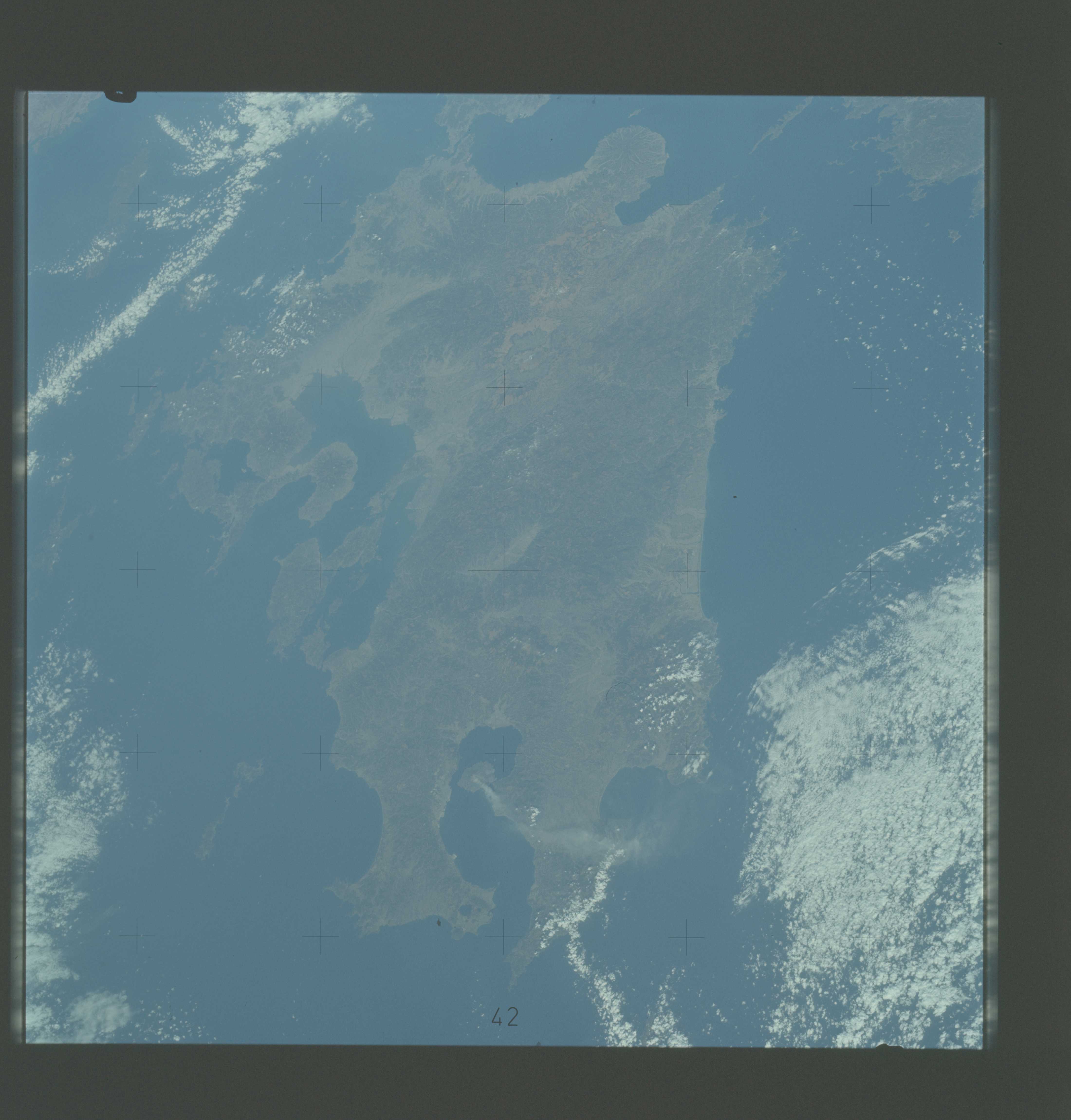
Country or Geographic Name: | JAPAN |
Features: | KYUSHU |
| Features Found Using Machine Learning: | |
Cloud Cover Percentage: | 30 (26-50)% |
Sun Elevation Angle: | ° |
Sun Azimuth: | ° |
Camera: | Hasselblad |
Focal Length: | 100mm |
Camera Tilt: | Low Oblique |
Format: | SO368: Kodak Ektachrome MS, equivalent to 2448 Kodak Aerochrome, ASA64, thin base, fine grain |
Film Exposure: | Normal |
| Additional Information | |
| Width | Height | Annotated | Cropped | Purpose | Links |
|---|---|---|---|---|---|
| 4400 pixels | 4600 pixels | No | No | Download Image | |
| 4400 pixels | 4600 pixels | No | No | Original file from film scan | Download Image |
| 478 pixels | 500 pixels | No | No | Download Image |
Download Packaged File
Download a Google Earth KML for this Image
View photo footprint information
Download a GeoTIFF for this photo
Image Caption: An oblique view of the Island of Kyushu, Japan (32.5N, 131.0E), as seen from the Skylab space station in Earth orbit. The plume from the volcano Sakurajima is clearly seen in this photograph. The volcano and its plume were observed several times by the Skylab crew. The plume was seen to stream out to the south or southeast and become increasingly diffuse away from the volcano. In this photograph, it extends about 80 kilometers (50 miles) east from the volcano. As the plume reached the open ocean east of Kyushu it changed direction, sometimes abruptly, and fanned out to the northeast.
