SL4-138-3894

| NASA Photo ID | SL4-138-3894 |
| Focal Length | 100mm |
| Date taken | |
| Time taken | GMT |

Cloud masks available for this image:
Spacecraft nadir point:
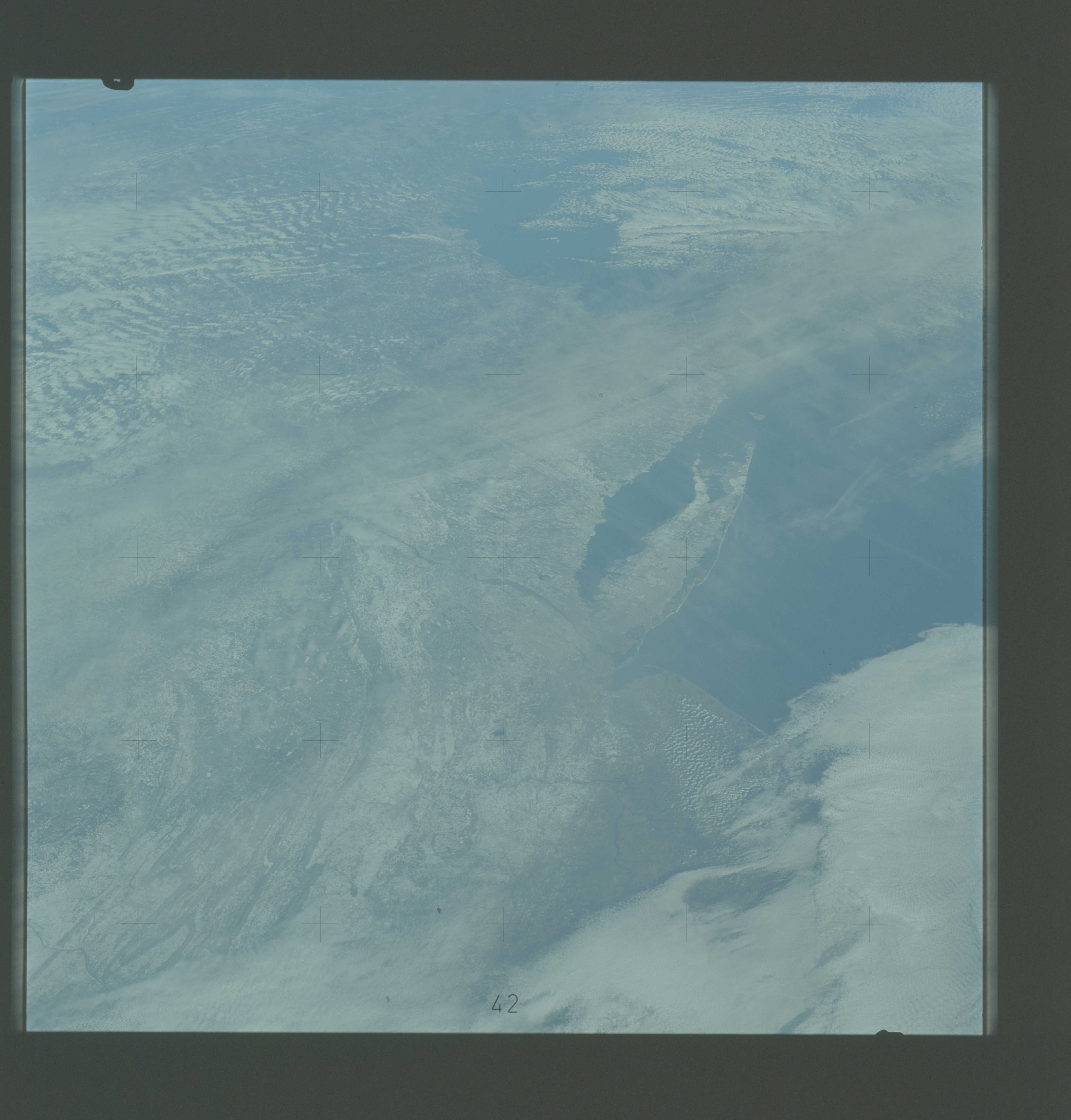
Photo center point: 41.5° N, 74.0° W
Photo center point by machine learning:
Photo center point: 41.5° N, 74.0° W
Photo center point by machine learning:
Nadir to Photo Center:
Spacecraft Altitude: nautical miles (0km)
Country or Geographic Name: | USA-NEW YORK |
Features: | LONG ISLAND, NEW JERSEY |
| Features Found Using Machine Learning: | |
Cloud Cover Percentage: | 80 (76-100)% |
Sun Elevation Angle: | ° |
Sun Azimuth: | ° |
Camera: | Hasselblad |
Focal Length: | 100mm |
Camera Tilt: | Low Oblique |
Format: | SO368: Kodak Ektachrome MS, equivalent to 2448 Kodak Aerochrome, ASA64, thin base, fine grain |
Film Exposure: | Normal |
| Additional Information | |
| Width | Height | Annotated | Cropped | Purpose | Links |
|---|---|---|---|---|---|
| 4400 pixels | 4600 pixels | No | No | Download Image | |
| 4400 pixels | 4600 pixels | No | No | Original file from film scan | Download Image |
| 478 pixels | 500 pixels | No | No | Download Image |
Download Packaged File
Download a Google Earth KML for this Image
View photo footprint information
Download a GeoTIFF for this photo
Image Caption: An oblique view of a portion of the northeastern United States (41.5N, 91.0W), as photographed from the Skylab space station in Earth orbit by one of the Skylab 4 crewmen. The entire area of New Jersey, eastern Pennsylvania, southeastern New York, and southern New England can be examined in one view. Long Island, New York City, and the lower Hudson River Valley are readily seen in their regional framework. The Boston area, although blurred by clouds, is also included. The snow enhances the contrast, especially of terrain and cultural features. Different levels of clouds can be studied, especially the crossing layers of cirrus in the center of the photograph, with the lower cirrus trending north-south and the upper (probably associated with a jet steam) trending east-west.
