SL4-138-3846
| NASA Photo ID | SL4-138-3846 |
| Focal Length | 100mm |
| Date taken | |
| Time taken | GMT |

Cloud masks available for this image:
Spacecraft nadir point:
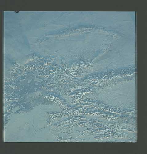
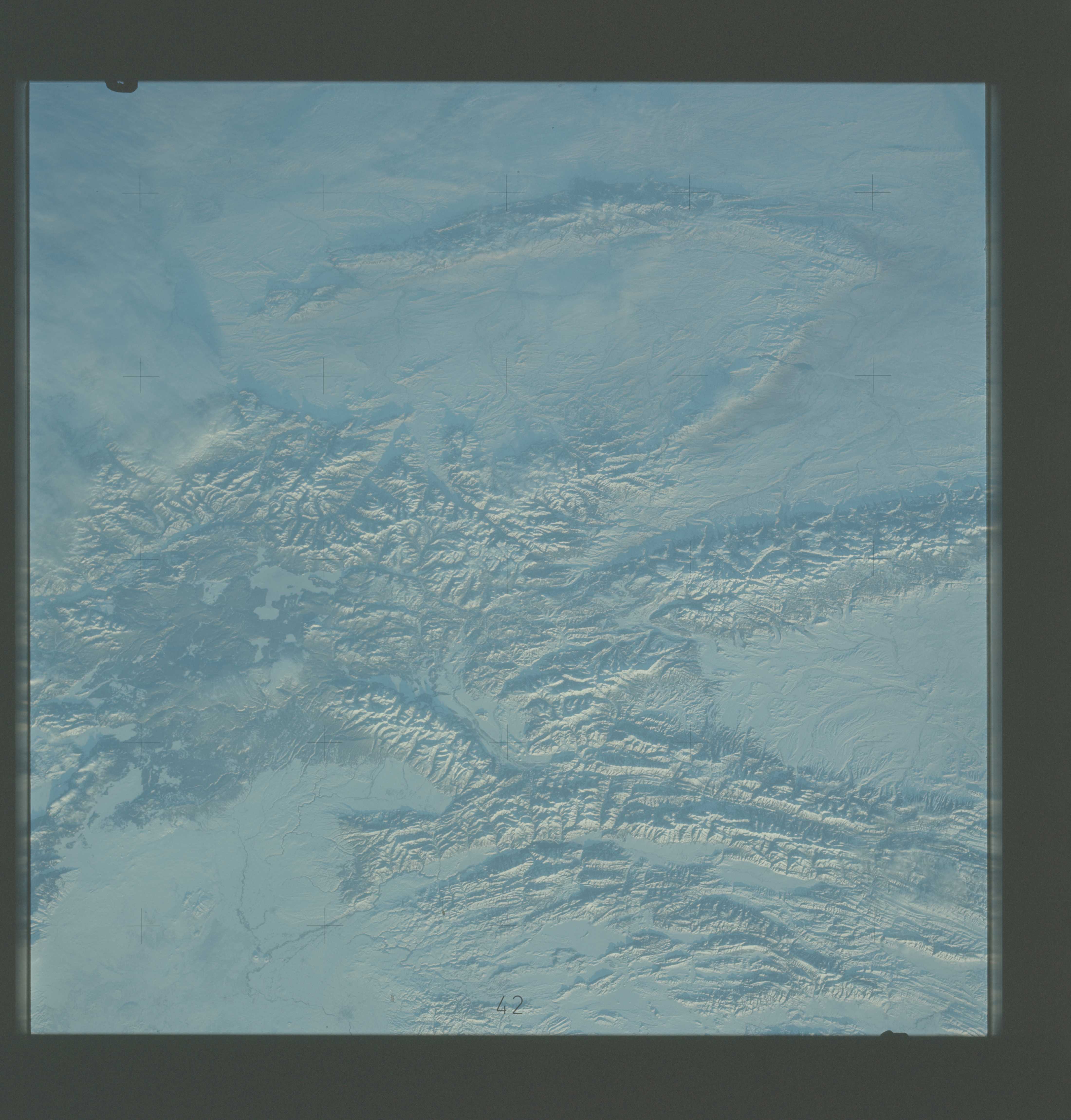
Photo center point: 43.5° N, 109.5° W
Photo center point by machine learning:
Photo center point: 43.5° N, 109.5° W
Photo center point by machine learning:
Nadir to Photo Center:
Spacecraft Altitude: nautical miles (0km)
Country or Geographic Name: | USA-WYOMING |
Features: | WIND RIVER RANGE |
| Features Found Using Machine Learning: | |
Cloud Cover Percentage: | 10 (1-10)% |
Sun Elevation Angle: | ° |
Sun Azimuth: | ° |
Camera: | Hasselblad |
Focal Length: | 100mm |
Camera Tilt: | Low Oblique |
Format: | SO368: Kodak Ektachrome MS, equivalent to 2448 Kodak Aerochrome, ASA64, thin base, fine grain |
Film Exposure: | Normal |
| Additional Information | |
| Width | Height | Annotated | Cropped | Purpose | Links |
|---|---|---|---|---|---|
| 4400 pixels | 4600 pixels | No | No | Download Image | |
| 4400 pixels | 4600 pixels | No | No | Original file from film scan | Download Image |
| 478 pixels | 500 pixels | No | No | Download Image |
Download Packaged File
Download a Google Earth KML for this Image
View photo footprint information
Download a GeoTIFF for this photo
Image Caption: A near vertical view of the snow-covered northwest corner of Wyoming (43.5N, 109.5W), as seen from the Skylab space station in Earth orbit. A small portion of Montana and Idaho is in this photograph, also. The dark area is Yellowstone National Park. The largest body of water is Yellowstone Lake. The elongated range in the eastern part of the picture is the Big Horn Moutains. The Wind River Range is at the bottom center. The Grand Teton National Park area is almost straight south of Yellowstone Lake. Approximately 30 per cent of the State of Wyoming can be seen in this photograph.
