SL4-138-3834
| NASA Photo ID | SL4-138-3834 |
| Focal Length | 100mm |
| Date taken | |
| Time taken | GMT |

Cloud masks available for this image:
Spacecraft nadir point:
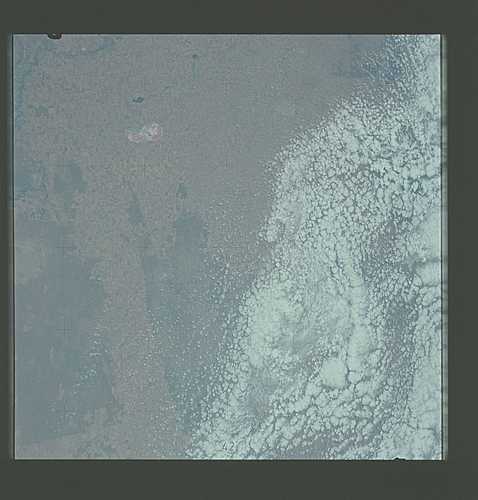
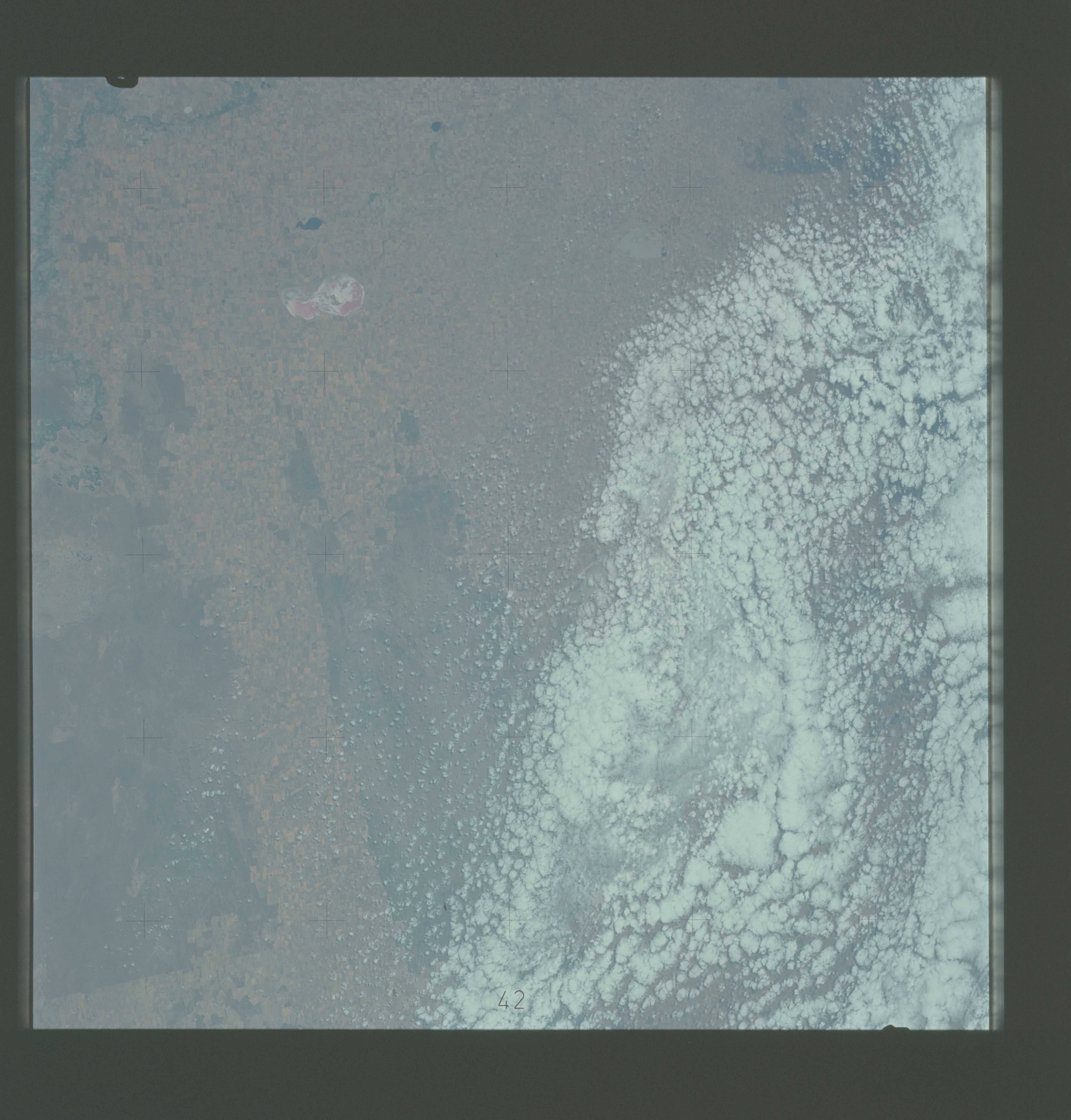
Photo center point: 35.5° S, 142.0° E
Photo center point by machine learning:
Photo center point: 35.5° S, 142.0° E
Photo center point by machine learning:
Nadir to Photo Center:
Spacecraft Altitude: nautical miles (0km)
Country or Geographic Name: | AUSTRALIA-V |
Features: | AGRICULTURE |
| Features Found Using Machine Learning: | |
Cloud Cover Percentage: | 50 (26-50)% |
Sun Elevation Angle: | ° |
Sun Azimuth: | ° |
Camera: | Hasselblad |
Focal Length: | 100mm |
Camera Tilt: | Low Oblique |
Format: | SO368: Kodak Ektachrome MS, equivalent to 2448 Kodak Aerochrome, ASA64, thin base, fine grain |
Film Exposure: | Normal |
| Additional Information | |
| Width | Height | Annotated | Cropped | Purpose | Links |
|---|---|---|---|---|---|
| 4400 pixels | 4600 pixels | No | No | Download Image | |
| 4400 pixels | 4600 pixels | No | No | Original file from film scan | Download Image |
| 478 pixels | 500 pixels | No | No | Download Image |
Download Packaged File
Download a Google Earth KML for this Image
View photo footprint information
Download a GeoTIFF for this photo
Image Caption: A near vertical view of a portion of the Murray River Basin area in the northwest corner of the State of Victoria, Australia (35.5S, 142,0E), as seen from the Skylab space station in Earth orbit. Dry Lake Tyrrell appears as pink and white. The Murray River is in the lower right corner of the photograph. A mass of clouds (white) covers a large portion of the left side of the picture. Rectangular fields of varying sizes indicate an area of major agriculture. A difference in soil color (from pink near the river to buff extending outward) is evident. Large uncultivated areas (dark) are either areas of recent burning or areas unsuitable for growing crops.
