SL4-137-3632
| NASA Photo ID | SL4-137-3632 |
| Focal Length | 100mm |
| Date taken | |
| Time taken | GMT |

Cloud masks available for this image:
Spacecraft nadir point:
Photo center point: 54.4° S, 3.4° E
Photo center point by machine learning:
Photo center point: 54.4° S, 3.4° E
Photo center point by machine learning:
Nadir to Photo Center:
Spacecraft Altitude: nautical miles (0km)
Country or Geographic Name: | BOUVET ISLAND |
Features: | BOUVETOYA, CLD WAKE WAVES |
| Features Found Using Machine Learning: | |
Cloud Cover Percentage: | 95 (76-100)% |
Sun Elevation Angle: | ° |
Sun Azimuth: | ° |
Camera: | Hasselblad |
Focal Length: | 100mm |
Camera Tilt: | |
Format: | SO368: Kodak Ektachrome MS, equivalent to 2448 Kodak Aerochrome, ASA64, thin base, fine grain |
Film Exposure: | Normal |
| Additional Information | |
| Width | Height | Annotated | Cropped | Purpose | Links |
|---|---|---|---|---|---|
| 4400 pixels | 4600 pixels | No | No | Download Image | |
| 4400 pixels | 4600 pixels | No | No | Original file from film scan | Download Image |
| 478 pixels | 500 pixels | No | No | Download Image |
Download Packaged File
Download a Google Earth KML for this Image
View photo footprint information
Download a GeoTIFF for this photo
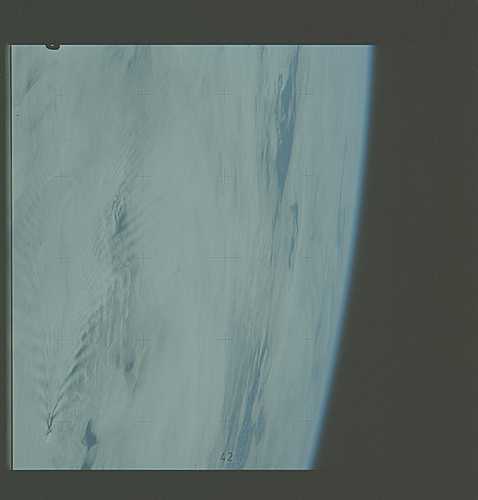
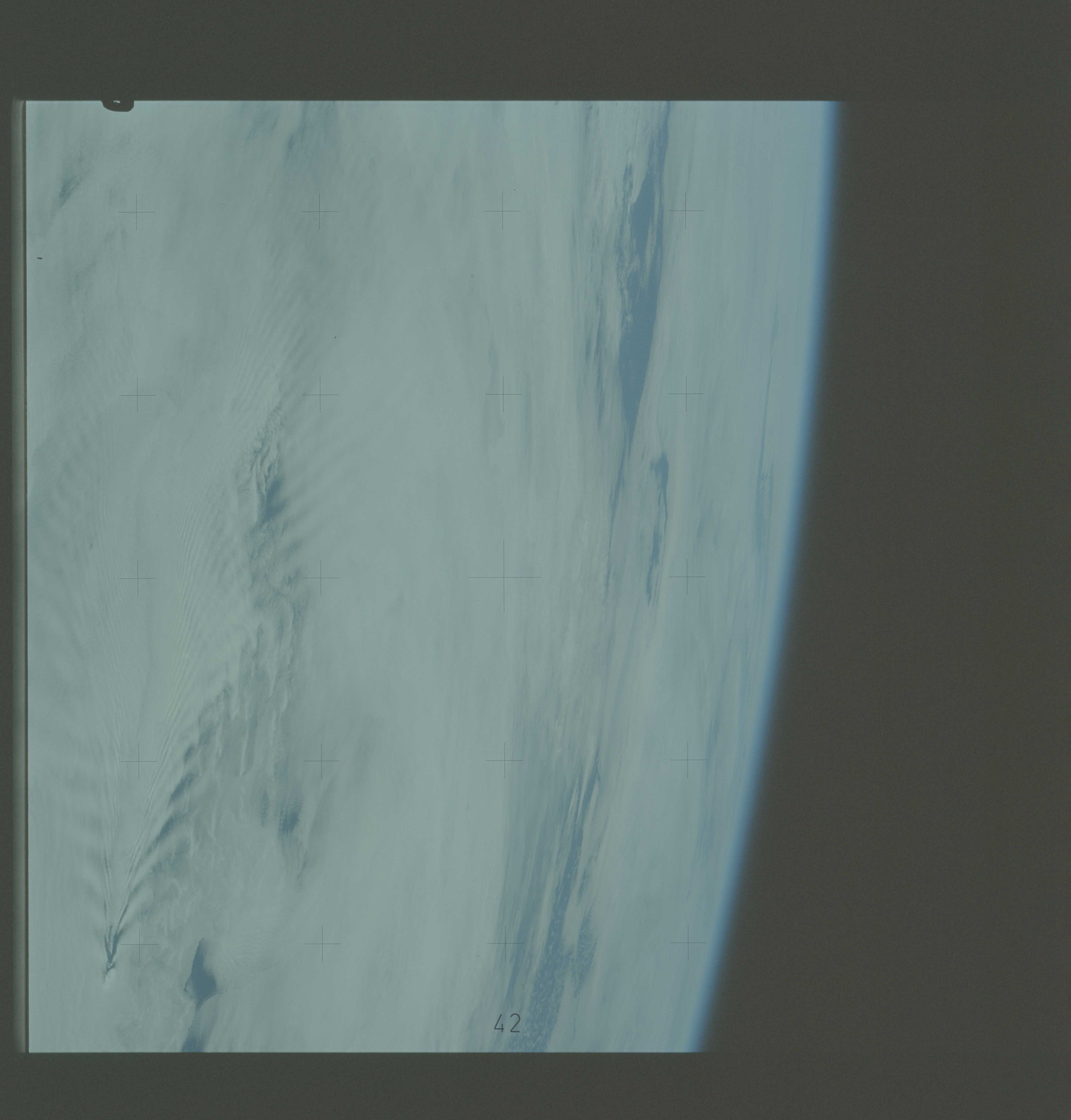
Image Caption: Cloud-wave types in the lee of an island
Both a low-type wave and a well-defined shock wave can be seen on the lower portion of this photograph of Glough Island. The wake extends at least 300 km downwind and appears to have a lateral extent of nearly the same scale. (From Pitts et al 1977.)
A photograph taken from the Skylab space station in Earth orbit illustrating an atmospheric wave pattern (54.4S, 3.4E) by the effect of a small mountainous island on wind currents. Various patterns can be seen downwind of small islands. This photograph illustrates a "bow wave" pattern which extends for hundreds of miles downwind from the island. The island itself is often clear when a wave pattern is formed downstream. This particular pattern is very symetrical. The island in the photo is in the south Atlantic, either Diego de Alvare or Gough Island.
